Weekend forecast: Staying warm and stormy
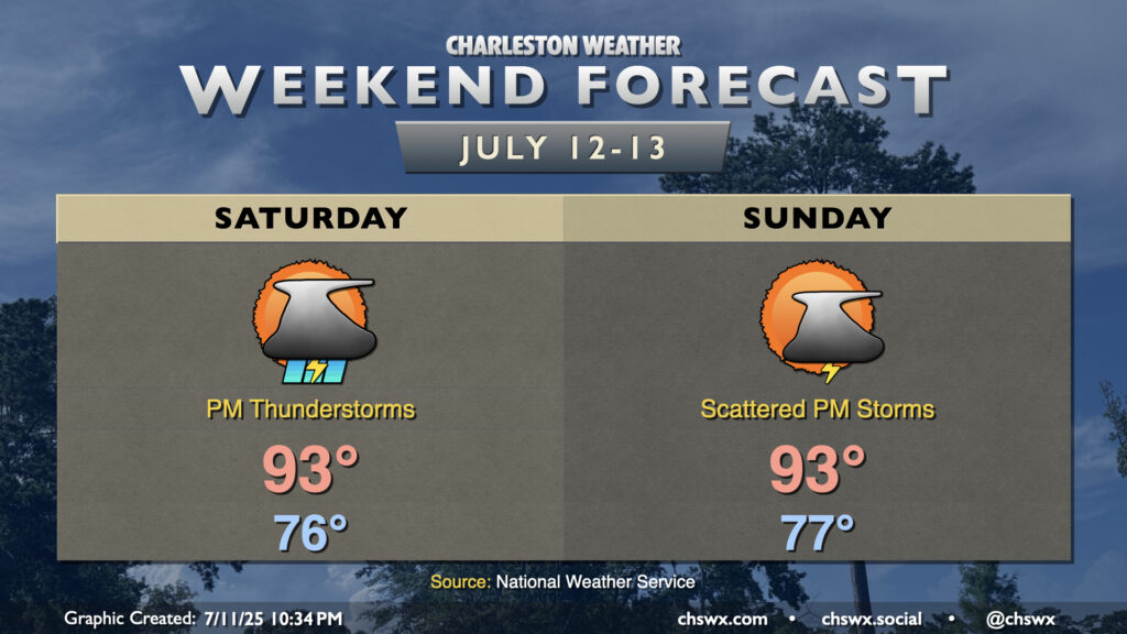
Plenty of heat and humidity continues as we head into the weekend, and this will lead to more afternoon thunderstorms (though perhaps not quite as many, especially Sunday). A ridge of high pressure aloft will nudge into the area from the west — enough to keep the heat on, but not quite enough to totally squelch the afternoon thunderstorm threat either. Temperatures will run in the mid-to-upper 70s each morning, warming to the low-to-mid-90s each afternoon. Showers and thunderstorms will initiate on the seabreeze as it pushes inland, though the prevailing flow around the ridge could send some storms back coastward — something to think about if the beach is in your plans. The ridge nudges in a bit more for Sunday, and that should help to keep the risk for thunderstorms a little lower than on Saturday, but either way, just be prepared to bring your outdoor activities indoors if thunderstorms approach.