Friday & the weekend: Much better this weekend after a Friday front
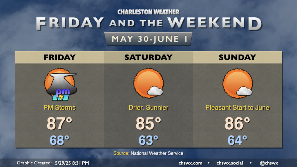
A respite from the rain is coming just in time for the weekend (and it’ll be a beaut), but we’ve got one more day with storms — and the risk for a few severe storms, at that — coming up with a cold front on Friday.
Read more »