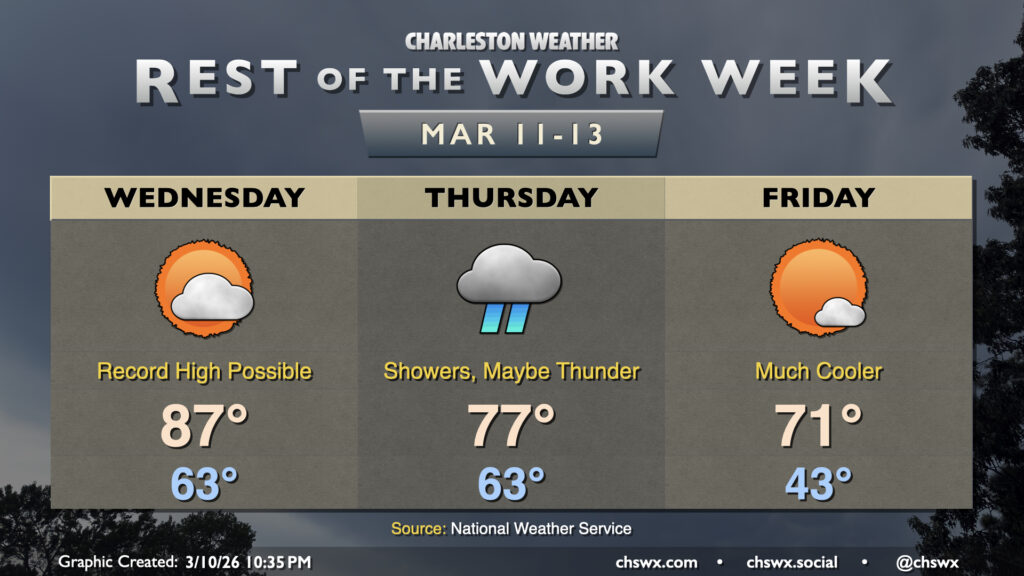
Another very warm day is on tap for Wednesday on the heels of the warmest day thus far in 2026. Wednesday’s forecast high of 87°, if it verifies, would break the daily record high for March 11 of 85° set in 2015. We’ll have plenty of sunshine for a good bit of the day, though cloud cover will tick up in the evening ahead of a cold front that will begin to restore a little order to a spring preview that’s gotten a bit out of hand.
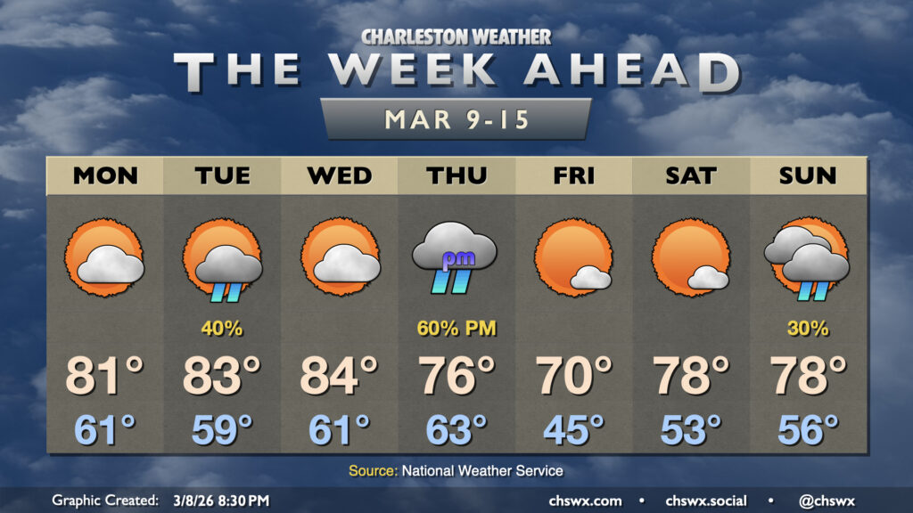
The stretch of abnormally warm, 80°+ days continues for the first half of the upcoming work week before a cold front knocks temperatures back a little bit as we head into the weekend.
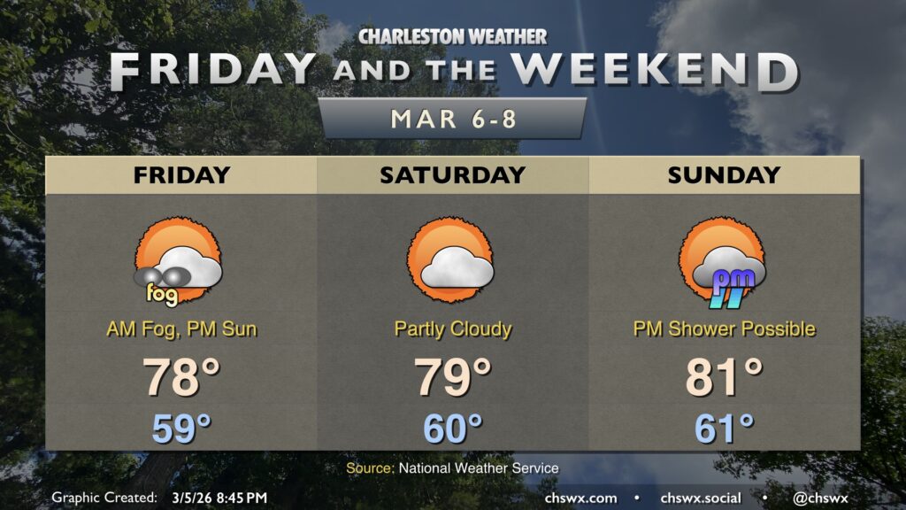
Our stretch of early-March warmth continues for Friday and the weekend — and, realistically, well into next week — as stacked high pressure remains in place.
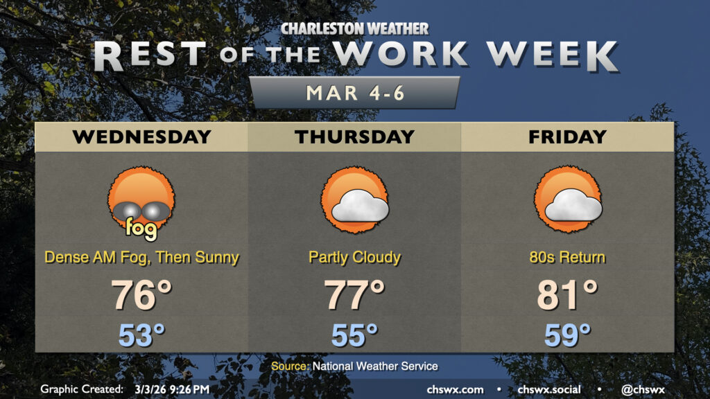
Generally quiet and rather warm weather continues for the rest of the work week. Wednesday morning will likely get off to a foggy start, with dense fog potentially reducing visibility to less than a quarter-mile at times. Use low beams and plenty of following distance in case you do encounter fog. Fog should erode by mid-morning, and we’ll head into the mid-70s under mostly sunny skies in the afternoon.