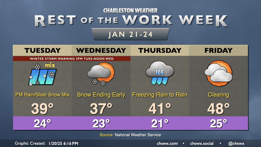
The weather story will continue to be the coldest air of the season and an attendant threat of winter weather, especially Tuesday evening through Wednesday morning. Regardless of what ends up falling at your location, it’ll be quite cold, and you’ll need to put your cold weather plans for your home in place each day through the weekend.
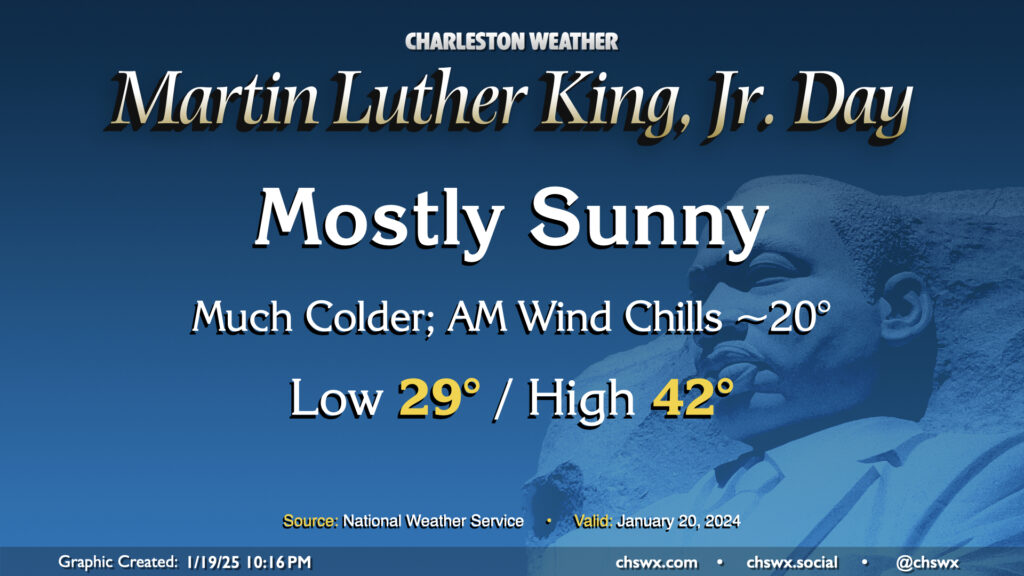
Arctic air will be spilling into the area for Martin Luther King, Jr. Day, bringing the first of several cold days to the Lowcountry. This one will at least come with some sunshine, but even despite that, highs only peak in the low 40s after an upper 20s start. Factor in the wind chill and it’ll feel closer to 20° in the morning, and like the 30s for the balance of the day. Layers will be necessary on Monday and for the next several days as the cold airmass takes residence.
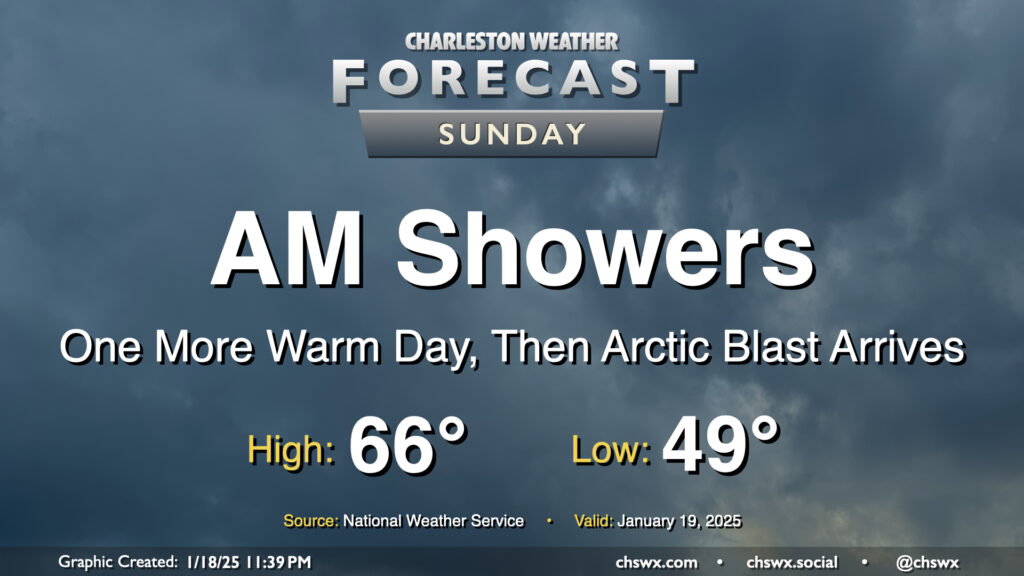
Showers will be ending by early Sunday afternoon as a cold front sweeps through the area later in the day, the forerunner to a much colder Arctic airmass that will arrive overnight Sunday into Monday, setting up a period of impactful winter weather starting Tuesday afternoon.
Temperatures on Sunday will be as warm as they will be for the forecastable future, with highs peaking in the mid-60s early in the afternoon after a start near 50° before falling off post-frontal passage later in the afternoon. We’ll get some peeks of sun as we head through the afternoon and early evening before sunset as much cooler and drier air filters into the area behind the front.
We remain on track to have a relatively quiet but cold day of weather on Monday before winter weather in the form of freezing rain and snow starts to affect the area beginning Tuesday afternoon through Wednesday. I’ll have a more in-depth look at this with Sunday evening’s post as we start to get more of the high-resolution data in, but long story short, we’re quite possibly going to see the most impactful winter weather in the area since 2018 this week. Stay tuned!
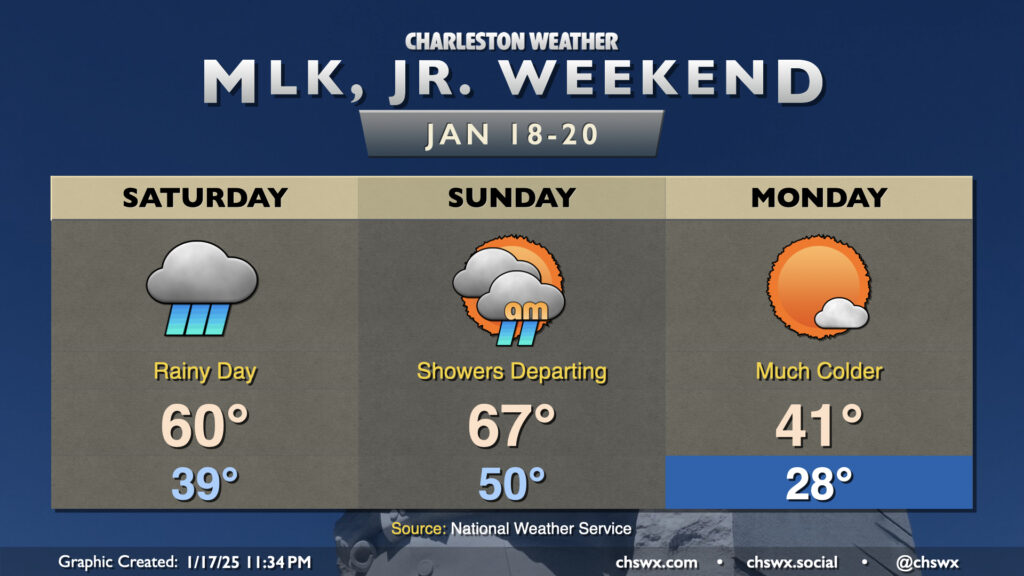
We have a rainy day on tap for Saturday as a complex storm system sweeps across the eastern half of the country. We’ll start the day in the upper 30s to around 40°, but warm to around 60° in the afternoon as warm, humid air moves in ahead of the storm system’s cold front. We’ll stay in the rain for a fair bit of the day after daybreak, though there will be breaks at times as well.
Showers depart early in the day on Sunday, which will be the warmest day in the forecastable future as highs top out in the mid-60s ahead of the cold front. Said front should swing through by evening, and we’ll start to see a sharp change in the airmass after that as Arctic air spills into the region from the northwest. Lows on Martin Luther King, Jr. Day bottom out in the upper 20s, heading to only the low 40s despite plenty of sunshine.