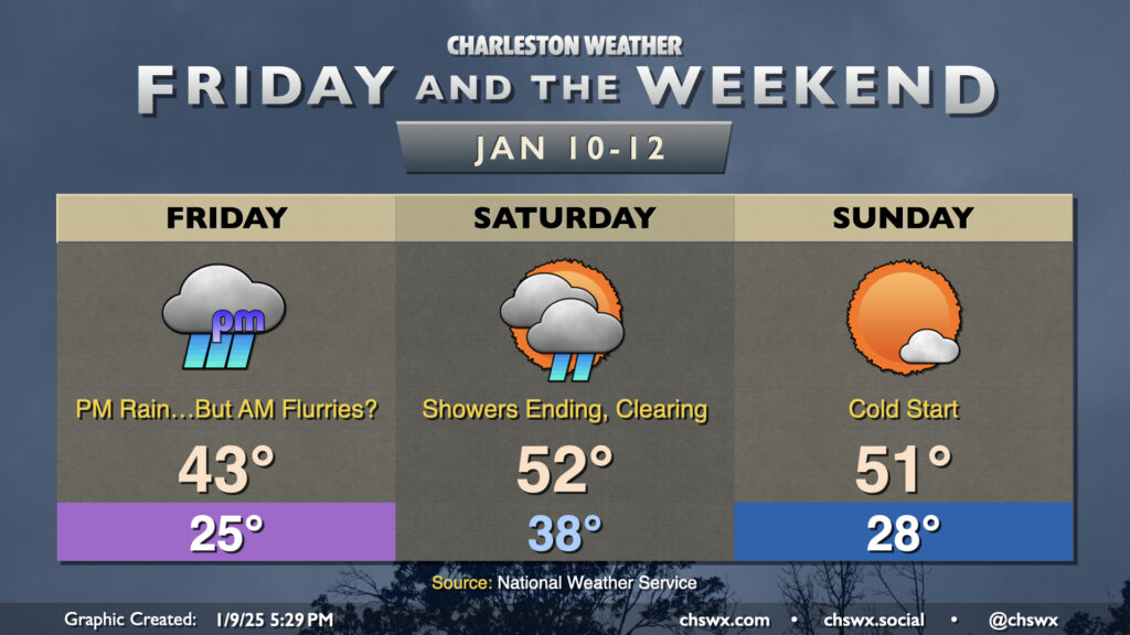
Low pressure organizing in the Gulf of Mexico, just off the southern Texas coast, will move east and northeast heading into Friday, bringing snow and ice to the I-85 corridor and an otherwise raw, gross day of cold rain here to the Lowcountry. We start the day in the mid-20s, and recent guidance signals that there is a slight chance of a few snowflakes through about 10am as a band of precipitation moves north across the area, with the best chance of catching a few conversational flurries further inland around I-95, but they won’t last as temperatures at the surface and aloft warm up. No traffic impacts are expected (unless someone gets distracted by a snowflake, anyway). There should be a little bit of a dry slot in the early afternoon before more steady rain moves in from the west along with the low; this will keep us in the rain for much of the mid-to-late afternoon into the overnight. Highs on Friday will crack the low 40s but won’t warm much more, so again, be ready to bundle up and stay that way if you’re headed out. (Honestly, a great night to stay in with soup and a good movie.)
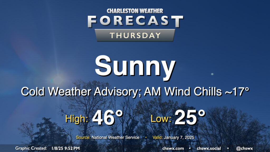
Thursday will be the coldest day of the week as a little reinforcing cool air moves into the area from the north. We start the day in the mid-20s, but the wind will factor in a bit more than the previous couple mornings, driving wind chills down into the teens across even the Charleston metro area. Thus, a Cold Weather Advisory will be in effect until 9am. Despite unfettered sunshine, highs will struggle to the mid-40s in the afternoon, and with the persistent north to northwest winds around 5-10 MPH, it’ll still feel like the upper 30s throughout the day. Layer up accordingly — you’ll be glad you did.
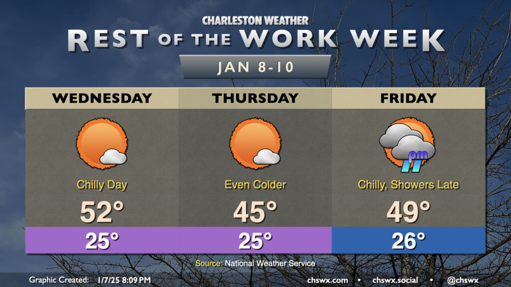
The chilly week continues as we get over the hump and down the stretch with high pressure in place for a couple more days ahead of a storm system that will affect the area Friday night into Saturday. You’ll want to make sure you have sensitive plants covered and your pets indoors the next few nights for sure with such cold temperatures expected!
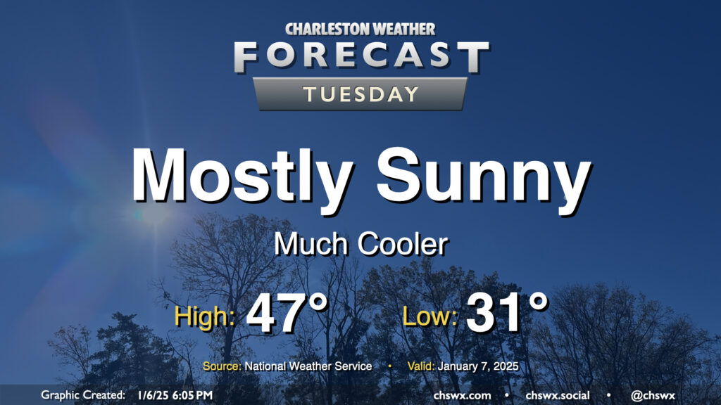
The weather takes a turn for the cold and stays there for the rest of the work week starting Tuesday in the wake of a front that passed through Monday evening. We’ll start Tuesday below freezing away from the coast, with lows in the low 30s expected. A bit of a breeze — though certainly not the gusty winds we saw on Monday — will keep wind chills in the low 20s Tuesday morning, so prepare accordingly for bus stops. Highs on Tuesday will struggle to the mid-to-upper 40s despite plenty of sunshine as cold and dry high pressure builds in.