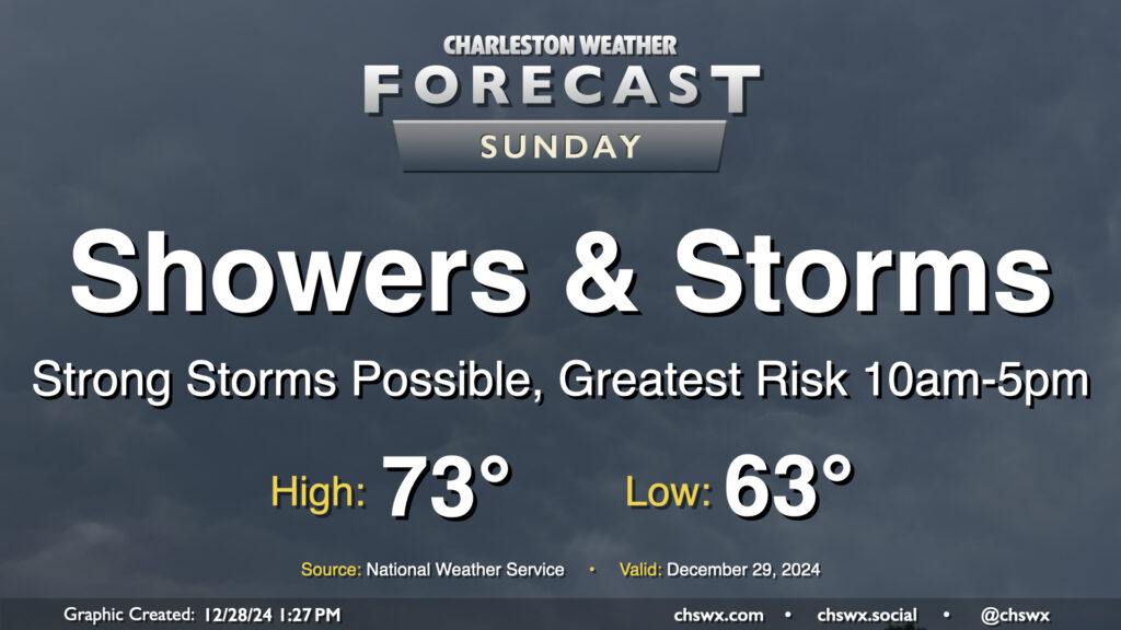
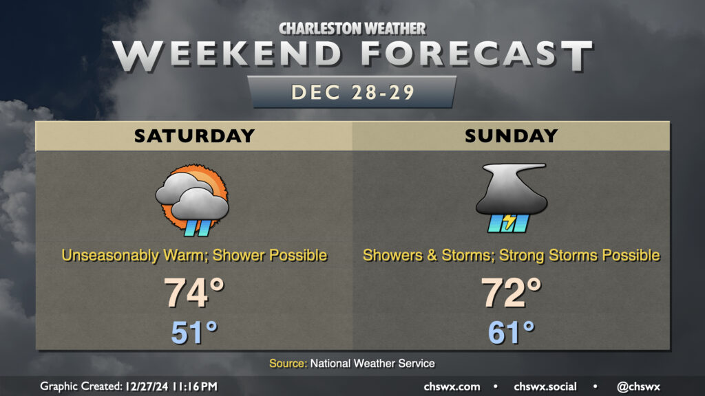
Sunday looks to be an active weather day as a cold front approaches the area. Expect at least scattered to numerous showers and thunderstorms to develop throughout the day, with a possible squall line moving by sometime in the early to mid-afternoon hours.
The final weekend of 2024 will be unseasonably warm as we get into the warm sector of an approaching storm system that could bring some rough conditions on Sunday.
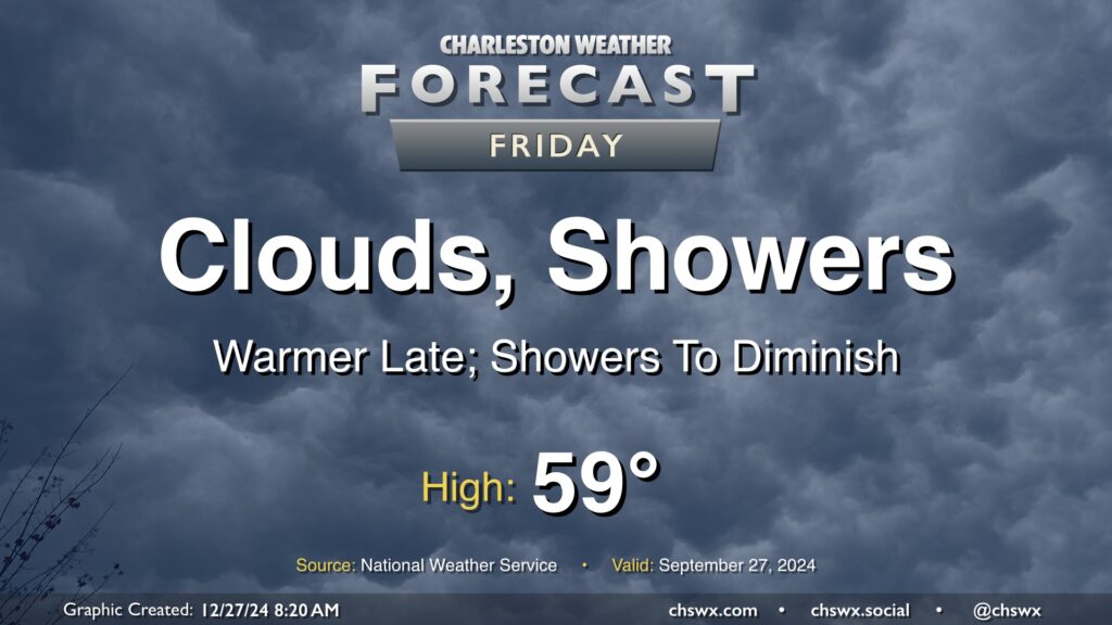
A coastal trough continues to affect the area today, with showers overrunning the top of a cold high pressure wedge that has kept temperatures pretty constantly in the mid-40s for the past couple days now. We should see that trough lift inland later today, though, as high pressure anchored to the northeast weakens and steps aside. This will help break the wedge and allow a little warmer air to move in, especially later, though we will stay somewhat cool with highs in the upper 50s. The risk for showers should also diminish with time today, though we can expect off and on rain for much of it.