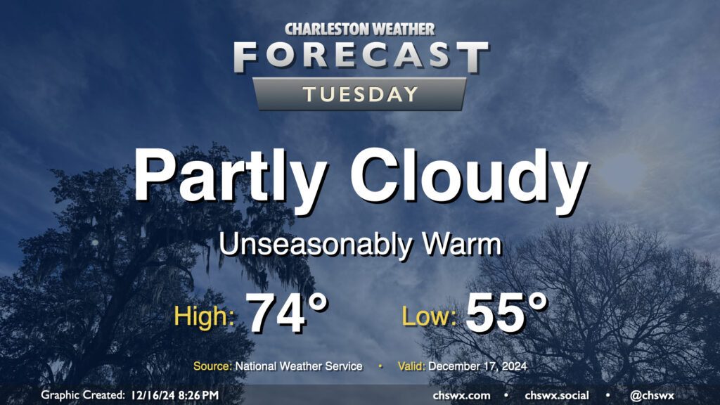
We hit 74° at the airport on Monday, and we’ll likely do the same — if not even running slightly warmer — on Tuesday as high pressure aloft and at the surface remains in control. We’ll likely start the day with another round of fog, and it might be dense in spots as well, so be ready to allow a little extra time to get to where you’re going. (Unfortunately, the fog horns near the coast might be pretty loud, too.) Lows in the mid-50s — about 15° above normal for mid-December — will warm quickly into the mid-70s once the fog dissipates in the morning. We’ll stay rain-free for one more day, with partly cloudy skies expected. Should be a nice day to spend a little time outside if you can!
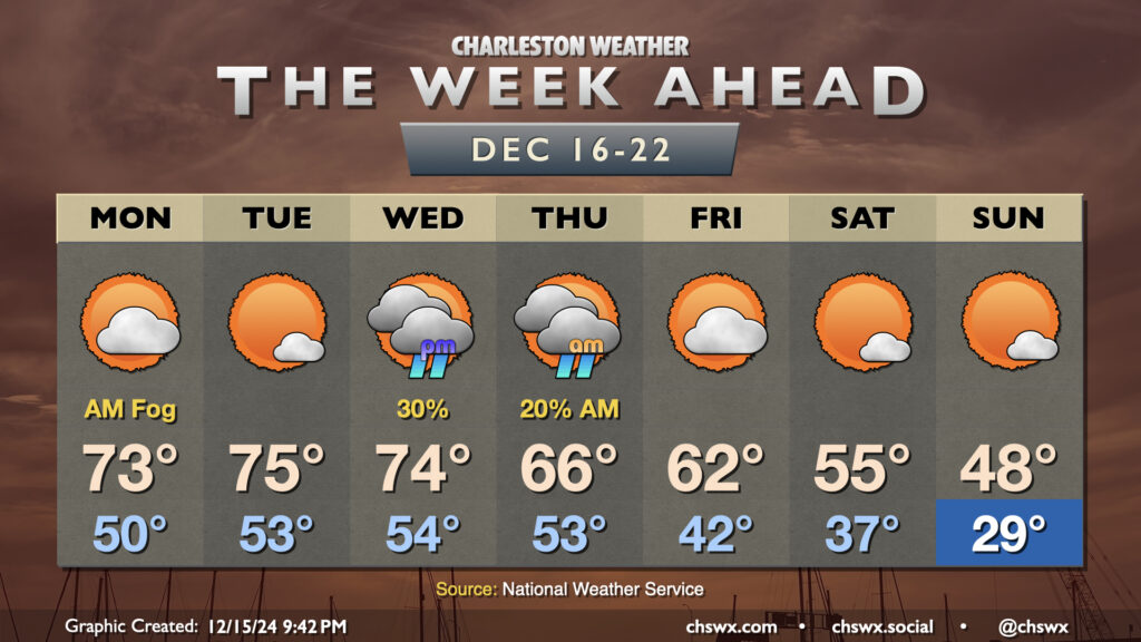
The week ahead will feature another up-and-down cycle of the temperature rollercoaster that has characterized this climatological winter so far. We start the week on the warm side, with temperatures running well above-normal through Wednesday. Monday could start a bit foggy as lows only drop to about 50°. We’ll warm to the low 70s in the afternoon under partly cloudy skies. After what could be another foggy start, expect a little reduction in cloud cover Tuesday afternoon which will lead to what should be the warmest day of the week as highs peak in the mid-70s (and maybe even a bit warmer further inland).
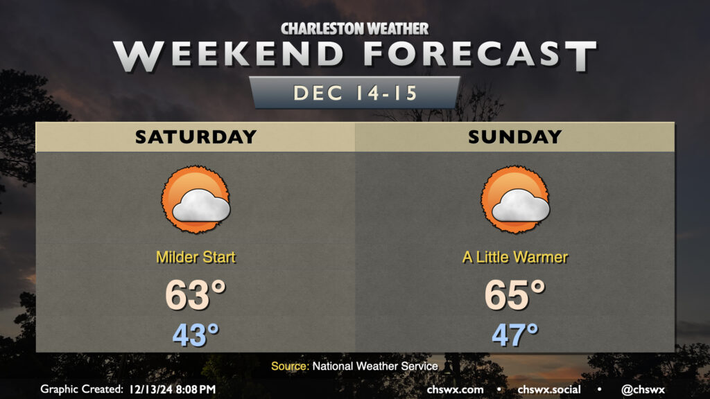
We’ve got a quiet weekend of weather ahead as high pressure remains generally in control. Notably, our starts will be a bit milder: expect Saturday to begin in the low to mid-40s, while Sunday starts in the mid-to-upper 40s as onshore winds help to take the edge off the chill a bit. Temperatures each afternoon head toward the mid-60s, and we can expect a mix of sun and clouds each day.
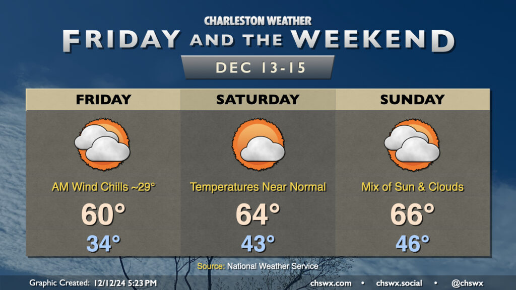
The only real issues with the weather this weekend come in the form of winds and tides. Saturday in particular will be a breezy day as high pressure butts up against a trough of low pressure that’ll be developing offshore. Winds stay elevated on Sunday, but won’t be quite as blustery.
The northeast winds along with the upcoming full moon will help drive water levels into flood stage in Charleston Harbor with the morning high tides. Saturday morning, we can expect a water level between 7.1-7.3′ mean lower low water with the 6:41am high tide, which is solidly within minor flood stage. We could approach moderate flooding with Sunday morning’s high tide, currently forecasted between 7.4-7.6′ MLLW around the 7:32am high tide. Moderate flooding begins at 7.5′, and this is the level when we start to see more widespread road closures downtown. If downtown’s in your plans early the next couple mornings, be ready to reroute around road closures. Otherwise, enjoy a nice weekend!
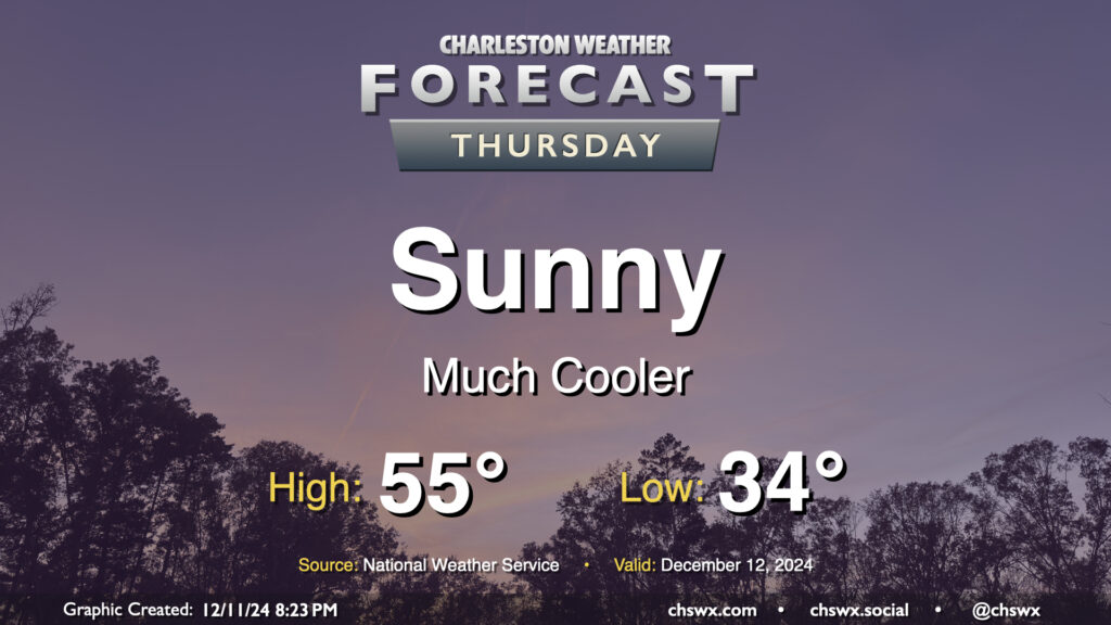
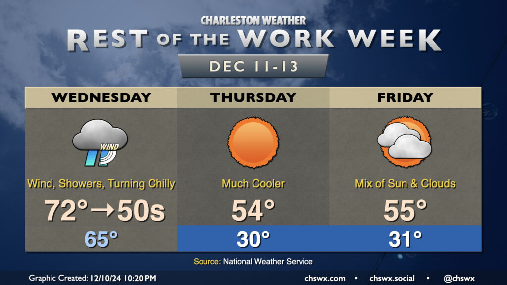
A cold front passed through earlier Wednesday will make Thursday a much cooler day despite plenty of sunshine. We’ll start the day in the mid-30s — with temperatures possibly dipping toward freezing in more rural areas — and warm to just the mid-50s in the afternoon despite all the sunshine. The wind won’t be whipping as much Thursday, with speeds generally around 5 MPH expected out of the north and northwest. Overall, it’ll be a seasonably cool day, with temperatures running several degrees below normal.
Wednesday will be a fairly unsettled day across the area as a cold front moves by, sending mid-morning temperatures in the 70s down to the 50s before sunset. Showers should be in the area by daybreak, with the greatest risk of showers and maybe even a thunderstorm or two generally mid-morning through early afternoon. A couple of those storms could be on the strong side with strong wind gusts the main concern, though the risk for any severe weather is fairly low. Even outside of thunderstorms, gusts 30-40 MPH will be possible, prompting a Wind Advisory for tidal Berkeley (Daniel Island, Wando, Cainhoy) and Charleston counties from 6am-1pm. Once the front is through, rain chances will end and temperatures will begin to fall like a rock. It won’t feel like it when you leave in the morning, but you’ll probably want a jacket handy as temperatures fall into the 50s by evening.