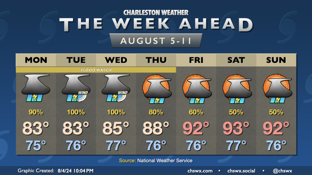
The weather story this week is Tropical Storm Debby. Some rain associated with the system has already tried to push ashore Sunday evening, and there’s a lot more where that comes from as we get into the first few days of the new work week. The forecast continues to call for Debby to stall out and meander over Georgia, causing excessive rainfall that could lead to widespread significant flooding across the Lowcountry over the next several days. We will also deal with the potential for tropical storm-force winds, storm surge, and tornadoes as well. The slow-moving nature of the storm increases the uncertainty about exact numbers for impacts as well as on timing, but we’ll do our best here within the limits of the science.
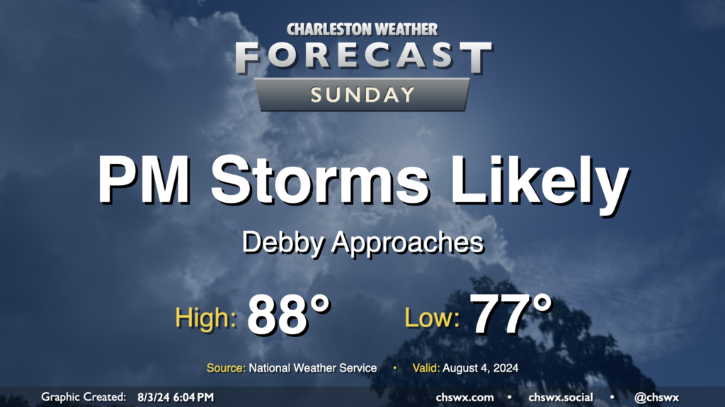
Tropical Storm Debby, newly christened as of 5PM, will march up the Florida coast on Sunday, strengthening as it goes over 90°+ degree water in the Gulf of Mexico. Here at home, moisture will begin to increase ahead of the storm, and that should lead to scattered to numerous showers and thunderstorms in the afternoon and evening hours. Expect balmy lows in the upper 70s to yield to highs in the upper 80s in the afternoon as the flow begins to turn more onshore and showers and thunderstorms become more numerous. A strong storm or two can’t be ruled out, as is normally the case this time of year.
So the disclaimer at the outset with this weekend’s forecast, especially for Sunday, is that a lot hinges on the eventual path, forward speed, and strength of what is, as of this writing, Potential Tropical Cyclone Four. You’ll want to keep closer tabs on forecast updates than you normally might as things are a little more fluid than normal due to the uncertainty.
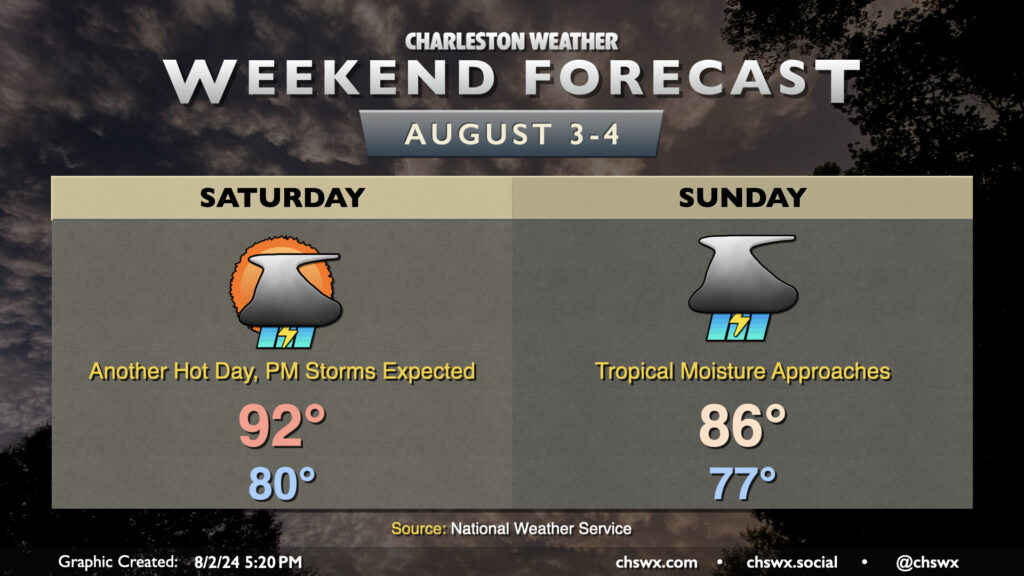
With that in mind, though, one thing that’s certain is that Saturday is going to be a hot and muggy day with ample storms in the afternoon. Temperatures don’t look to get below 80° across more of the metro area than we might like, warming to the low 90s in the afternoon. Dewpoints in the upper 70s will yield heat indices that peak around advisory criteria (108°) before showers and storms develop and cool things down.
Sunday will start on the mild side once again, but showers and thunderstorms should — provided the current NHC track for Four holds — become fairly widespread across the area by Sunday afternoon as the surge of tropical moisture and a little daytime heating combine for some rather heavy downpours. The upside will be that highs will be suppressed to the mid-80s, but I’d expect it to be soggy enough to where we wouldn’t get to enjoy that all that much. An inch or two of rain will be possible Sunday, especially near the coast.