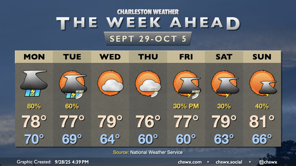
We’ll close September on a stormy note as moisture from Tropical Storm Imelda interacts with a stalled front/trough situated along the coast to produce solid shower and thunderstorm chances through Tuesday. From there, a good shot of fall welcomes us to October before more shower and storm chances return for Friday and the weekend.
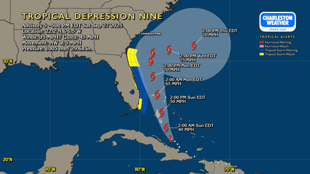
Tropical Depression Nine continues to organize, moving NW at 5 MPH on approach to the Bahamas, where Tropical Storm Warnings are in effect. Nine is still expected to strengthen, becoming a tropical storm tonight or early tomorrow morning. The next name on the list is Imelda.
On the current forecast from the National Hurricane Center, future Imelda will continue to move north-northwest heading into Monday, gradually strengthening into a hurricane (albeit a low-end Category 1). From there, it will stall out somewhere off the GA/SC coast Monday night into Tuesday, meandering until Humberto — a category 5 beast well out in the central Atlantic — gets close enough to help weaken the blocking high pressure to the north and “pulls” presumed Imelda eastward, away from the continental US.
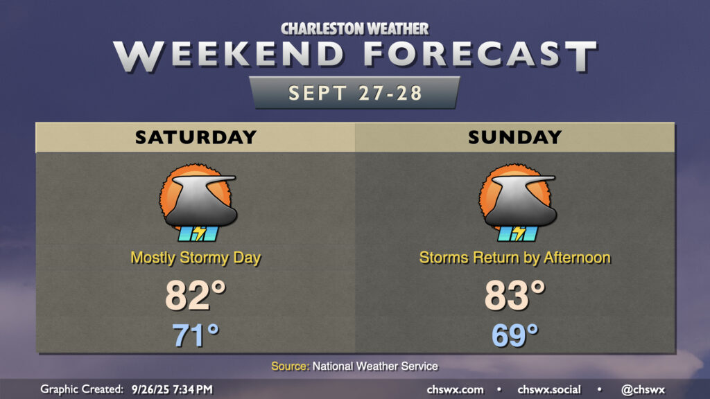
A slow-moving cold front combined with a stalling upper-level low will help spread rain further into the metro for the weekend, especially on Saturday, as we continue to monitor the progress of now-Potential Tropical Cyclone Nine.