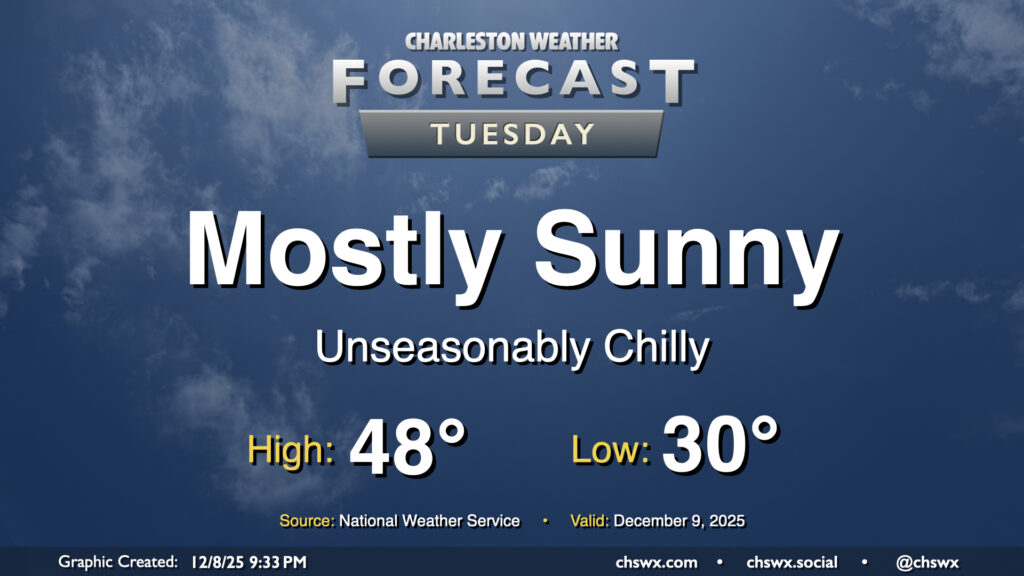
We’ll finally shed the cloud cover that’s punctuated the last several days on Tuesday as high pressure builds in from the northwest. The aforementioned high pressure will drive even cooler and drier air into the area, and we’ll wake up below freezing as a result away from the coast. The northerly breeze will help drive wind chills down into the low to mid-20s during the morning, so be sure to add a layer or two as you head out for the day. The feed of cooler and drier air continues throughout the day, so even with plenty of sunshine, highs will likely not climb out of the upper 40s.
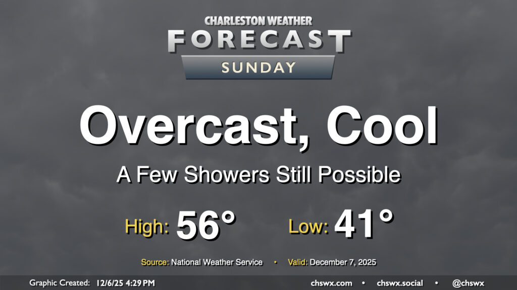
We’ve had some much-needed rain over the past few days, but it’s certainly not made for the best outdoors weather, either. Unfortunately that continues on Sunday, which will decidedly not live up to its name as overcast skies look to persist with a few showers continuing to be possible at times. It won’t be as much rain as we’ve seen over the past couple days with some drier air working in, but there will still be enough moisture to wring out a few more raindrops. Temperatures will remain on the cool side, with lows in the low 40s warming to just the mid-50s in the afternoon at best, making for a sixth consecutive day of highs in the 50s.
This dreary stretch will start to work itself out on Monday, with a front ushering in cool and dry high pressure by Tuesday, which will scour out the clouds. It’ll be chilly still, but we do have a brief warmup into the low 60s for Wednesday and Thursday before cooling right back off for the weekend with another front.
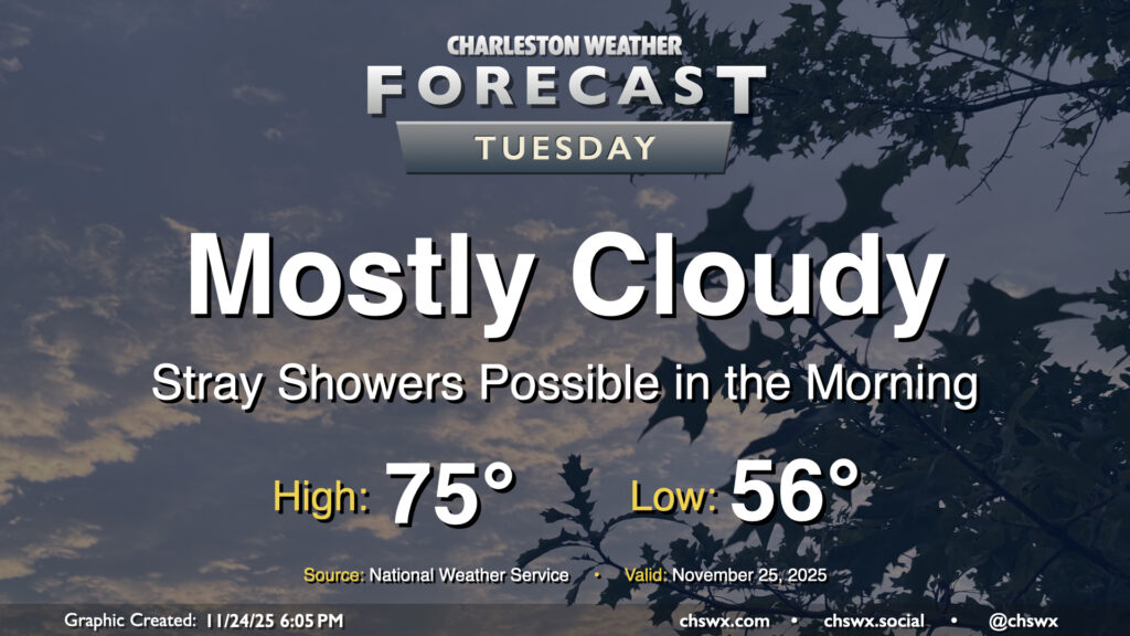
High pressure to our north will be shifting offshore as Tuesday goes on ahead of a storm system moving through the Ohio Valley, allowing a warm front to push northward into the area during the day. Some of us may see a few showers as this warm front moves northward, especially later in the morning and closer to the coast. They’ll be relatively short-lived, clearing the area during the afternoon, and won’t amount to too terribly much rain for those who see any of it at all. It’ll be a mild day once again, with lows in the mid-50s warming to the mid-70s in the afternoon in the wake of the warm front.
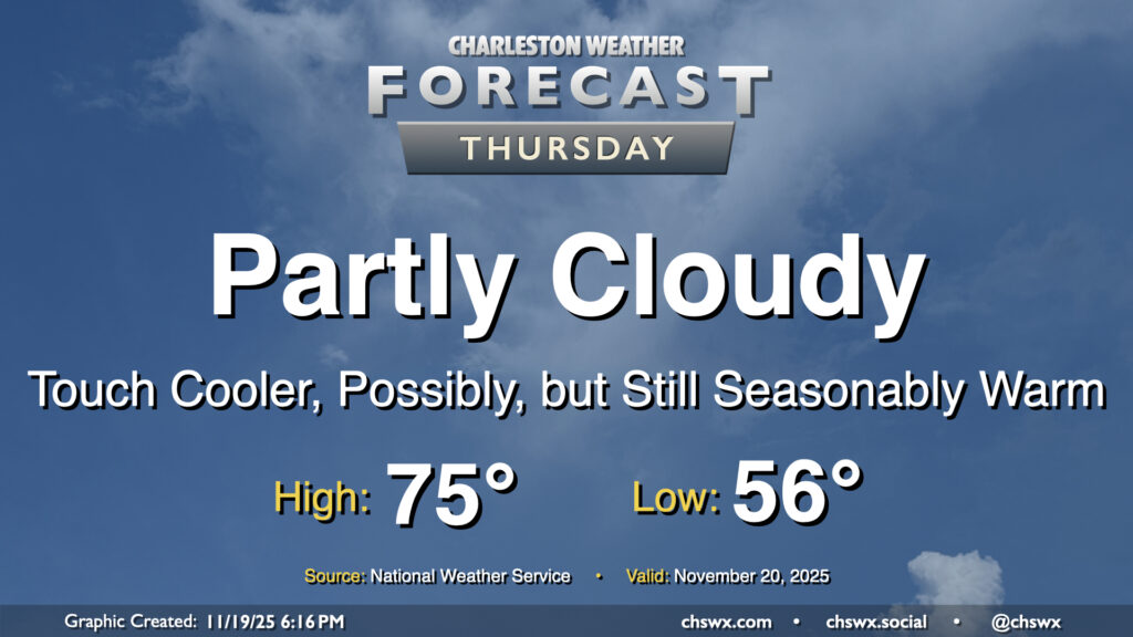
Warm temperatures continue for Thursday, though a nearby front and some more cloud cover will likely preclude temperatures from getting too out of hand. Wednesday’s highs were close to records for the date: 82° at the airport was just a degree shy of the record of 83° set in 1942, while 80° downtown missed the record of 82° set there in 1958. Depending on where the front hangs up, we may yet make another run at records, but the preponderance of the evidence suggests that we’re going to stay in the mid-to-upper 70s on Thursday. The front won’t come with much moisture, so an uptick in cloud cover is about it.
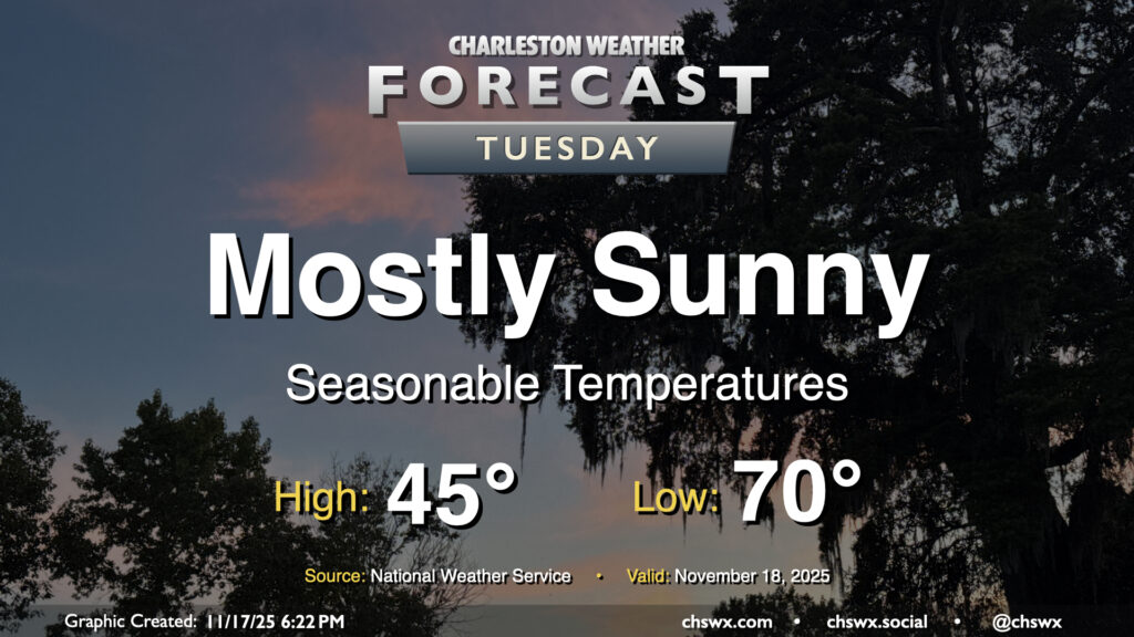
After a near-normal day of temperatures on Monday, we’ll look for a similar performance on Tuesday. Temperatures will start in the mid-40s across much of the area (a little warmer near the coast, a little cooler further inland), and highs will peak around 70° in the afternoon with mostly sunny skies remaining the rule. Winds will be going more southerly during the day as surface high pressure begins to shift offshore. This will set us up for a few days of rather warm temperatures starting Wednesday.
A highly anomalous Arctic intrusion is arriving this evening, evidenced by gusty winds 25-30 MPH and plummeting dewpoints across much of the area as of 7PM Monday. Further north, some flurries were reported in the Charlotte metro area and as far south as Hartsville, SC. Here at home, the first freeze of the season will occur for the vast majority of us; ensure pets and plants are protected and safe tonight as temperatures will fall into the 20s. Wind chills could drop into the upper teens, prompting a Cold Weather Advisory for Dorchester County. (Layer up!) Despite full sunshine, temperatures may not crack 50° in the afternoon, owing to the strength of the Arctic blast. If these forecasts verify, new record low and record cold high temperatures will be set at the airport: the record low for November 11 is 29°, set in 1943, while the record cold high temperature is 54°, set in 1968.
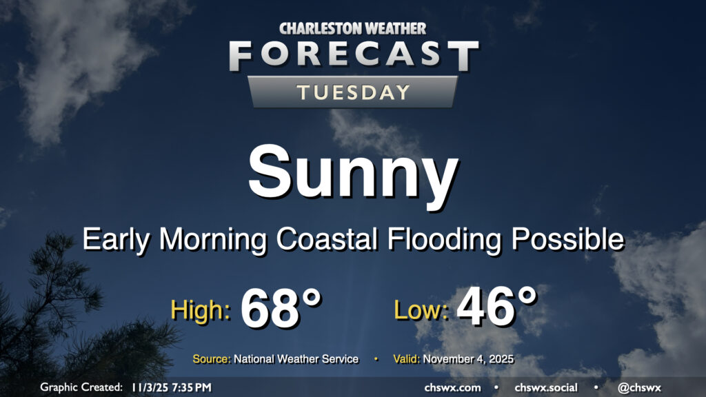
Plenty of sunshine will continue on Tuesday as high pressure builds across the area from the west, keeping northeasterly flow in place which will keep temperatures on the cool side of normal and also help to elevate the morning high tide into minor flood stage. We’ll start the day in the mid-40s, warming to the upper 60s in the afternoon, which will feel quite comfortable with the sun out. The aforementioned northeasterly winds will run generally in the 5-10 MPH range, which will be enough of a breeze to make it feel a little cooler in the shade.
As mentioned, some coastal flooding will be possible between 5-8am as water levels peak in minor flood stage (7-7.2′) with the 6:11 am high tide. This may have limited impacts in the most vulnerable areas of the peninsula, primarily around the Hagood/Fishburne intersection as well as possibly on parts of Lockwood. Be ready to reroute around any closures.
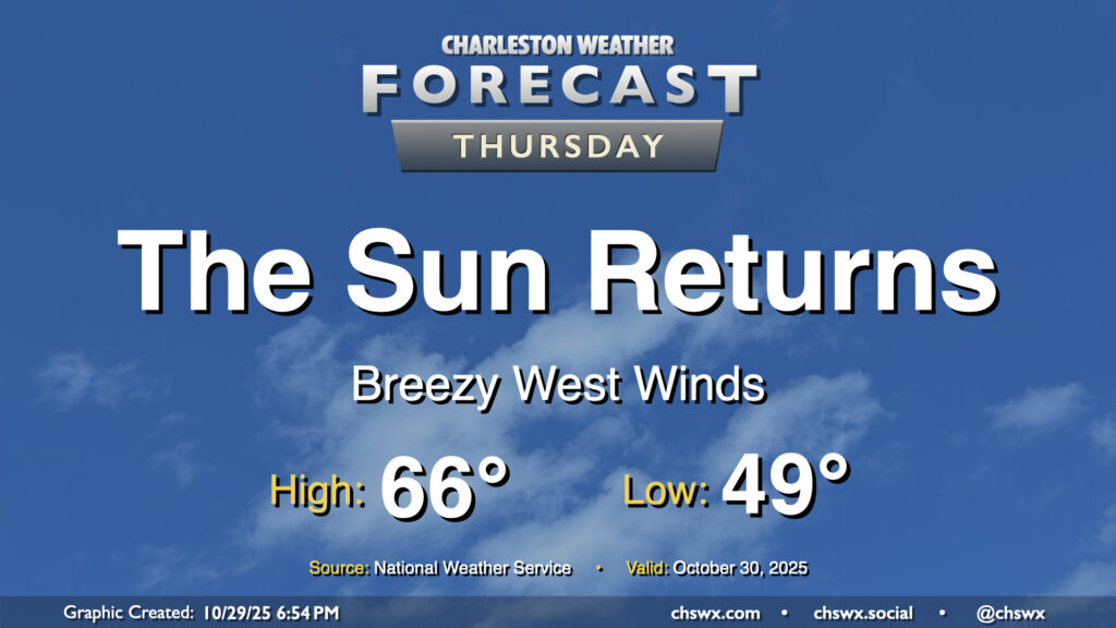
A cold front will swing through overnight, scouring out the clouds and ushering in drier high pressure behind it. It’ll be great to see the sun, which will make highs in the mid-60s feel quite nice. We’ll have a bit of a westerly breeze in the wake of the front, so keep that in mind if you have any plans to dine al fresco, but otherwise, it looks like a really good day of weather across the Lowcountry.
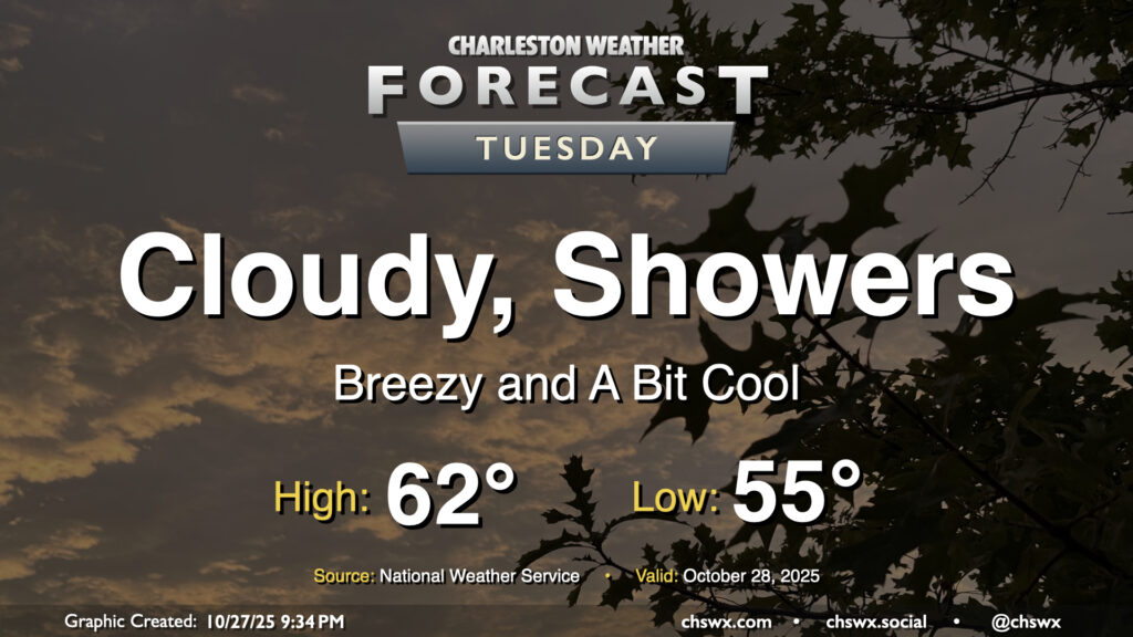
More overcast is in store for Tuesday despite low pressure departing the area. The overcast combined with gusty northerly winds and a few lingering showers will keep us on the cool side in the afternoon, with highs only peaking in the low 60s after a start to the day in the mid-50s. Showers should taper off by evening, with a rain-free period expected until Wednesday afternoon.
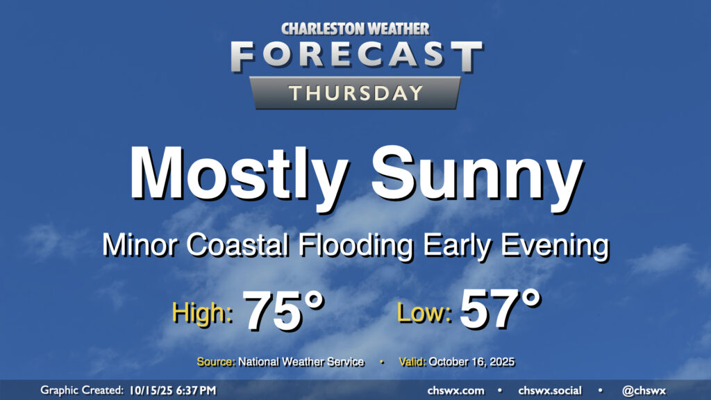
Mother Nature’s apology for the nor’easter continues Thursday with another day of comfortable temperatures and plenty of sunshine expected. A weak, dry front moves by early in the day, and so we should see temperatures start and peak a little cooler than we did on Wednesday. Expect lows in the mid-to-upper 50s warming to the mid-70s under mostly sunny skies. Winds will swing around to the northeast and pick up a little bit, and this could drive some minor coastal flooding with the early evening high tide cycle. A Coastal Flood Advisory is possible, but impacts beyond the most vulnerable locations downtown will be minimal.