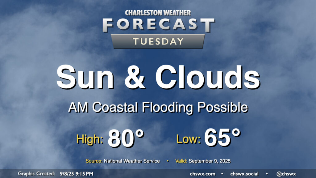
Another quiet weather day is ahead as high pressure wedges across the area from the northeast. Expect a mix of sun and clouds with comfortable temperatures. We start the day in the mid-60s, warming to about 80° in the afternoon. It’ll be a bit breezy, with winds gusting around 15-20 MPH especially near the coast. These northeasterly winds will continue to drive tidal departures in Charleston Harbor above flood stage, and we should see minor to moderate flooding with the 9:35 AM high tide. Some flooding may have impacts on the tail end of the commute, so be prepared for delays if downtown is your destination.
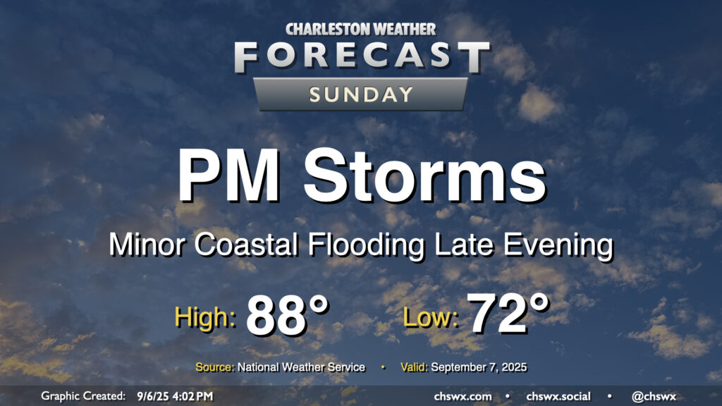
After a few welcome rain-free days, shower and storm chances return to the forecast for Sunday as a cold front moves into the area. We’ll start the day in the low 70s, working our way into the upper 80s in the afternoon before showers and storms kick off. Some rain could be heavy at times, and lightning may be an issue particularly inland where some stronger storms may be possible. It won’t be an all-day rainout, thankfully, but you’ll want to have your indoor plans ready to go if thunderstorms approach.
Isolated salt water flooding may also be a concern around the 7:47 PM high tide. The current total water level forecast brings the tide right to around 7′, which may be enough to cause a little flooding on the most vulnerable roads in downtown Charleston. The risk for coastal flooding around times of high tide increase throughout the first part of the week with the combination of the full moon, lunar perigee, and northeasterly winds in the wake of Sunday’s front, so stay tuned for Coastal Flood Advisories from the National Weather Service.
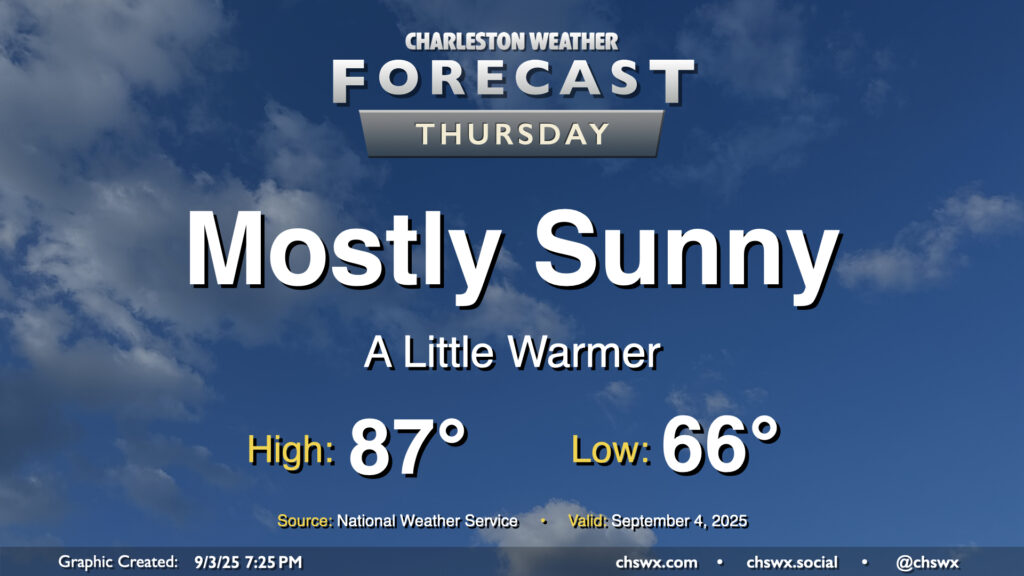
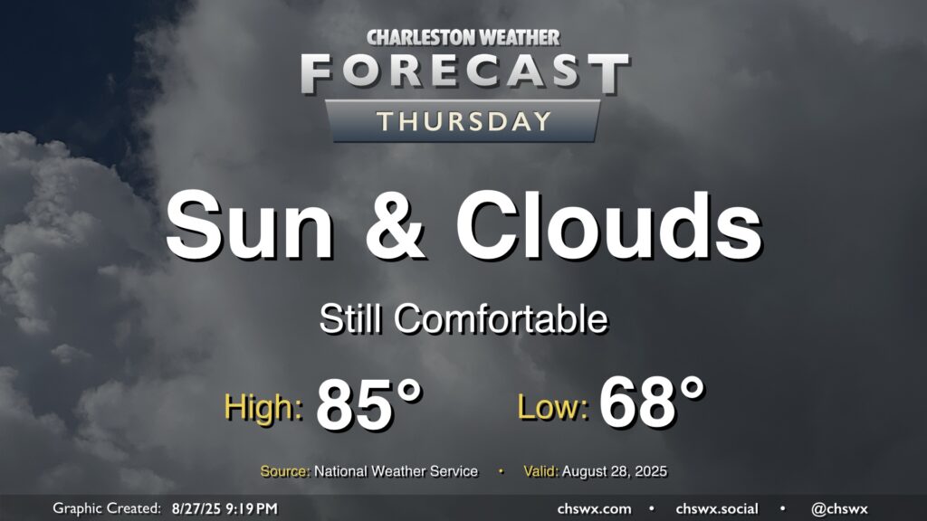
We’ll start to turn a little warmer on Thursday as high pressure to the northeast breaks down a bit, but we should still get one more good day of low humidity in before we start to see dewpoints begin to climb back toward 70° starting Friday. Temperatures on Thursday start quite comfortably once again, with mid-60s the general rule across much of the area. We’ll warm to the upper 80s on Thursday afternoon with plenty of sunshine. The only fly in the ointment may be some very minor coastal flooding around the 6:19 PM high tide, with water levels currently forecast just below 7′. If water levels trend a little higher, a Coastal Flood Advisory may be issued. Otherwise, though, it’ll be another really nice early September day in the Lowcountry.
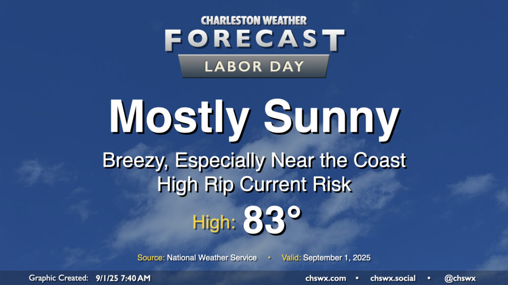
High pressure wedging into the area from the north will make for a beautiful Labor Day and start to climatological fall. Temperatures are starting in the low to mid-60s for the first time since early June, and we’ll warm to the low to mid-80s in the afternoon under mostly sunny skies with an elevated northeasterly breeze keeping things on the cool side.
If the beaches are in your plans, it’ll be noticeably windier there — gusts 25-30 MPH will be possible — and there is a high risk of rip currents today as a result. Today just won’t be a good day to get into the ocean as it could turn dangerous in a hurry. However, the refreshing dry air and comfortable warmth will certainly help make up for it!
Another nice day lies ahead on Thursday, with a nice start in the upper 60s warming to the mid-80s in the afternoon. We should see a little uptick in cloud cover with a little higher-dewpoint air infiltrating in, but the forecast is largely rain-free. So, it’ll be another nice day to get out and about if you’ve got some time.
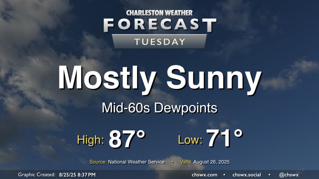
Dewpoints will continue to fall on Tuesday as drier air filters into the area, making for a comfortably warm day with plenty of sunshine to be had. We start the day in the low 70s, warming to the mid-to-upper 80s in the afternoon with just some fair weather cloud cover to be had. All in all, a welcomed nice day after yet another deluge in Mt. Pleasant on Monday.
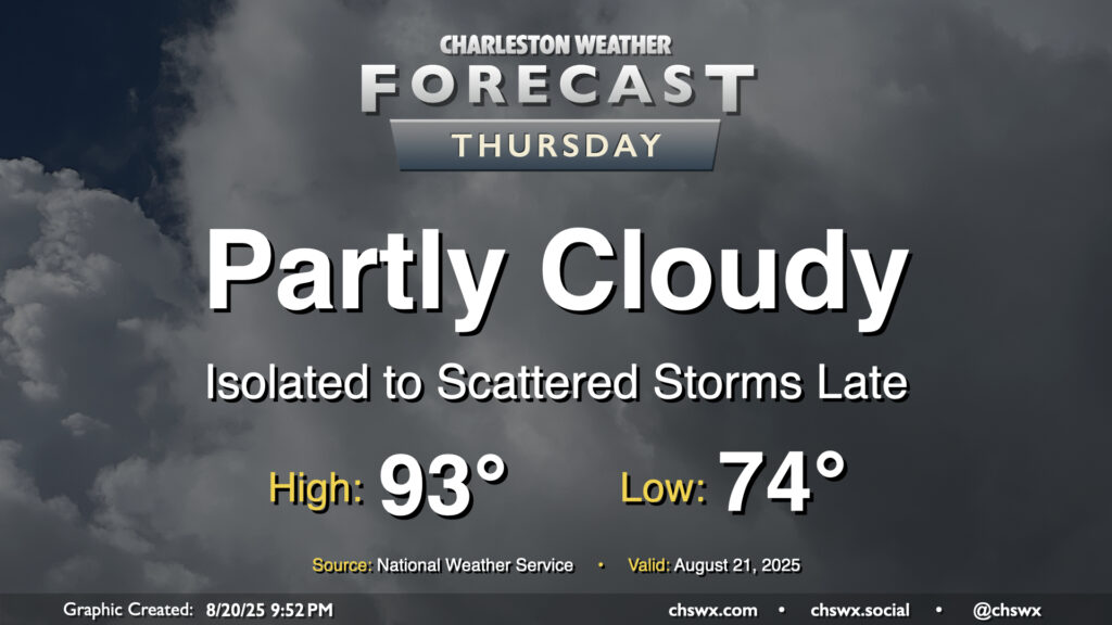
Thursday will be another warm day across the Lowcountry, with lows in the mid-70s warming to the low-to-mid-90s in the afternoon. Heat indices will run in the upper 90s to perhaps 100° in spots under generally partly cloudy skies. We should start to see cloud cover begin to thicken a bit as we get into the afternoon and evening hours, though, with rain chances increasing as Hurricane Erin accelerates to the northeast and a cold front drives south into the area, stalling out as it gets to our south.
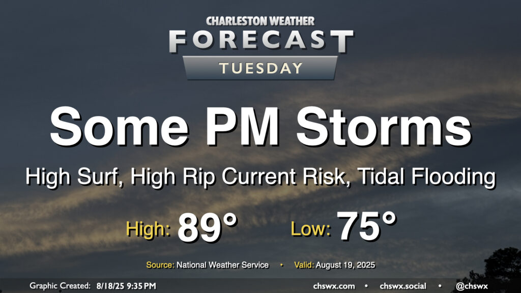
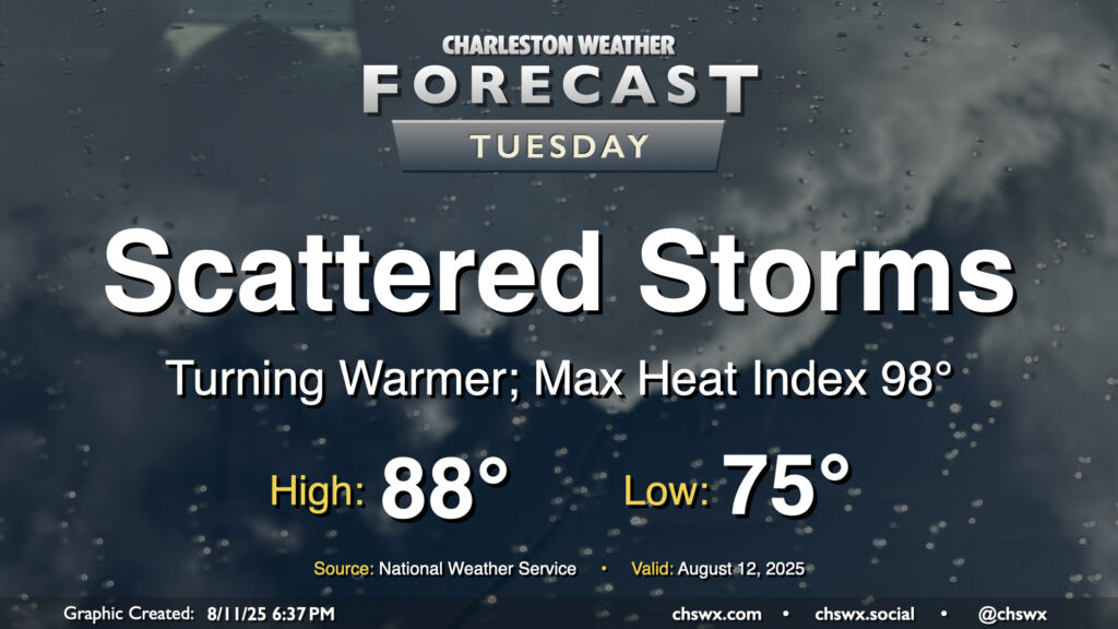
After an uncharacteristically quiet Monday (weather-wise, anyway), Tuesday should feature a few more storms as a little energy aloft moves through and interacts with the afternoon seabreeze. Temperatures start in the mid-70s, warming to the upper 80s to around 90° before thunderstorms disrupt the temperature curve for some of us. Models do indicate some isolated heavy downpours, though with less in the way of deep moisture, the flooding threat shouldn’t be terribly high.
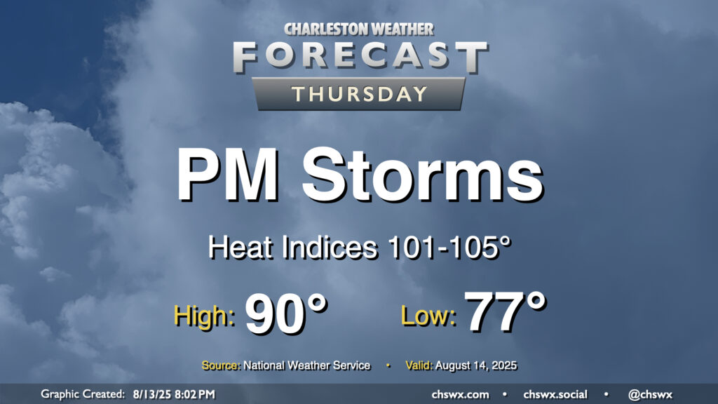
Thursday will be a fairly typical mid-August day across the area. We’ll start in the mid-to-upper 70s, warming to around 90° in the afternoon with heat indices generally running in the low to mid-100s given continued dewpoints in the mid-to-upper-70s, highest downtown and along the coast with closer proximity to the water. Once again, showers and thunderstorms should fire on the seabreeze in the afternoon, and a couple of those could be on the strong side with frequent lightning and gusty winds. Winds out of the west will drive showers and storms coastward, so keep an eye on this if you’re taking a day at the beach (you lucky duck).
After a rambunctious Monday that featured widespread showers and thunderstorms leading to flash flooding downtown as well as a lightning strike caught on camera in Mt. Pleasant, the weather will return to a more traditional summertime pattern beginning Tuesday as Charleston County heads back to class. Temperatures will start on the mild side, generally in the mid-to-upper 70s, warming to the upper 80s in the afternoon. Mix in the continued humidity, and it’ll feel closer to 98°. Scattered showers and storms should fire again in the afternoon along and ahead of the seabreeze, and yes, there is a risk of heavy rain with these storms, but the risk for flash flooding will be a bit lower especially as storm motions should be a bit faster.