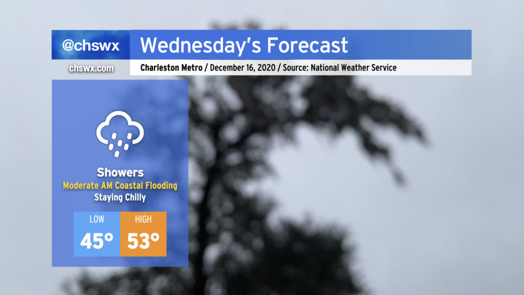
This evening, a coastal low is beginning to develop off the Georgia coast. This low will move northward tonight into tomorrow, eventually turning into quite the nor’easter for New England. Locally, expect periods of showers to continue tonight into Wednesday as the low lifts northward and a cold front approaches from the west. Temperatures will remain chilly, only topping out in the low 50s in the afternoon. The front will clear the area during the evening, giving way to drier air for Thursday.
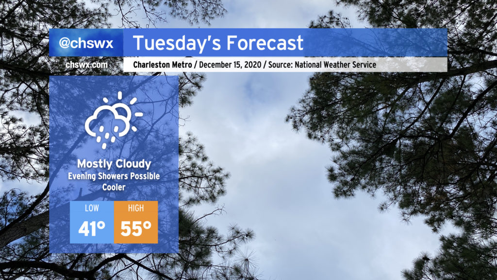
Clouds will increase overnight into Tuesday morning, giving the day a mostly cloudy look with just a few peeks of sun possible in the morning and early afternoon hours. It’ll feel noticeably colder in the wake of today’s cold front — highs should only top out in the mid-50s.
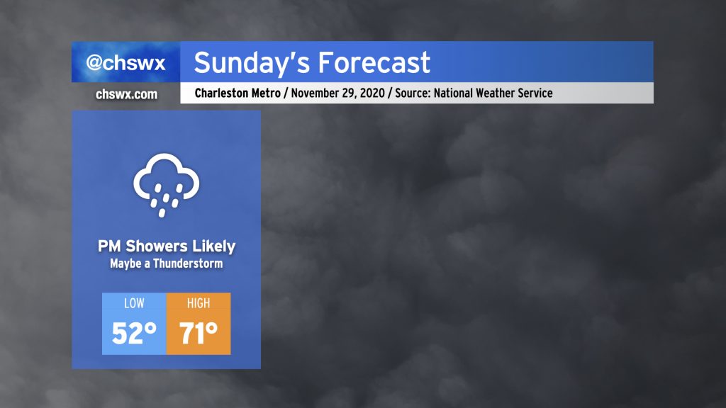
As low pressure organizes off the coast and begins to move northward, some overrunning should take place, generating scattered light showers across the area by mid-afternoon. Showers will continue into the evening, with the best rain chances arriving with the cold front Wednesday.
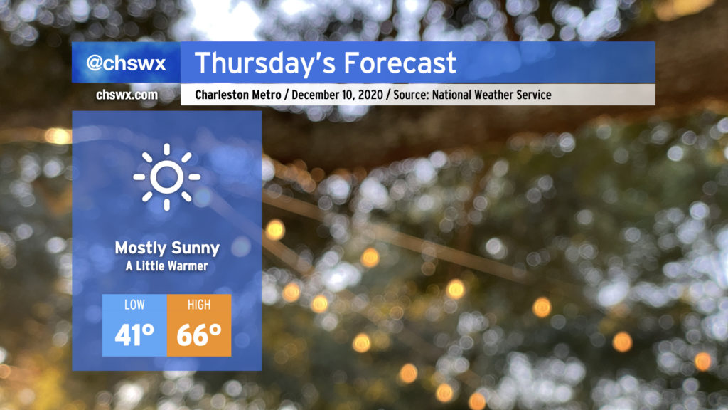
Mostly sunny skies and warmer temperatures will make for a very nice Thursday across the Lowcountry. Expect temperatures to start out in the upper 30s to low 40s in the morning, followed by highs topping out in the mid-60s — just a touch above normal for December 10.
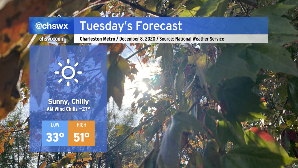
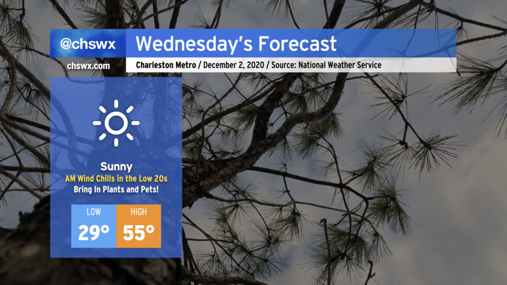
After a fun evening of rain mixed with graupel, we return to clear and chilly conditions for Tuesday. Temperatures will fall to freezing in a few spots well inland, with low to mid-30s across much of the Charleston metro. Factor in a decent northwest breeze and it’ll feel closer to the mid-20s in the morning.
We’ll remain under full sunshine throughout the day, but temperatures will struggle to the low 50s as cool air continues to filter into the area.
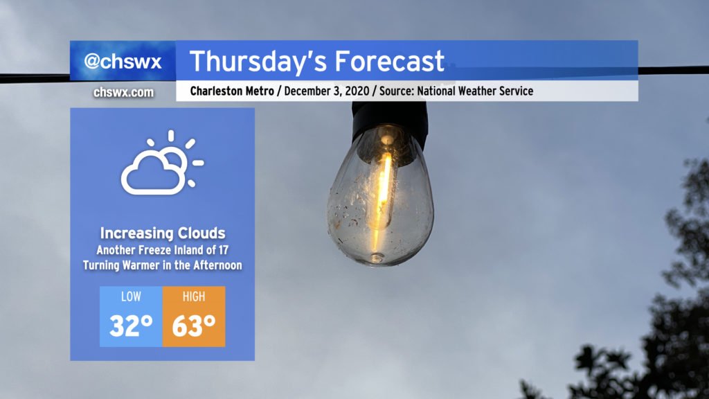
Bring in your pets and plants again tonight as temperatures will be headed toward the freezing mark once more, generally along and inland of Highway 17. The freeze won’t be quite as widespread as we saw this morning, but expect temperatures to fall into the 30s close to the coast, including into downtown Charleston.
After the chilly start, temperatures will rebound back into the 60s for the afternoon as winds turn more onshore throughout the day. Expect clouds to increase as well from the west ahead of our next storm system, which brings rain back to the area for Friday.
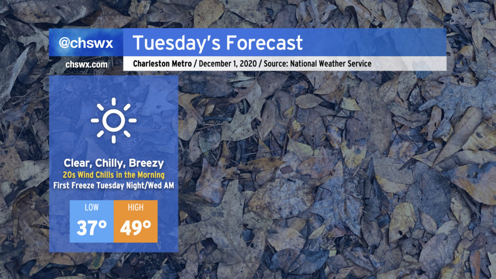
Bring in plants and pets tonight as temperatures will be dropping into the upper 20s in many spots away from the coast. Temperatures will dip into the 30s even near the coast, with an outside shot at freezing at downtown Charleston.
At least the afternoon will be warmer than today’s 48° — the airmass will slowly modify starting Wednesday, allowing for highs in the mid-50s. We’ll be back in the 60s by Thursday with increasing clouds ahead of our next storm system.
We in the weather community have been talking about this cold snap for a while, and it is finally here. Tuesday promises to be a very chilly day — the coolest since mid-February — with highs struggling to reach 50° despite full sunshine. A persistent westerly wind will keep temperatures feeling even colder, too, with wind chills in the upper 20s expected in the morning. Make sure your loved ones, two and four-legged, have a warm place to be tonight (and for the next couple nights).
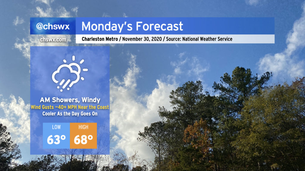
We’ll get this week off to a rainy and windy start as the storm system which rained on us for a fair bit of today moves through the area on Monday, ushering in the coldest air of the season in its wake.
Sunday will start out dry and mostly cloudy, but will turn more rainy as a warm front lifts north across the area during the afternoon and evening. This rainfall is associated with a storm system that will move across the Gulf Coast states tomorrow and then more northeastward into the Mid-Atlantic Sunday night into Monday, ushering in a legit winter chill behind it — just in time to start meteorological winter on Tuesday.
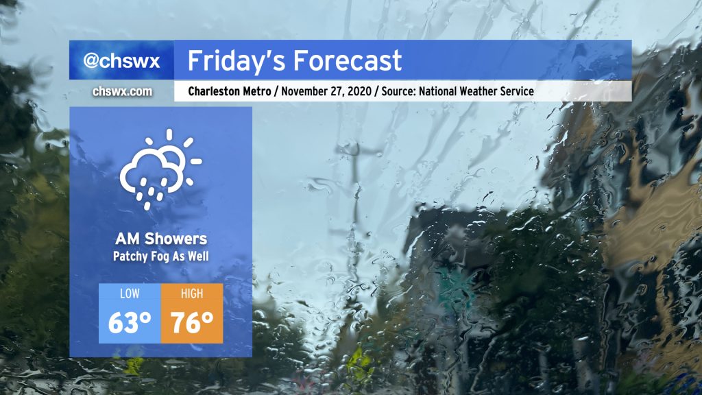
We’ll start the Friday after Thanksgiving with some showers as a cold front slowly trudges through the area. Once this front is through, rain chances will decrease and we should have a fairly nice afternoon, with temperatures still running well above normal in the mid-70s — though not quite getting to 82° like we did today.