Chilly night ahead, but we trend warmer into Easter and beyond
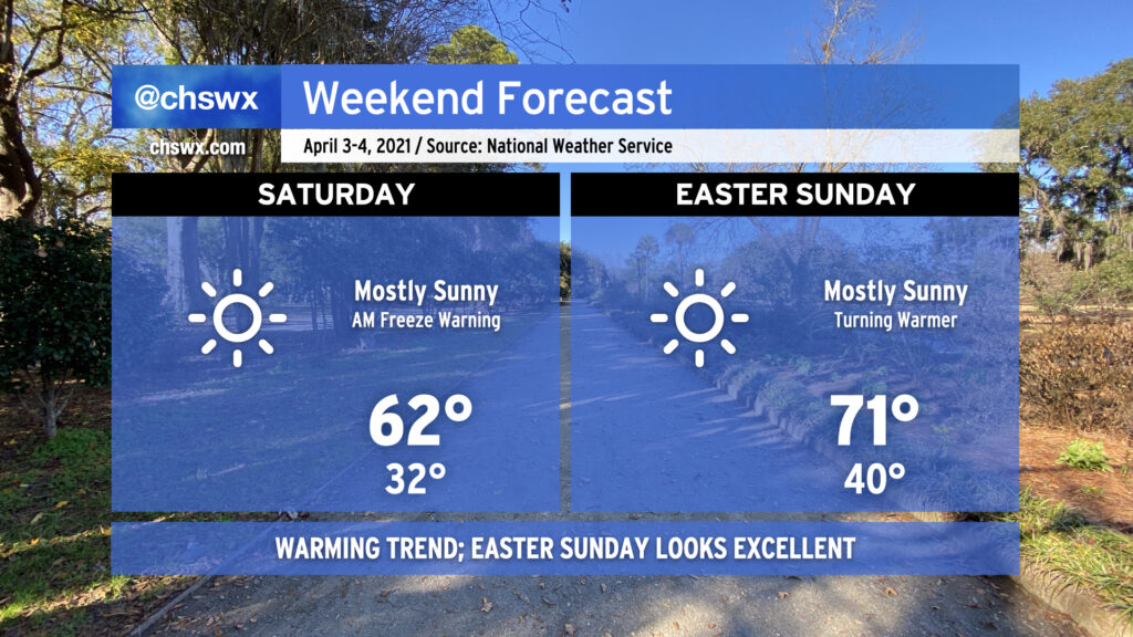
After very likely setting a new record low maximum temperature today with a high so far of just 53°, our cold snap continues into tonight and tomorrow. A Freeze Warning is in effect for the Tri-County tonight as temperatures are expected to dip below freezing for at least a little while particularly inland and in sheltered areas. The record low of 33° at the airport, set in 1962, certainly seems in jeopardy to fall. Even where temperatures don’t drop below freezing, there is some potential for frost. Wherever you are, protect plants and pets tonight!
Saturday afternoon should see high temperatures run about 9-10° warmer as the trough that brought us this cold snap moves well away from the area and the April sun angle is able to modify the airmass. We’ll keep high pressure firmly in place at the surface, and that should yield an exceptionally nice spring day with highs in the low 70s in the afternoon.
Beyond the weekend, temperatures will gradually warm to the low 80s by the middle of next week. We’ve got a pretty decent dry stretch ahead of us before our next storm risk arrives for next weekend. Enjoy, and stay warm!
