Excessive heat expected particularly near the coast this afternoon; line of thunderstorms approaches late
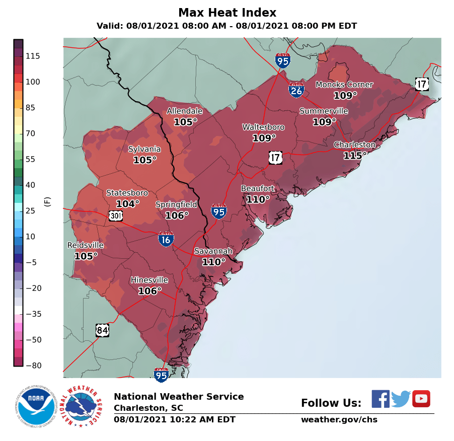
Temperatures will once again reach the mid-90s this afternoon across the area (fun fact: yesterday was the first 95° day all year at the airport). Combined with moisture-laden air characterized by dewpoints near 80°, this will once again drive the risk for excessive heat indices upwards of 115° near the coast, where an Excessive Heat Warning is in effect for today. For the inland counties, a Heat Advisory will be in effect with heat indices approaching 110°. Regardless of whether you are in the advisory or warning area today, you’ll want to take precautions against heat illness if you must be outside during the afternoon.
Showers and thunderstorms look to initiate a little later in the day than we saw yesterday, with the best risk of storms coming in the late afternoon and early evening hours. Models suggest a line of thunderstorms could develop and move across the area today. Timing is always a question mark, but I would be on guard for storms starting about 3-4 PM, with the earlier timeframe the further north and west you are. Available energy will be abundant with such strong surface heating and moist dewpoints. Thus, a few storms could be on the strong to severe side with damaging wind gusts, but frequent cloud-to-surface lightning and pockets of heavy rain remain the overwhelming concern from any storms that form this afternoon.
A cold front looks to get close to the area tonight. This will help shut off the oppressive heat of the last few days, but at the cost of another few days of on and off heavy, flooding rainfall. Will have more on the upcoming week later this evening.