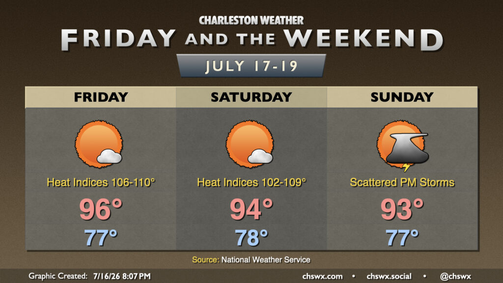
What looks to be a top-five-warmest July on record will close on a slightly cooler and drier note as high pressure nudges in from the north. Thursday starts in the mid-70s across the area, warming to the low-to-mid-90s in the afternoon with plenty of sunshine. As mentioned, the drier air will keep heat indices a little more in check, though they may still get close to 100° near the coast where the more humid maritime airmass resides. But with all that in mind, it’ll still feel better outside than it did at the start of the week.
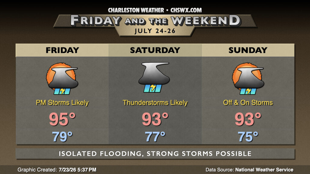
A cold front that’s brought quite a bit of rain to North Carolina today will continue to sag southward Friday, stalling out around the area over the weekend and keeping our weather relatively unsettled as a result.
Heat and humidity continues for Friday and the weekend with high pressure aloft the main weather driver. Atlantic high pressure will continue to drive high dewpoints into the area, and that not only will drive heat indices well into the 100s, but it will keep us quite toasty at night, too. Expect lows in the upper 70s each day, perhaps not dropping below 80° closer to the coast and downtown.
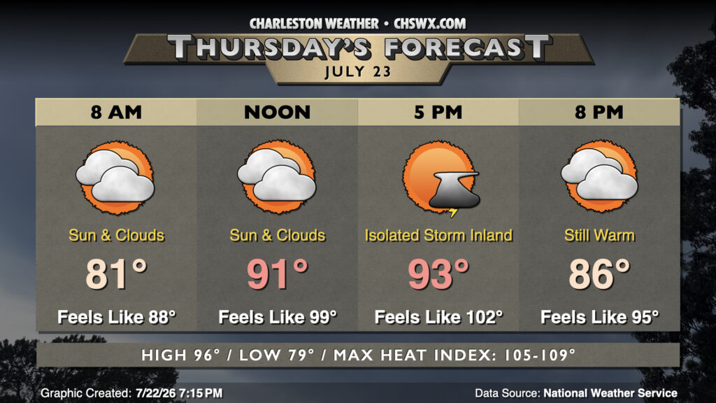
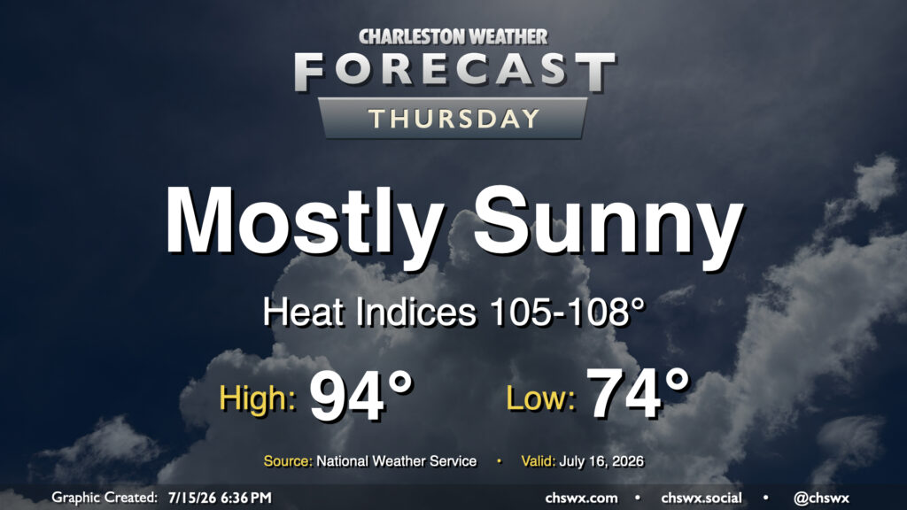
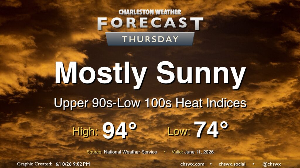
High pressure rebuilding aloft will bring more sunshine — but more heat, too. We’ll start Thursday in the mid-70s inland to upper 70s near the coast. From there, plenty of sunshine will drive highs into the mid-90s. Dewpoints will be fairly juicy — generally in the mid-to-upper 70s — and this will drive heat indices well into the mid-100s. Closer to the coast as well as in downtown, dewpoints near 80° will help drive the heat index up toward 108° for at least a brief period. Heat Advisory criteria is a heat index 108°-112° for two hours or more, and we certainly could be close in the coastal corridor. Regardless, be sure you’re taking frequent breaks in the shade with plenty of water if you’re working outside.
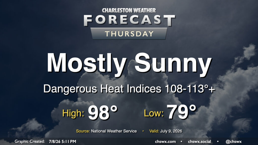
It was a stifling hot Wednesday in the Lowcountry, with highs reaching the upper 90s and heat indices peaking between 113-116° in parts of the metro area. Another round of high heat is in store for Thursday, as temperatures once again return to the upper 90s. Dewpoints near the coast and behind the seabreeze should surge well into the mid-to-upper 70s once again, sending heat indices between 108-113° (with locally higher readings possible) in the Highway 17 corridor. This has prompted another Extreme Heat Warning for Charleston County as well as the southern portion of Berkeley County that includes Hanahan and Daniel Island. Elsewhere, a Heat Advisory will be in effect for heat indices around 108-110°. Model guidance still suggests a few showers and thunderstorms will fire off along and ahead of the seabreeze, which will help cool some of us off. Coastward storm motions moving against the inland-moving seabreeze could cause some back-building of thunderstorms with some locally heavy rain. The strongest storms could produce damaging wind gusts, and a warning or two can’t be totally ruled out as a result.
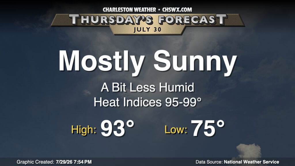
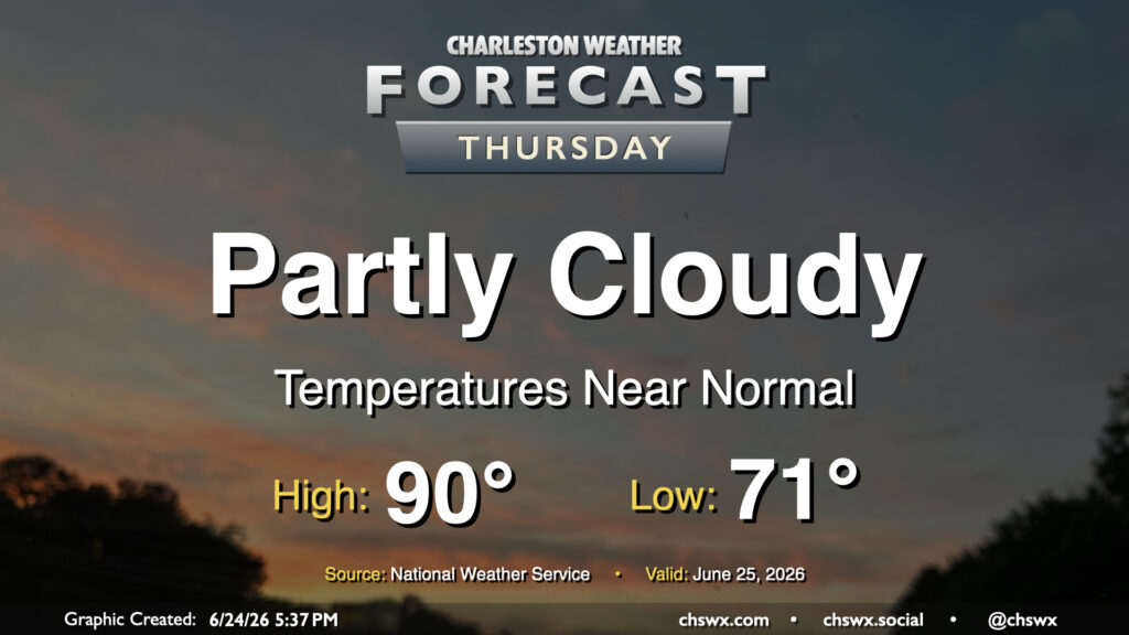
Another quiet day is on tap for Thursday with high pressure in control. Lows bottom out in the low 70s, warming to around 90° in the afternoon. Dry air (for this time of year, anyway) will hang on for one more day, though it will be a bit more humid than it was on Wednesday. High pressure and warm air aloft should keep a lid on thunderstorms for one more day as well.
Unsettled weather continues as the remnants of short-lived Tropical Storm Arthur move across GA and South Carolina late tonight into early Friday. From there, more typical summertime weather sets in.
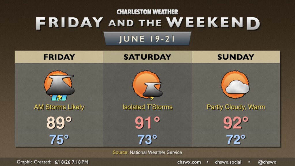
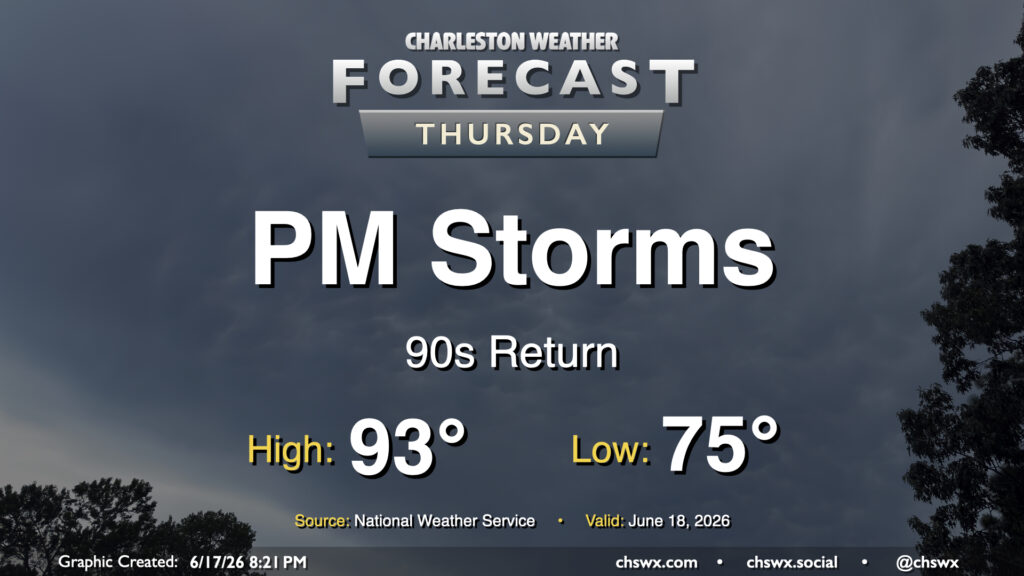
We’re back in the 90s on Thursday as we get a brief lull in between disturbances, but showers and thunderstorms will return in the afternoon and evening as a slug of moisture from what we expect will be the remnants of Tropical Storm Arthur, which was christened earlier today, There will be a risk for a storm or two to produce some damaging wind gusts, but the overall severe weather threat this far to the east is fairly marginal. Will keep an eye out, though.
High pressure remains in control across the area, limiting afternoon thunderstorms and allowing heat to continue to build on Thursday. We’ll start in the mid-70s, warming to the mid-90s in the afternoon. Mix in dewpoints in the low-to-mid-70s and that will yield heat indices approaching or even slightly exceeding 100°. And while a brief popup sbower is never fully out of the question this time of year, the vast majority of us will stay rain-free.