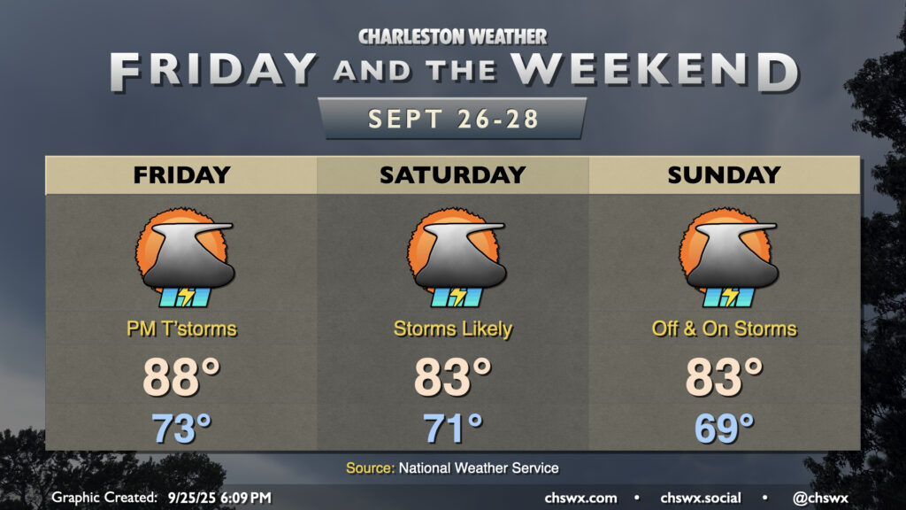
A front and upper-level low will send weather downhill as we get into Friday afternoon and the rest of the weekend, though that won’t be the main weather story, methinks, as we monitor the disturbance currently known as Invest 94L in the tropics for possible development and subsequent impacts next week.
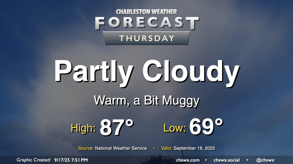
After hitting 91° on Wednesday, we look to take another trip to the 90s on Thursday as ridging aloft combines with Atlantic high pressure to keep us well on the warm side of normal for another day. Temperatures start in the low to mid-70s, well above normal for this point in the year, warming to the 90s in the afternoon with heat indices making it feel more like the mid-90s. We could see a stray shower or thunderstorm in the afternoon and evening along and ahead of the seabreeze, but most of us should stay dry.
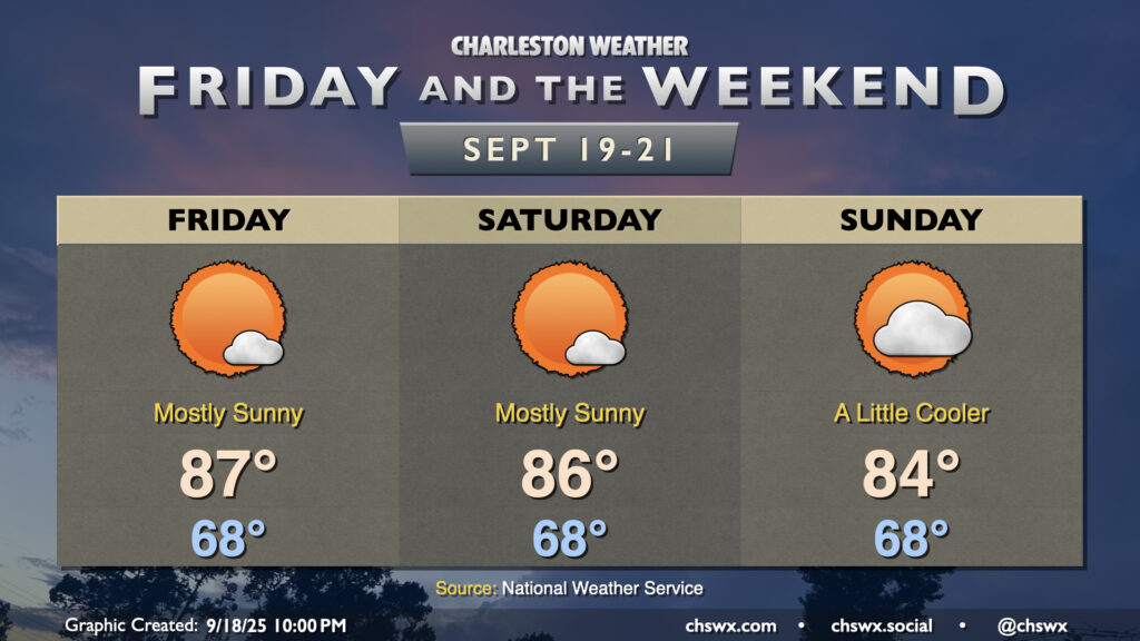
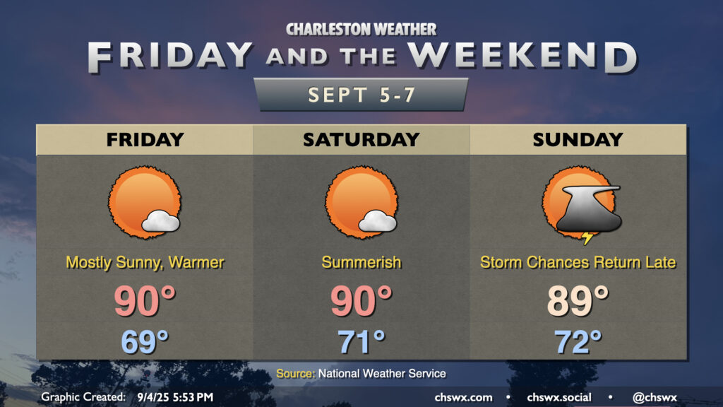
There’s really not terribly much to write home about weather-wise for Friday and the weekend with high pressure remaining in control. Temperatures will remain on the warm side of normal, particularly on Friday and Saturday. We start each day in the upper 60s, warming to the upper 80s Friday and into the mid-80s on Saturday with mostly sunny skies expected. A front sinking south across the area on Sunday will bring in some cloud cover and maybe even a stray shower or two, along with gusty winds (especially at the coast). This will keep highs a little cooler as a result, but still right around normal for this point in the year. Dewpoints will remain elevated — generally running in the upper 60s to around 70° — so there will be a bit of mugginess in the air as well (especially compared to how we started the week).
With winds starting to come back around to the northeast, we could see another round of coastal flooding begin with Saturday evening’s high tide. Stay tuned for possible Coastal Flood Advisories from the National Weather Service.
Another warm day is ahead for Thursday as high pressure generally remains in control with winds coming a bit more out of the west and southwest. Temperatures Thursday start much warmer than they did on Wednesday, with lows in the upper 60s to around 70° expected. We’ll warm to the mid-to-upper 80s in the afternoon under generally partly cloudy skies. A stray shower or storm is possible well inland, but the vast, vast majority of us will stay rain-free.
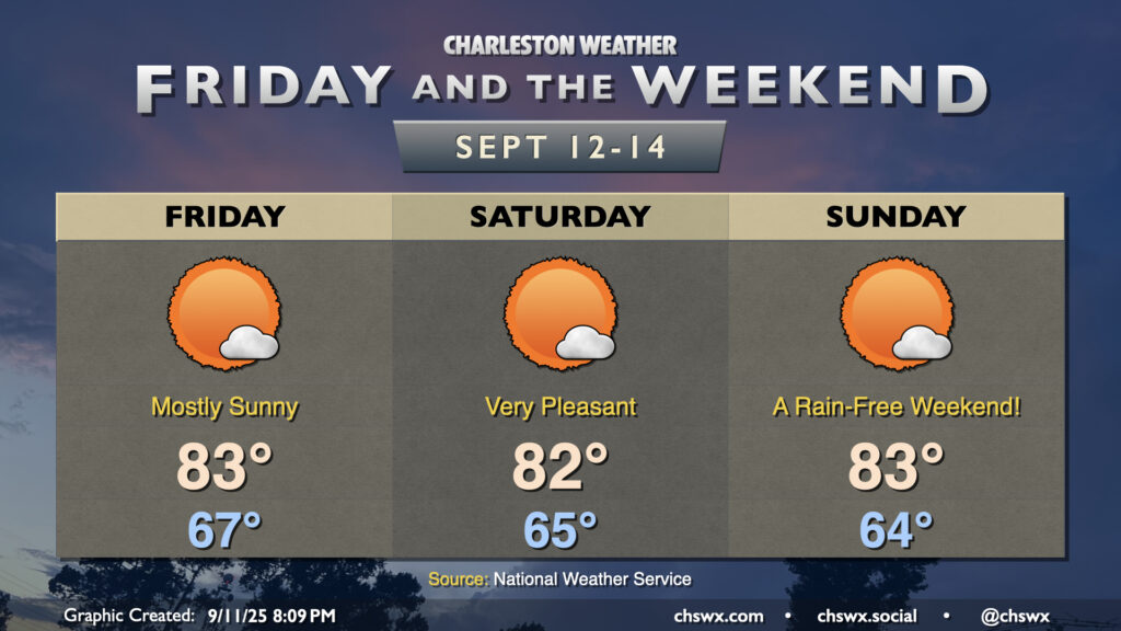
More sunshine will show itself starting Friday and lasting into the weekend courtesy of continued high pressure and northeasterly winds keeping a feed of cooler and drier air coming in. All in all, we can expect lows in the mid-60s each morning, with highs peaking in the low to mid-80s in the afternoon. Fun fact: This looks like the first weekend since July 26-27 without at least a trace of rain at either of the climate sites, so suffice it to say, we are very, very due for a quiet weekend of weather.
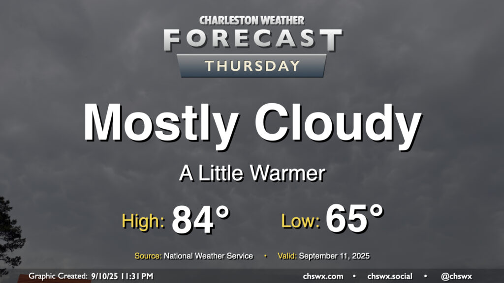
Thursday will run a bit on the cloudy side, but we’ll still see some peeks of sun at times to allow temperatures to warm from the mid-60s in the morning to the mid-80s in the afternoon. Northeasterly winds persist, keeping dewpoints relatively low and the air comfortably warm as a result. We will continue to contend with some salt water flooding around the midday high tide, which could close a few roads for those of us headed for an early lunch downtown.
Warmer and a little more humid air will return to the area Friday as winds go more southerly. With high pressure remaining in control for a few more days, though, we’ll stay largely quiet weather-wise this weekend before a front starts to affect the area later Sunday.
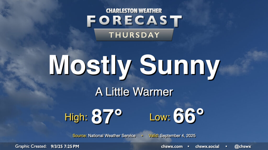
We’ll start to turn a little warmer on Thursday as high pressure to the northeast breaks down a bit, but we should still get one more good day of low humidity in before we start to see dewpoints begin to climb back toward 70° starting Friday. Temperatures on Thursday start quite comfortably once again, with mid-60s the general rule across much of the area. We’ll warm to the upper 80s on Thursday afternoon with plenty of sunshine. The only fly in the ointment may be some very minor coastal flooding around the 6:19 PM high tide, with water levels currently forecast just below 7′. If water levels trend a little higher, a Coastal Flood Advisory may be issued. Otherwise, though, it’ll be another really nice early September day in the Lowcountry.
Friday is looking a little warmer but should remain rain-free as high pressure remains the main weather driver for at least one more day. Temperatures start in the upper 60s, warming to the mid-to-upper 80s in the afternoon under partly cloudy skies. An uptick in cloud cover and maybe a stray shower or two could accompany the seabreeze in the afternoon, but guidance keeps the majority of the area dry.
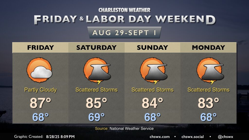
Shower and thunderstorm chances kick up a little bit for the weekend, though the trend has been a bit drier overall as high pressure to the north keeps the better rain chances further south. Still, waves of low pressure should at least kick up scattered coverage across the area especially in the afternoons, but it doesn’t look like a washout, and it will be a far, far cry from last weekend’s deluge. Temperatures will continue to run below normal; expect highs in the mid-80s each afternoon after starting each day in the upper 60s. It won’t feel much like summer as we unofficially bring it to a close, but it should still at least feel fairly pleasant when storms aren’t around.
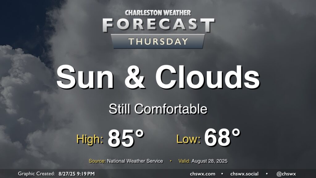
Another nice day lies ahead on Thursday, with a nice start in the upper 60s warming to the mid-80s in the afternoon. We should see a little uptick in cloud cover with a little higher-dewpoint air infiltrating in, but the forecast is largely rain-free. So, it’ll be another nice day to get out and about if you’ve got some time.