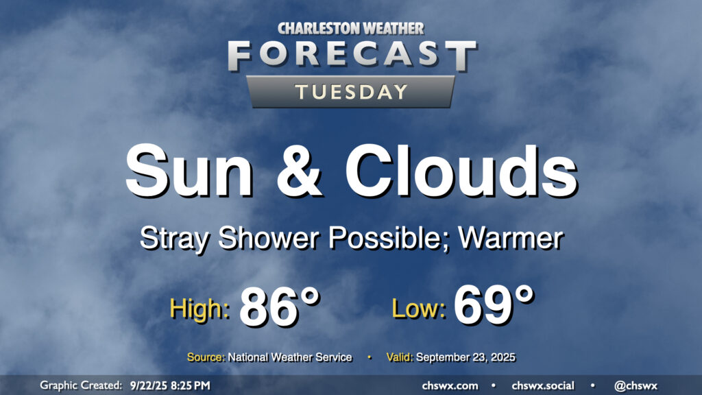
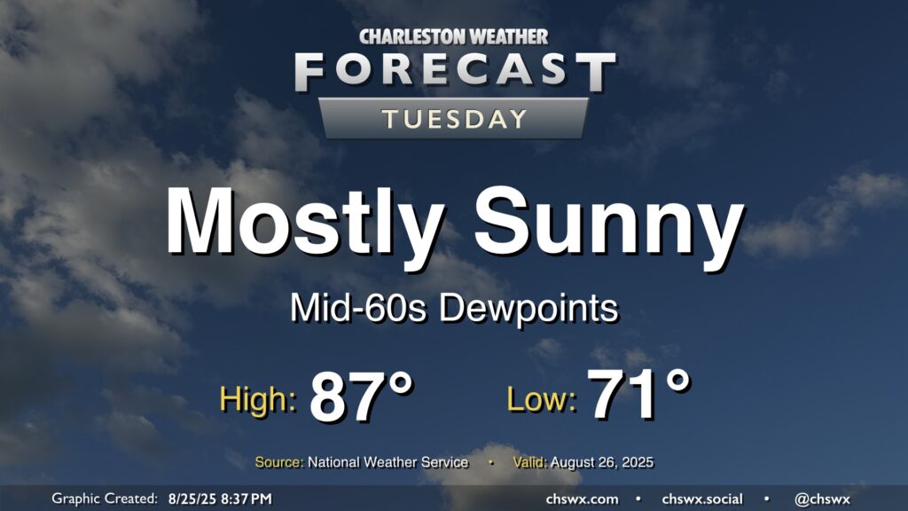
A warming trend begins Tuesday as high pressure to the north continues to weaken and winds turn more onshore, ushering in a much more summer-like feel over the next few days. Temperatures Tuesday start in the upper 60s to around 70°, warming to the mid-80s in the afternoon with a mix of sun and clouds. Factor in the upper 60s-lower 70s dewpoints and it’ll feel more like 90°. Like we saw on Monday, a few afternoon showers are possible, though the weakening high also will portend a weakening coastal trough, which should keep the risk for showers relatively low.
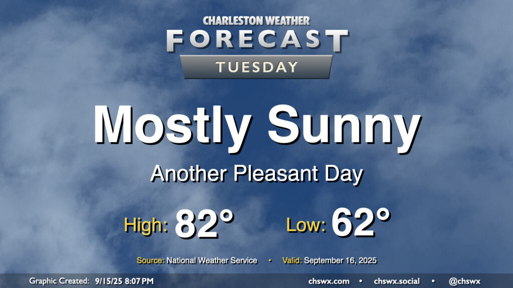
There’s not too much to write home about weather-wise for Tuesday other than it will be a really nice mid-September day across the Lowcountry. Below-normal temperatures continue, with lows in the low 60s warming to the low 80s in the afternoon under mostly sunny skies. Dewpoints mix down to the mid-50s in the afternoon, making the warmth comfortable. Plus, water levels will fall short of flood stage Tuesday as we get further away from the full moon and the recent perigee, so there are no coastal flooding concerns for the rest of the week, either.
Another quiet weather day is ahead as high pressure wedges across the area from the northeast. Expect a mix of sun and clouds with comfortable temperatures. We start the day in the mid-60s, warming to about 80° in the afternoon. It’ll be a bit breezy, with winds gusting around 15-20 MPH especially near the coast. These northeasterly winds will continue to drive tidal departures in Charleston Harbor above flood stage, and we should see minor to moderate flooding with the 9:35 AM high tide. Some flooding may have impacts on the tail end of the commute, so be prepared for delays if downtown is your destination.
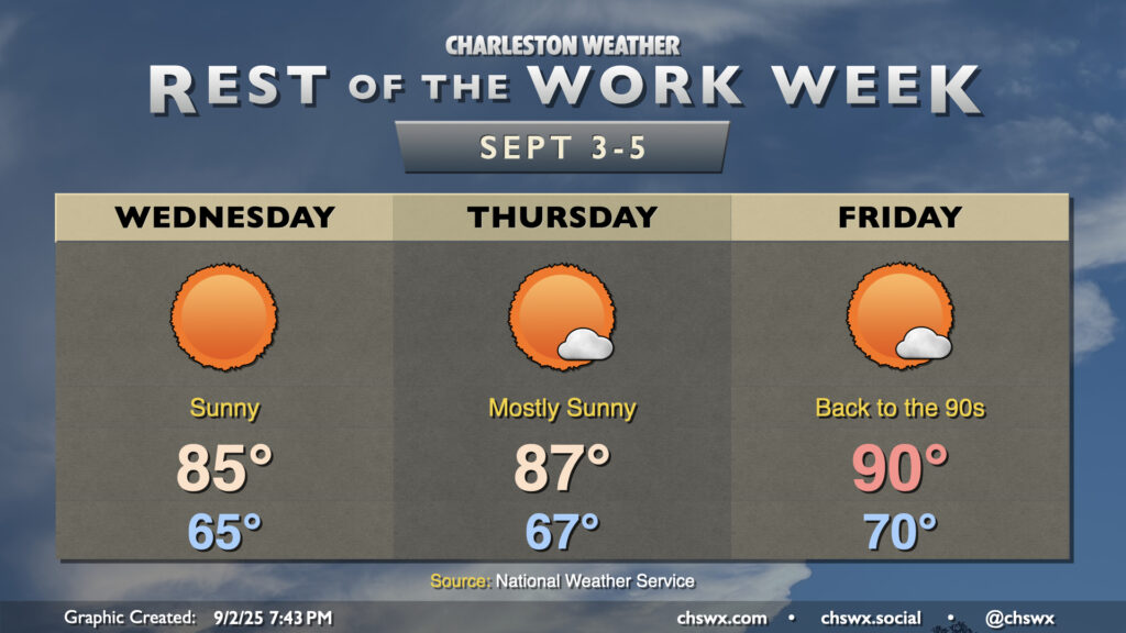
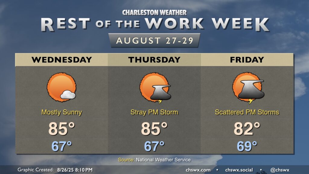
The rest of the work week will remain generally quiet (weather-wise, anyway), as high pressure remains in control at the surface. Temperatures will be on a warming trend as we get over the hump and into the second half of the work week as the mid-level trough that’s kept us on the cool side flattens out and retreats a bit north. We’ll also start to see high pressure build back in from the Atlantic for a few days, which turns the flow at the surface more southerly and starts to bring that more warm and humid air back to the area. We’re in the mid-80s Wednesday, upper 80s Thursday, and likely back to around 90° on Friday, with lows steadily climbing with the dewpoints back to around 70° by Friday morning. However, we look to stay rain-free through about Saturday before another front approaches for late weekend/early next week.
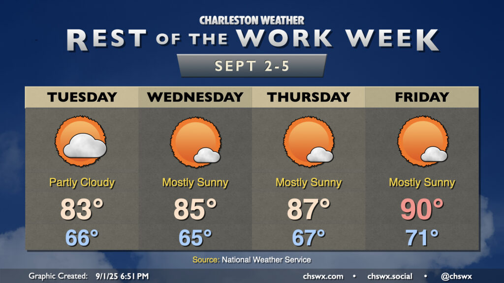
Mostly quiet weather is expected for the rest of the work week, with a warming trend taking us from the fall-like Labor Day weekend back to something a little more resembling summer by the end of the week, with highs back in the 90s by Friday.
Cooler and drier air will continue to push into the area overnight into Wednesday, yielding a well-deserved beautiful day across the Lowcountry with comfortable warmth and few clouds. We start the day in the mid-to-upper 60s, warming to the mid-80s in the afternoon. Dewpoints mixing down to the low 60s — and perhaps as low as the upper 50s — will feel quite good!
Dewpoints will continue to fall on Tuesday as drier air filters into the area, making for a comfortably warm day with plenty of sunshine to be had. We start the day in the low 70s, warming to the mid-to-upper 80s in the afternoon with just some fair weather cloud cover to be had. All in all, a welcomed nice day after yet another deluge in Mt. Pleasant on Monday.
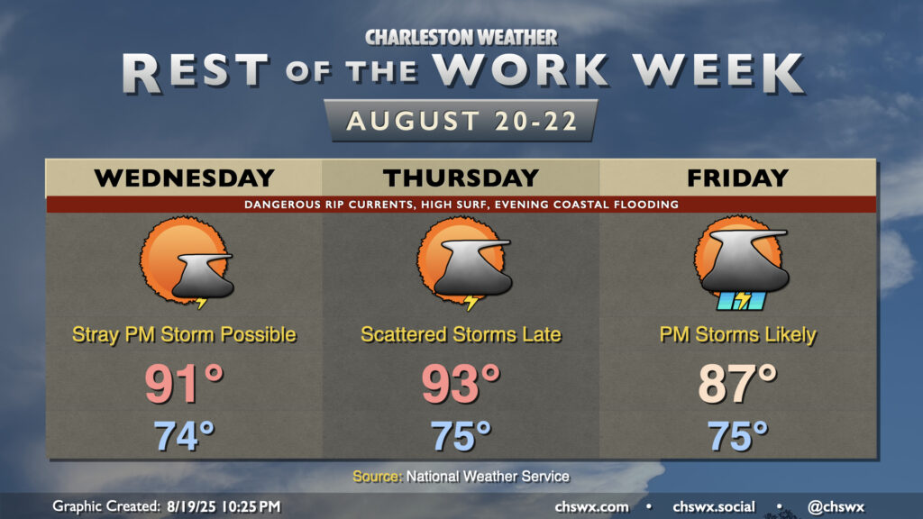
The main story for the next couple days will be Hurricane Erin’s impacts on the Lowcountry. While not a direct hit — the storm will pass hundreds of miles offshore — the strong, dangerous rip currents and high surf will cause beach erosion and coastal flooding issues over the next few days.
After an uncharacteristically quiet Monday (weather-wise, anyway), Tuesday should feature a few more storms as a little energy aloft moves through and interacts with the afternoon seabreeze. Temperatures start in the mid-70s, warming to the upper 80s to around 90° before thunderstorms disrupt the temperature curve for some of us. Models do indicate some isolated heavy downpours, though with less in the way of deep moisture, the flooding threat shouldn’t be terribly high.
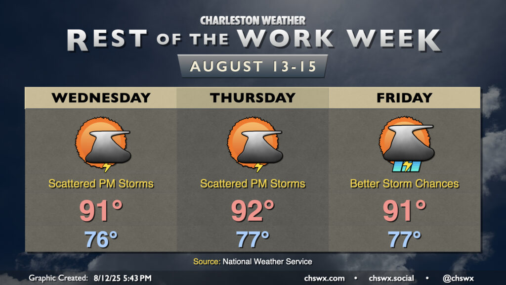
90° temperatures have been tough to come by so far this August. (Please note this is not necessarily a complaint.) Since August 1, only today (August 12) has been a 90° day. It’ll get a little easier to achieve the 90° mark going forward, though, as ridging aloft continues to build in. High pressure in the mid-levels helps temperatures heat up while keeping more widespread thunderstorm activity tamped down. We’ll have plenty of humidity in play, which will allow heat indices to head into the low 100s each afternoon — hot for sure, but not Heat Advisory hot, at least. And yes, there will be a chance for a few thunderstorms each day primarily along and ahead of the seabreeze (with perhaps better coverage on Friday). A couple storms could turn strong or even severe where outflow boundaries collide, and heavy rainfall is certainly a concern as well given deep moisture. However, once again, we’ve had much worse very recently, and shouldn’t have a replay of the past weekend for a bit. Just be ready to head indoors in case thunderstorms approach, and you’ll be fine.