Climatological winter, which runs from December 1 to February 28 (or 29th, depending on the year) will end on a very spring-like note this week as temperatures head back above normal starting mid-week and beyond (with the exception of Friday, when a front comes by with a minor shot of cooler air).
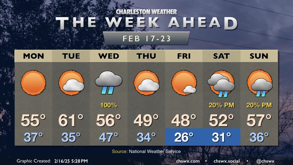
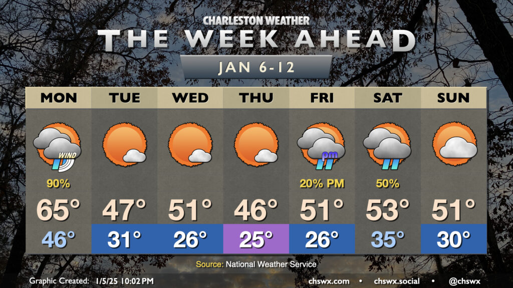
The week ahead will be notable for the return of cooler-than-normal temperatures to the forecast, especially after a mid-week storm system moves by which will send morning lows below freezing for the first time since the mid-January snowstorm.
After a record-breaking stretch of warmth over the past few days, we turn much cooler and cloudier for Monday as a backdoor front slides south and cooler high pressure wedges into the area in its wake. We could see some showers in the morning, but otherwise expect a mostly overcast day as lows in the mid-50s only warm a few degrees, perhaps not even cracking 60° in the afternoon. This stands in stark contrast to the record high of 84° set on Sunday, smashing the previous record for the date of 80° set in 1949. And while it’s been easy to forget with such warm weather, it is still February, and these things happen.
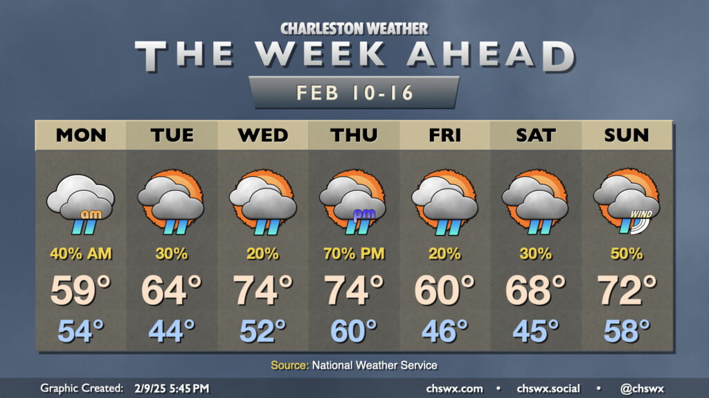
A mostly quiet week of weather lies ahead across the Tri-County area with high pressure aloft contributing to some of the warmest weather thus far in 2025.
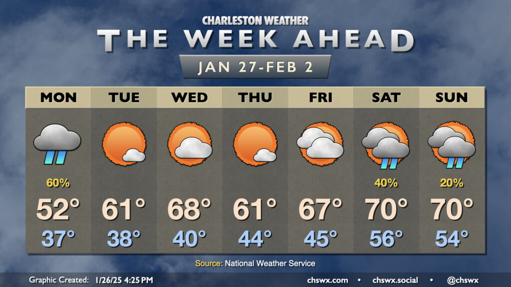
January will end much differently than how it has gone thus far as temperatures head around and even above normal to close out the month and bring in February with just a few rain chances mixed in to start and end the week.
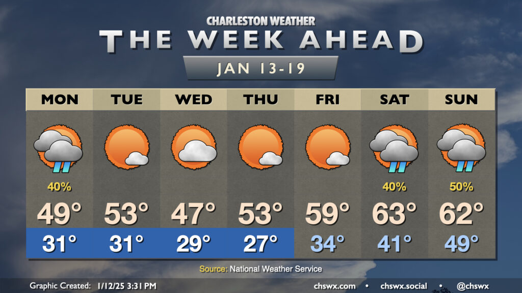
A chilly week ahead is bookended by two winter storm systems that will affect the area. Whether wintry precipitation gets involved remains to be seen; the probability of anything but cold rain taking place in the Charleston metro remains very low.
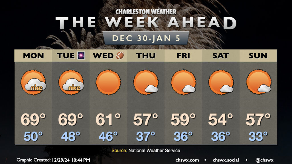
After a windy and wet cold front on Sunday that, thankfully, was devoid of any severe weather in the Lowcountry, we’ll finish 2024 on a warm but quiet note and ring in 2025 with more seasonable temperatures.
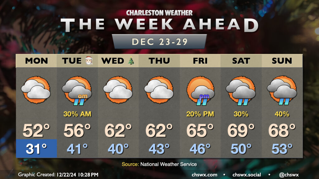
We start the holiday week off on a chilly note. Expect subfreezing temperatures inland of the coast Monday morning, with wind chills in the low 20s expected. We could even see those wind chills drop below 20° further inland, prompting a Cold Weather Advisory for inland Berkeley and Dorchester counties from 4-9am. Cloud cover will build across the area throughout the day Monday, with even a stray shower possible at the coast. Highs will remain well below normal, with low 50s expected at best.
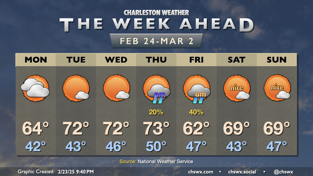
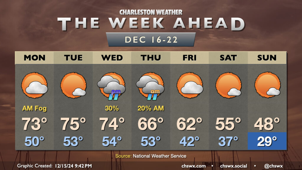
The week ahead will feature another up-and-down cycle of the temperature rollercoaster that has characterized this climatological winter so far. We start the week on the warm side, with temperatures running well above-normal through Wednesday. Monday could start a bit foggy as lows only drop to about 50°. We’ll warm to the low 70s in the afternoon under partly cloudy skies. After what could be another foggy start, expect a little reduction in cloud cover Tuesday afternoon which will lead to what should be the warmest day of the week as highs peak in the mid-70s (and maybe even a bit warmer further inland).