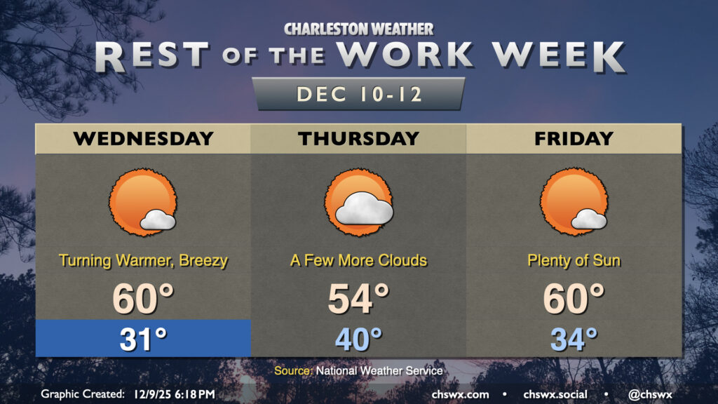
After a fairly warm day (away from the coast, anyway, where temperatures ran some 10°+ cooler), we’ll turn even warmer on Wednesday as high pressure slips offshore, pumping in warmer air from the south and southwest. Wednesday starts around 50° with perhaps a few patches of fog, and we’ll warm well into the low-to-mid-70s under a mix of sun and clouds. Winds will be a bit breezy out of the southwest, generally around 10-15 MPH during the afternoon as mixing from daytime heating taps into 25-30 MPH winds a few thousand feet off the deck.
We had quite the temperature swing on Tuesday, with a low of 33° giving way to a high of 76° in the afternoon. A warm front that swung through around daybreak helped temperatures jump from 37° a little after 6am to 46° about 20 minutes later, according to the National Weather Service. From there, plenty of sunshine propelled us to the warmest day since January 10.
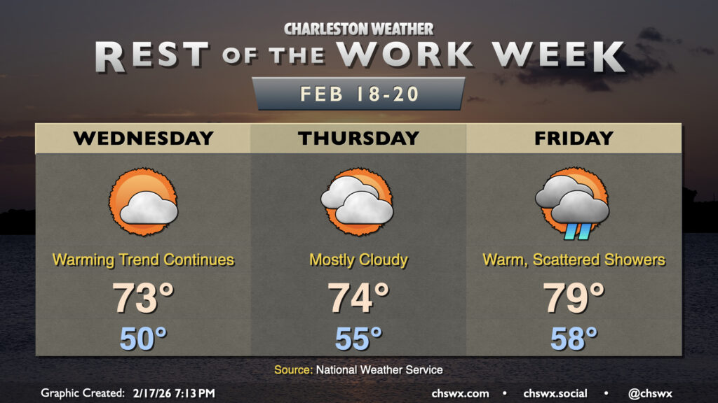
I hope you got to enjoy the brief spring preview, because the weather will turn more unsettled on Wednesday as a cold front approaches from the northwest. Temperatures will still run well above normal, with lows in the low 50s yielding to highs once again approaching 70° in the afternoon. Showers will begin to move into the area as early as daybreak, with off and on showers possible through the evening hours.
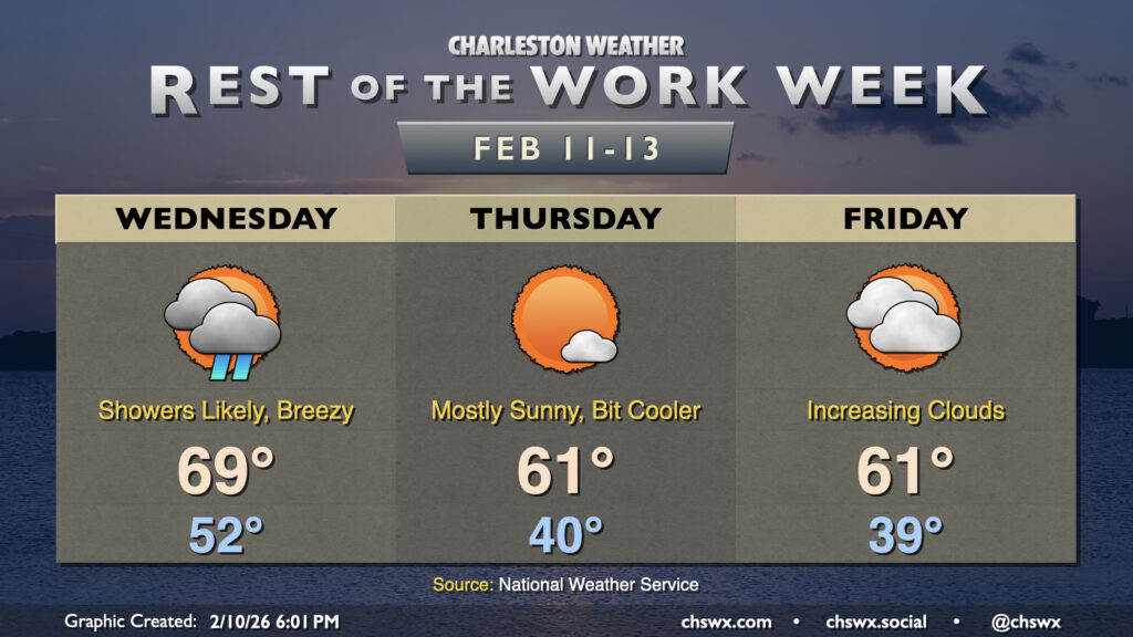
With a high of 63°, Tuesday ended up being the warmest day since January 23rd, when the high was 68°. We’ll fall back off that peak a little bit for the rest of the work week, but 60s should return for next week. In the meantime, we’ve got another cold front to deal with on Wednesday, which will spread some showers into the area on and off, especially as we get into the afternoon and evening hours. Temperatures start in the low-to-mid-40s, and peak generally in the upper 50s to near 60° as showers overspread the area.
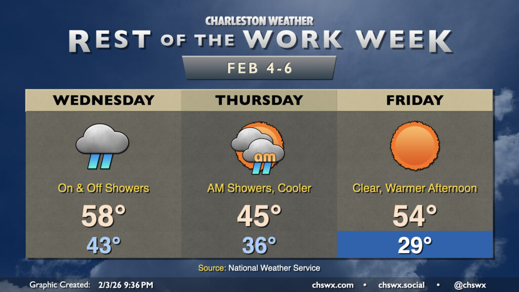
Another big cooldown is in store as we get beyond Hump Day and head into the second half of the work week. First, though, we’ll have a relatively seasonally-appropriate Wednesday, with highs topping out in the upper 50s to around 60° after a low around 40°. There will be a bit more in the way of cloud cover, with a chance for a few showers in the afternoon as low pressure moves northward out of the Bahamas, spreading a little moisture our way. Don’t expect much in the way of any meaningful rainfall, though, if you see any at all.
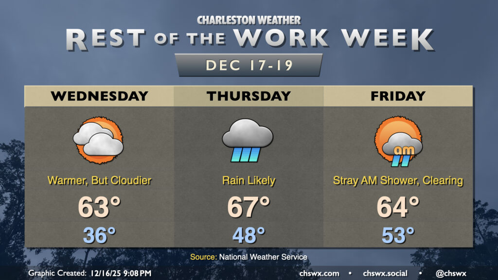
We’ll continue to put Monday’s cold snap in the rear view on Wednesday as temperatures continue to trend warmer with high pressure moving eastward. Temperatures will fall to the mid-30s overnight, but increasing cloud cover should keep a lid on further radiational cooling and keep us above freezing. From there, we’ll warm into the low-to-mid-60s as the cloud deck continues to thicken courtesy of a coastal trough taking shape offshore.
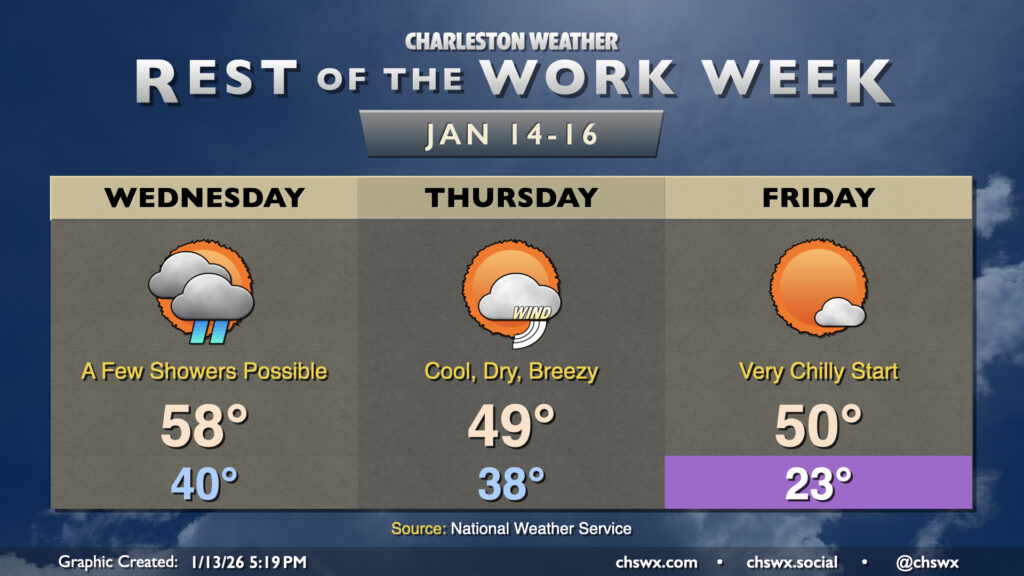
After another cold start on Wednesday, we’ll see temperatures climb a bit, though it’ll still be on the chilly side of normal, especially Thursday as a reinforcing front kicks up the cloud cover a bit.