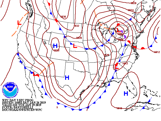
Regarding rumors of snow on Tuesday night

Source: NWS Environmental Modeling Center
I’ve received a few questions around the potential for snow on Tuesday night based on the output from a prominent weather app which will remain unnamed. Long story short: I wouldn’t bet on it.
The Setup

Tuesday, a very strong cold front will be driving into the Southeast ahead of a frigid Arctic airmass associated with the polar vortex incursion you’ve likely heard about over the last week. Ahead of the front, temperatures will actually spike up to the low 60s early Tuesday afternoon as winds turn southwest. There’s not a tremendous amount of moisture with the system, but there will be enough to wring out some showers along and slightly behind the frontal zone.
Showers look to affect the Charleston area mainly late Tuesday and perhaps lingering a little past midnight Wednesday. However, we look to be high, dry, and chilly by the time we wake up.
Why snow is unlikely
It is difficult — but not impossible — to wring snowflakes out of a setup like this. However, the stars just don’t seem to align this go-around. In this case, as in so many others, the cold air necessary to get snow to the surface outpaces the moisture by several hours. Model guidance is pretty consistent in this scenario panning out, with scattered showers coming to an end before midnight Tuesday and subfreezing temperatures arriving in the area a few hours thereafter.
If anyone is going to see any flakes, the best — yet still minuscule — chances will be in the I-95 corridor for a brief period late Tuesday. That being said, this would still require the cold air to come in a little quicker than currently expected.
I will keep an eye on it as we get into range of some of the higher-resolution mesoscale models — often with these marginal events, those models make a world of difference as far as deducing what could happen thanks to their ability to look at the finer details more carefully — but until then, don’t count on any flakes Tuesday, no matter what your app might say.