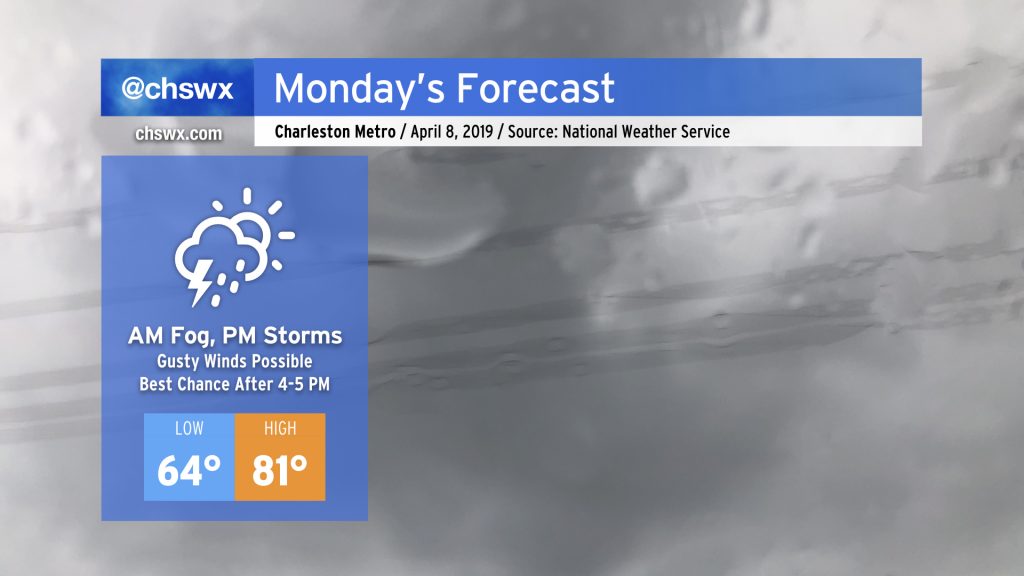
Foggy start, stormy finish for Monday
More drought relief is on the way for Monday as energy from a storm system makes its approach to the Lowcountry. This beneficial rain may come with a few strong wind gusts, though.
Dense fog possible in the morning

First, we will deal with the potential for fog in the early morning hours, which may have some impacts on the commute. The expectation is that sea fog will develop and push inland overnight. It’s unclear just how far inland it may go, but regardless, be ready for the potential for a slower drive in the morning. Interestingly, a couple of the models were showing precipitation in this area as well, but I suspect that is a side effect of the model resolving fog and not necessarily a sign that we’ll be dealing with rain in the morning.
Severe weather threat for Monday afternoon and evening

Atlantic high pressure and ridging aloft will try to hang on a little bit longer for much of the day. This will allow temperatures to rise into the low 80s away from the coast, contributing to destabilization of the atmosphere. At the same time, mid-level energy will be approaching the area from the west. This should kick off thunderstorms in Georgia and the SC Upstate and Midlands by early afternoon. These thunderstorms will have the potential for damaging wind gusts and large hail; the Storm Prediction Center has outlined this area in a slight risk for severe weather for Monday.

For our part, this evening’s model runs have so far indicated that the Lowcountry will stay dry through late afternoon. Then, it appears that the thunderstorms to the west will congeal into a line and head our direction. The timing is such, though, that the storms will miss the time of peak heating. Instability will wane through the late afternoon and early evening hours, which will be a limiting factor for our severe threat. Additionally, our shelf waters remain somewhat chilly at 64°. Onshore winds transporting some of this marine air ashore will help limit destabilization at the coast. As storms approach, they will suck in some of this more stable air, weakening them.
Despite waning instability, energy in the mid and upper levels as well as vertical wind shear will remain conducive for maintaining thunderstorms to the coast. As such, there is the potential for a couple thunderstorms to produce damaging wind gusts and perhaps some hail. (The tornado threat is very low.) We are within the marginal risk convective outlook category for Monday as a result. I suspect the best chance for seeing any severe storms is going to be along and west of 17-A in Dorchester and Berkeley counties, where the marine layer is likely to have the least impact and temperatures should remain warmest the longest.
Drought watch
The good news is that this storm system will bring us much-needed rainfall over the next couple days. While it may not turn out to be a whole lot — think at or below an inch of rain — any little bit helps as we continue to run fairly significant deficits for 2019. As of Sunday evening, the deficit at the airport was still 6.14″ for the year despite a rather unsettled weekend.
Stay weather-aware
While widespread severe weather is not expected tomorrow, it still behooves you to stay alert to changing conditions, particularly as the afternoon and evening wear on. Stay weather-aware via your favorite trusted meteorologists, NOAA Weather Radio, or some of the more reliable weather apps (such as the ones from local television stations).
Follow my Charleston Weather updates on Mastodon, Bluesky, Instagram, Facebook, or directly in a feed reader. Do you like what you see here? Please consider supporting my independent, hype-averse weather journalism and become a supporter on Patreon for a broader look at all things #chswx!