Dorian Advisory 42: Track shifts westward
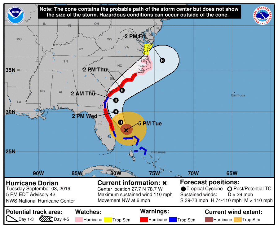
Advisory 42 for Hurricane Dorian continues to indicate a high-end Category 2 storm with max winds of 110 MPH. It has picked up some forward speed and is now moving NW at 6 MPH. A Hurricane Warning and Storm Surge Warning continue for Charleston, with Tropical Storm Warnings inland.
The most notable change in this update is that NHC has shifted the track and cone of uncertainty westward, making its closest pass to Charleston Thursday afternoon. This shift westward is going to increase the potential for hurricane-force winds along the coast (and perhaps slightly inland), add to the storm surge threat, and increase the potential for heavy, flooding rainfall. Be preparing for high-end category 2 hurricane conditions!
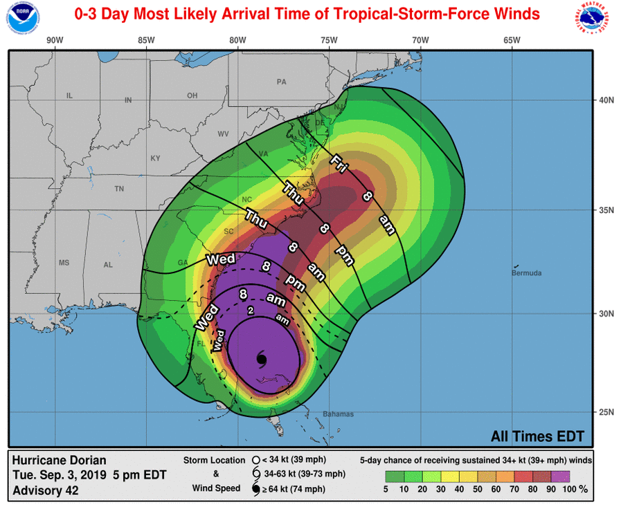
Preparations should wrap up this evening. Rain bands will likely begin overnight with tropical storm-force gusts. More sustained tropical storm-force winds are possible as early as Wednesday at 8am, and should overspread the area by Wednesday evening.
This post will be updated with new impact graphics.
Follow my Charleston Weather updates on Mastodon, Bluesky, Instagram, Facebook, or directly in a feed reader. Do you like what you see here? Please consider supporting my independent, hype-averse weather journalism and become a supporter on Patreon for a broader look at all things #chswx!