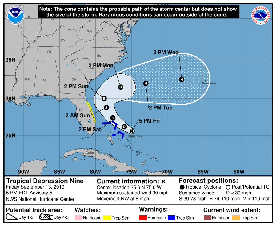
Tropical Depression Nine forms as track shifts further east

We now have Tropical Depression Nine in the Atlantic after a closed circulation was found. It has maximum sustained winds of 30 MPH and it moving NW at 8 MPH. It is expected to become Tropical Storm Humberto tomorrow as it moves very near the Abaco Islands.
Looking better for the Lowcountry
The NHC track envelope has been consistently shifting eastward today, a good trend for us. Expectations are that a weakness in the high pressure ridge steering Nine will allow the storm to turn north and northeast away from the coast by Monday. As the storm pulls away, the official forecast has it strengthening into a hurricane.
On this track, impacts should be minimal. Rip currents and beach erosion would be the primary concerns. Still can’t rule out some rain, but with a stalling front nearby, it is likely going to rain at some point on Sunday anyway.
Continuing to monitor
While things continue to improve for our outlook with Nine, we in #chswx will continue to keep an eye on it to make sure it behaves. We aren’t totally out of the woods yet, but it isn’t a situation to get worked up about. If that changes, I’ll let you know.