The week ahead: A hint of cooler weather in store

A warm start to the work week will give way to a taste of fall to close it out. (I mean, my goodness, 82° and fair skies on Thursday? Pinch me!) Plus, no worries about the tropics for the foreseeable future, either. Here’s a look at the week ahead…
Monday and Tuesday: Heat continues
Warmer-than-normal temperatures for mid-September will continue for the early part of the work week as ridging persists aloft (despite onshore surface flow).
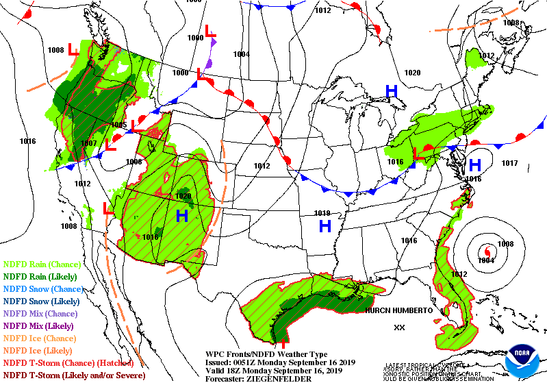
Some moisture on the far western periphery of Hurricane Humberto could contribute to a shower or two on Monday. As the storm pulls away, so do our shower chances for much of Tuesday. Tuesday looks to be the hottest day of the week as compressional heating ahead of a cold front should allow temperatures to get into the low 90s.
By Tuesday evening, there will be a chance of a few showers and perhaps some thunderstorms as the front begins to swing through.
Wednesday-Friday: Cooling off, drying out
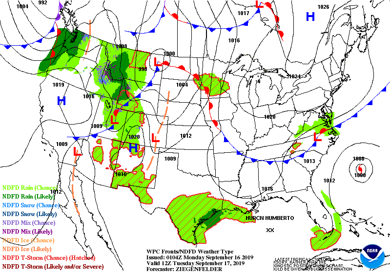
Any showers or storms that do develop along with the cold front will head southward with said front as Wednesday wears on. Cooler and drier high pressure will build in from the north, bringing high temperatures much more in line with climatological normals (roughly 85°) for this time of year.
It will feel comparatively chilly Thursday morning with lows bottoming out around the mid-60s away from the warmer coastline. (Grab the very light jackets!) Thursday should be an excellent weather day as temperatures will top out in the low 80s under mostly sunny skies.
There is a small chance of a shower or two east of I-95 on Friday as a little coastal trough tries to nudge ashore a bit, but mostly dry weather should continue with lows in the mid-60s and highs topping out in the low 80s once again.
The weekend: Warming back up a bit
As we get into the weekend, the airmass will moderate some as upper-level ridging builds back into the area. Dewpoints will come up a touch with a more onshore component of wind, but we should remain dry with high pressure firmly in place and no real convective triggers to be found in the guidance (which, admittedly, can be tough to resolve when we get 5-7 days out).
Slight coastal flooding potential late week
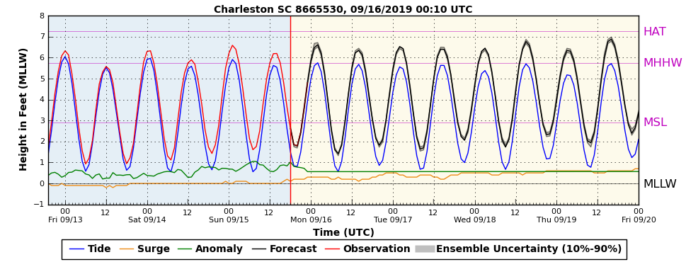
We will want to keep an eye on tide levels as we get later into the week as winds turn more onshore with high pressure building in from the northeast. Probabilistic tide guidance suggests water levels approaching 7′ will be possible as early as the Wednesday morning high tide. While a major coastal flooding event is currently not in the cards, we still could see some periods of minor salt water flooding during the daytime high tides through at least Friday.
Tropical update
The tropical Atlantic remains reasonably active, as one would expect in mid-September.
Humberto
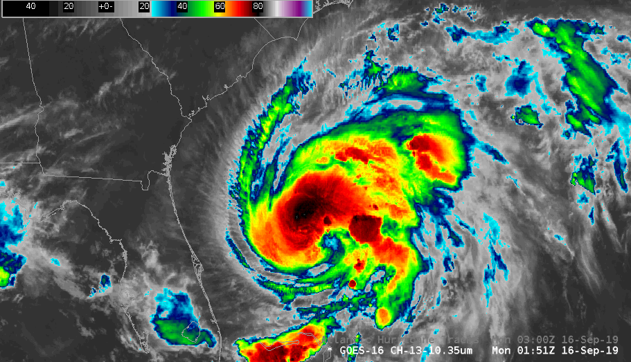
Humberto, named on Saturday, has become a hurricane as of the 11PM advisory Sunday night. Hurricane Humberto has begun making its turn to the right, moving NE at 3 MPH, and aside from elevated rip current risks does not pose a threat to our weather.
Here is the 11PM track, illustrating exactly this:
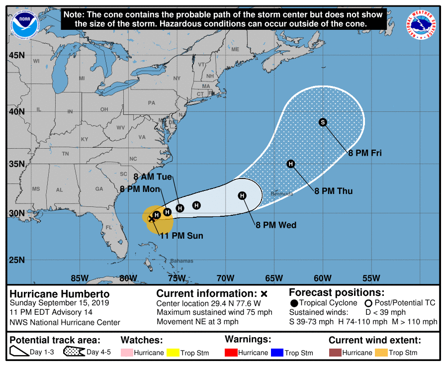
Interests in Bermuda will want to keep an eye on Humberto’s progress as it is forecast to make a close pass sometime Wednesday night into Thursday as it accelerates east and northeast. But as far as we’re concerned, it’s seeya later, Humberto.
Atlantic disturbance

A disturbance between the Cabo Verde Islands and the Lesser Antilles has an 80% chance of becoming a tropical cyclone in the next five days. It’s got a long way to go, and so far the trend in the longer-range models is for this to hitch a ride in a weakness in the ridge and recurve away from the US mainland. We’ll keep an eye on it, but it is far from threatening any land. Plenty of time to watch.
Gulf disturbance

There is also a disturbance in the Gulf which has a small chance of developing into a tropical cyclone before reaching the Texas Gulf Coast on Tuesday. It won’t be a concern for our weather.
Bottom line
- We’ve got a couple shower chances sprinkled in this week, but otherwise, dry weather looks to dominate.
- After a couple hot and humid days to start, Fall will tease us for a few days during the middle and end of the work week.
- Upper 80s and a little more humidity return to the picture for the weekend, but rain-free conditions look to prevail.
Follow my Charleston Weather updates on Mastodon, Bluesky, Instagram, Facebook, or directly in a feed reader. Do you like what you see here? Please consider supporting my independent, hype-averse weather journalism and become a supporter on Patreon for a broader look at all things #chswx!