Remnants of Nestor to bring lousy weather this weekend

Our tranquil, fall-like weather will come to an abrupt halt Saturday as the remnants of Tropical Storm Nestor, currently in the Gulf as of this writing, move through the Carolinas Saturday into Saturday night, bringing heavy rain, gusty winds, coastal flooding, and maybe even a tornado or two.
Rainfall
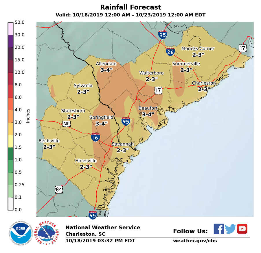
The main thrust of Satuday’s storm is going to be a fair bit of beneficial rainfall across much of the state, including some especially drought-stricken areas near I-95. Generally speaking, 2-3″ of rain looks likely across the Charleston metro area, with locally higher amounts possible.
Rain looks to begin by 8-9am across the Charleston metro, with the heaviest rain expected Saturday afternoon and evening. Rain will taper off overnight into Sunday.
Coastal flooding
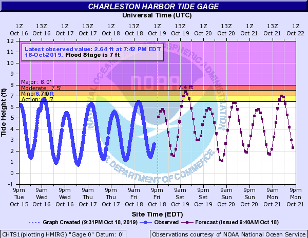
Due to stiff onshore winds (20-30 MPH with higher gusts at the coast), we will need to watch the noon-ish high tide for moderate coastal flooding. Rainfall on top of this won’t help, but current projections are that the heaviest rain will hold off until later in the evening as the low makes its closest pass.
The current forecast water level in the harbor for the 12:05 PM high tide is roughly 7.4′ MLLW. This is knocking on the door of moderate coastal flood thresholds. If winds are a little stronger earlier, and more water can pile up, these water levels may head up even more. Be ready to use alternate routes if driving around downtown Charleston midday tomorrow.
Tornado threat
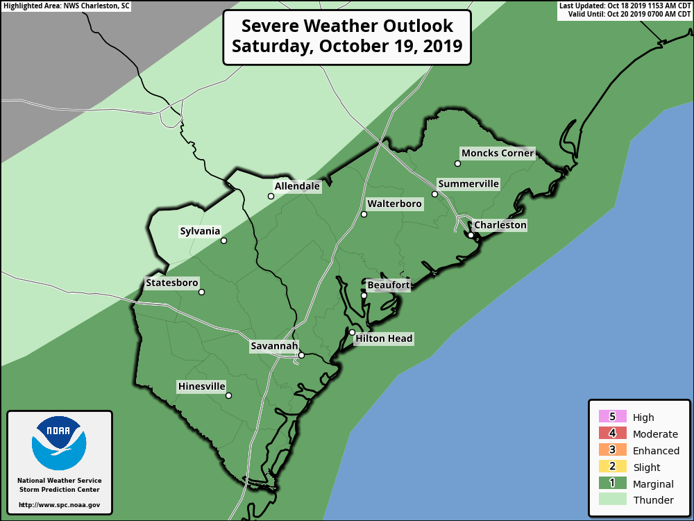
While not the centerpiece of tomorrow’s weather concerns, there is the potential for a tornado or two to develop if instability can make some inroads tomorrow evening as the low passes to our west. If it’s going to happen, the best chance to see any severe weather is going to be near the coast where the shear and instability ingredients will combine the best.
Regardless of thunderstorm development, expect winds to come up throughout the day. Sustained winds 15-25 MPH with gusts 30-40 MPH will be common by evening, especially near the coast. These winds will begin to relax overnight into Sunday as the low moves away from the area.
Bottom line
- Rain will be on the increase throughout the day on Saturday, with the heaviest rain in the evening. 2-3″ of rain is possible.
- Coastal flooding appears likely two hours either side of the 12:05 PM high tide. Rain on top may prove troublesome, especially downtown.
- Winds will be gusty; 20-30 MPH gusts will be common inland, with gusts over 40 MPH possible at the coast.
- There is a small chance for a tornado to develop near the coast with the stronger cells Saturday evening.
- Sunday will be better.
Follow my Charleston Weather updates on Mastodon, Bluesky, Instagram, Facebook, or directly in a feed reader. Do you like what you see here? Please consider supporting my independent, hype-averse weather journalism and become a supporter on Patreon for a broader look at all things #chswx!