Freeze expected overnight, coastal flooding with morning high tide
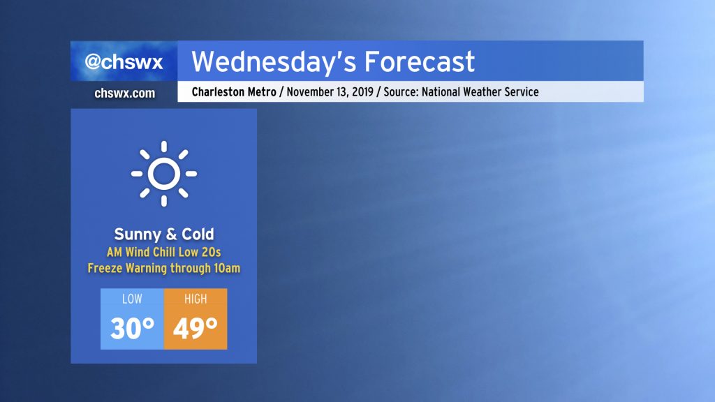
Wednesday will be the coldest day in the Charleston metro area since early March as an Arctic airmass, rushing in tonight, makes a brief visit to the Lowcountry through Thursday morning. Many locations will experience a freeze, and wind chills will be heinous (think low 20s). Time to dust off the jackets!
Growing season likely to end
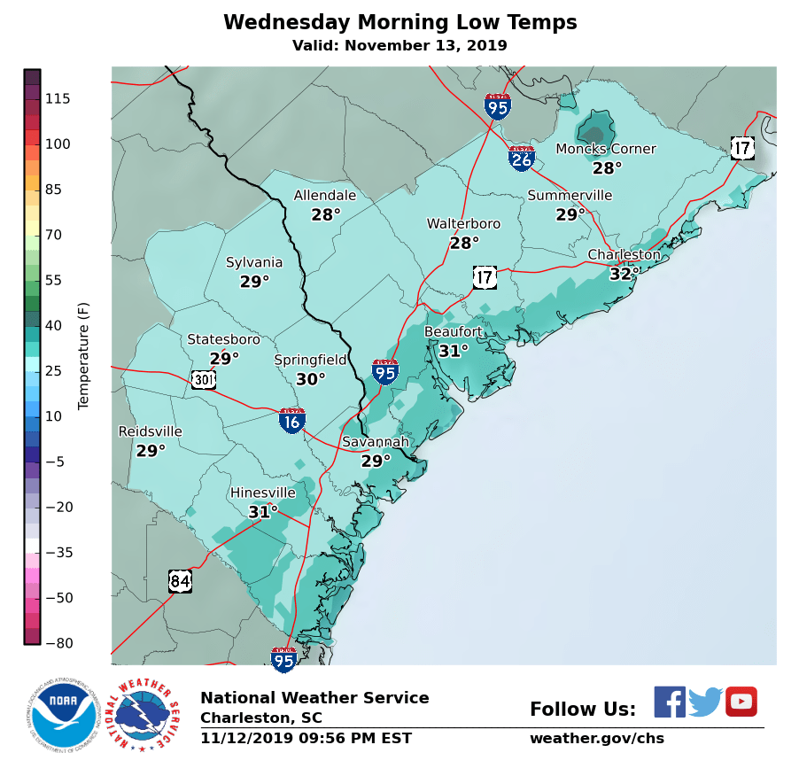
It certainly appears that with widespread temperatures below freezing — including quite a few 20s possible along and west of 17-A — the growing season will be coming to an end across the Lowcountry. If this pans out, this means no more Freeze Warnings until March.
Be sure you bring in pets and plants tonight. Then, make sure everyone’s very well bundled up in the morning with wind chills in the low 20s expected.
Tidal concerns
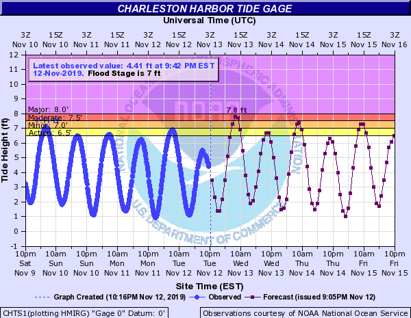
There are some concerns that the 7:59 AM high tide may top out well into moderate flood stage in Charleston Harbor. Guidance is on board with a roughly 7.8′ high tide, which would approach major coastal flooding levels (8.0′). This may cause significant travel disruptions in parts of downtown Charleston during the morning commute. Much of this forecast will be determined by the degree to which the winds lean onshore during the morning hours. We will need about a foot of departure or so from the predicted tide levels to generate flooding, so this will be a trend worth watching.
I’d be ready for the potential for road closures in the morning in case this apparently worst-case scenario verifies.
Unsettled weather closes the work week

Wednesday’s Arctic blast will give way to a more unsettled pattern as we close out the work week as a coastal storm develops and heads up the coast, bringing good rain chances especially Thursday evening into Friday. The northerly flow around the low, in concert with rainfall, will keep temperatures suppressed well below mid-November normals with highs only expected in the 50s both days.
The progress of the coastal storm and an upper-level system will largely determine how the weekend turns out. I wouldn’t cancel any plans, but I would recommend keeping an eye on forecast updates and having a strong Plan B in place, just in case. I’ll have more on the weekend tomorrow.
Follow my Charleston Weather updates on Mastodon, Bluesky, Instagram, Facebook, or directly in a feed reader. Do you like what you see here? Please consider supporting my independent, hype-averse weather journalism and become a supporter on Patreon for a broader look at all things #chswx!