Weekend showers and a whole lot of warmth

Unseasonable warmth will continue through the weekend as the Charleston area remains within the warm sector of a rather potent storm system that is bringing heavy snow to Wisconsin and severe weather to Oklahoma, Texas, and Arkansas. Fortunately, we look to miss out on much, if not all, of the severe weather, but unsettled conditions will continue well into next week. A washout is not expected, but scattered showers will be possible from time to time.
Thunderstorm threat
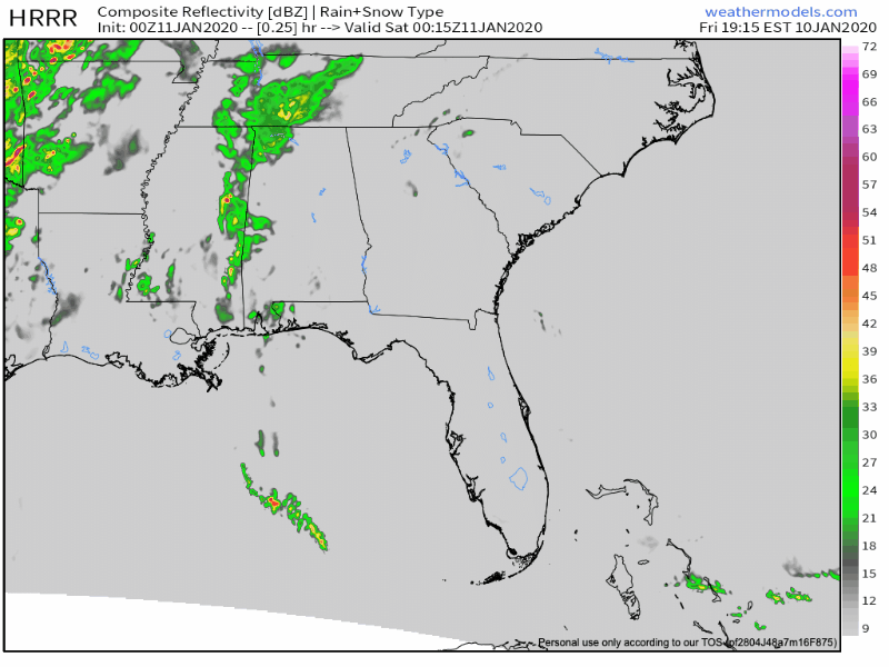
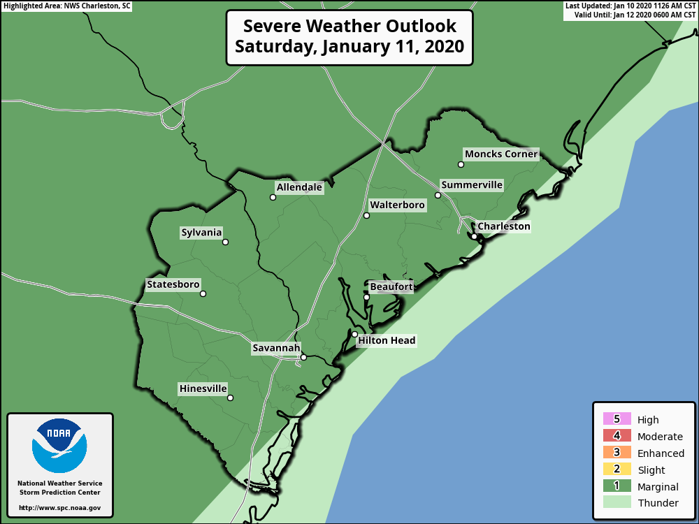
Scattered showers will be with us for much of Saturday as an intense line of thunderstorms marches across the Southeast throughout the day. This line of storms will approach overnight Saturday and into early Sunday morning. The environment over Charleston will be largely unfavorable for severe weather as the far stronger jet dynamics will remain to our north and west. Still, a damaging wind gust or two cannot be ruled out with the line of storms overnight Saturday into Sunday, so the Storm Prediction Center has outlined a marginal severe weather risk into Sunday morning.
This warmth, though
The main weather story for Charleston, though, will be this stretch of unseasonable warmth. Record high minimum temperatures will be challenged both downtown and at the airport over the next several days as the cold front stalls out nearby. Highs in the 70s will be common through Thursday, based on the latest NWS forecast!
It appears likely that for the first time since 2013, we will have at least seven consecutive days of 70°+ temperatures at the airport. This has only happened five times in January since records began in 1938: 2013, 2005, 1989, 1947, and 1946.
The record longest stretch of 70° days at the airport in the month of January is 10. This has happened twice: once from January 1-10, 2005 and again from January 8-17, 2013. This record does not look to be under threat as we should have a push of more seasonable air overnight Thursday into Friday, but we should add a sixth instance of seven straight days of 70s before it’s all said and done.
Watching Saturday morning’s tide
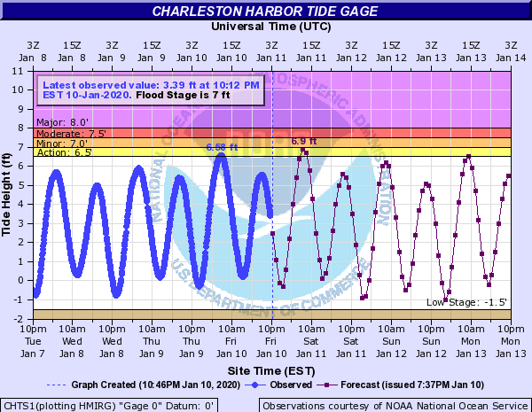
The combination of onshore winds and the full moon may bring water levels awfully close to coastal flood criteria with the 8:06 AM high tide. The current NWS forecast is for water levels to top out around 6.9′ mean lower low water; flooding generally starts at 7′. Even though we may fall short of coastal flood criteria, salt water has been known to pool up and onto the Hagood and Fishburne intersection at water levels around 6.8′, so be aware if that neck of downtown is in your plans Saturday morning.
Follow my Charleston Weather updates on Mastodon, Bluesky, Instagram, Facebook, or directly in a feed reader. Do you like what you see here? Please consider supporting my independent, hype-averse weather journalism and become a supporter on Patreon for a broader look at all things #chswx!