Showers and thunderstorms overnight into Thursday morning; a couple could be strong
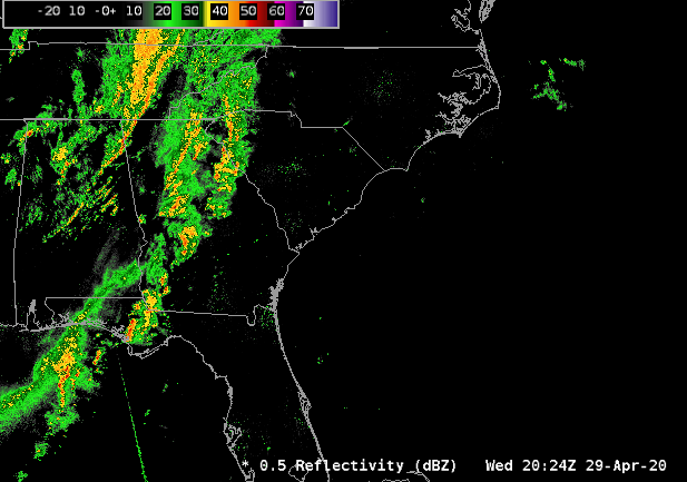
Showers and thunderstorms associated with a cold front will move through the area tonight, bringing with it some brief heavy rain and perhaps the risk for a damaging wind gust or two through early Thursday morning. This is not the high-end risk we have seen in a few times in the past few weeks — not by a long shot! — but you may want to have a flashlight at bedside just in case of a brief power outage overnight as some sporadic wind damage does appear possible.
Thursday: Rain ends, clearing thereafter

Rain looks to stick around through mid-morning before finally clearing the area sometime between 10am and noon. Drier air will be filtering into the area throughout the afternoon and evening hours, but highs will still top out in the upper 70s in the afternoon. The cloud deck will scour out by dark, setting us up for a crisp start to Friday morning with lows in the low 50s.
A great-looking weekend lies ahead, with temperatures rising into the low 80s by Sunday with lots and lots of sunshine in the area.
Follow my Charleston Weather updates on Mastodon, Bluesky, Instagram, Facebook, or directly in a feed reader. Do you like what you see here? Please consider supporting my independent, hype-averse weather journalism and become a supporter on Patreon for a broader look at all things #chswx!