The week ahead: A gradual return to fall weather
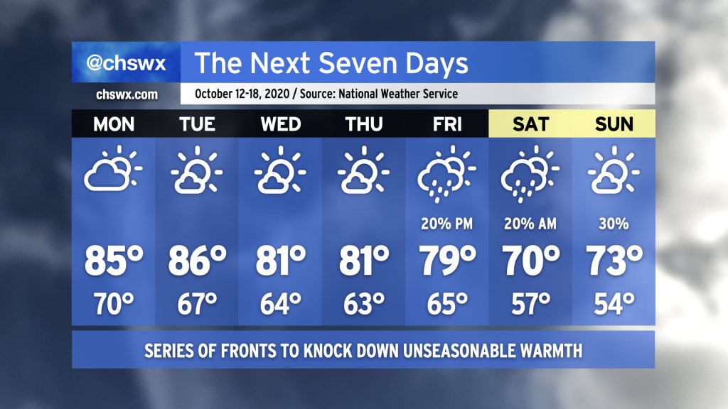
The remnants of Delta are on their way out, giving way to a series of fronts over the next few days that will gradually ease us back into fall weather. First, though, we will still contend with elevated heat and humidity Monday into Tuesday with highs in the mid-80s and dewpoints in the low 70s. Then, a front will wedge in from the north, cooling us off a little for Wednesday and Thursday with highs only topping out in the low 80s. A better shot of cooler and drier air arrives late Friday into early Saturday — perhaps with some showers — as another area of high pressure builds in from the west. This one will bring us back to fall, with upper 60s to around 70° for Saturday and low 70s for Sunday.
Coastal flooding concerns return this week
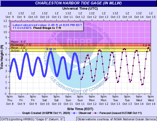
The new moon and lunar perigee will combine to produce higher-than-normal tides this week. Evening high tides are forecast to approach or exceed minor flood stage starting Tuesday, and with northeast winds mixing in occasionally, we could see levels nudged even a little higher. Probabilistic guidance suggests the potential for moderate coastal flooding as we get into the second half of the week. It’s something to watch, but thankfully, there will be no rain on top.
Follow my Charleston Weather updates on Mastodon, Bluesky, Instagram, Facebook, or directly in a feed reader. Do you like what you see here? Please consider supporting my independent, hype-averse weather journalism and become a supporter on Patreon for a broader look at all things #chswx!