Frosty start to Thursday gives way to a comfortable afternoon
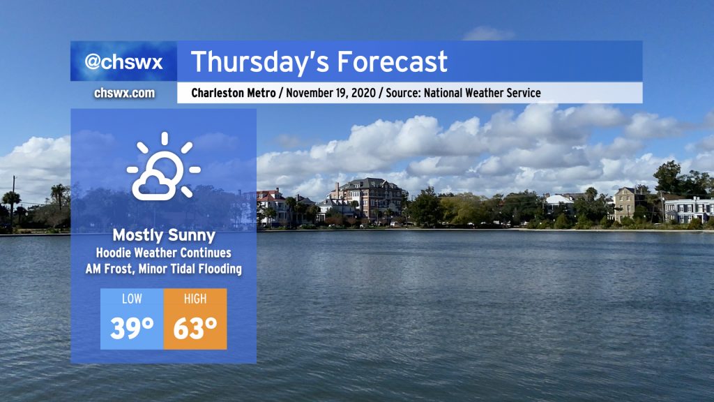
Clear skies and light winds will allow temperatures to drop into the upper 30s overnight, likely causing some frost to develop away from the coast. The National Weather Service has issued a Frost Advisory that includes Berkeley and Dorchester counties for early Thursday. Make sure you cover up your plants and have your pets in a warm place tonight.
Once we get clear of the frost, we’ve got a pretty solid November day ahead with highs topping out in the low 60s under mostly sunny skies and a bit of a northerly to northeasterly breeze.
Minor coastal flooding possible with the mid-morning high tide Thursday
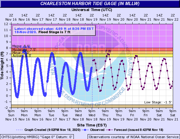
There will be the risk for a few pockets of salt water flooding around the 11:11am high tide Thursday. If flooding should occur, it would likely be around Gadsden Creek, Fishburne and Hagood, and perhaps pockets of Lockwood Drive.
This should do it for tidal flooding for this week. We’ll keep an eye on things as we head toward the end of November, with the next full moon coming on November 30.
Nerd notes: Charleston NEXRAD gets an upgrade, improving range and low-level coverage
The NEXRAD radar serving the Charleston area got a big upgrade over the last couple days which will help meteorologists get a little better look at storms across the Charleston metro area by altering the lowest angle of the radar antenna during its volume scans.
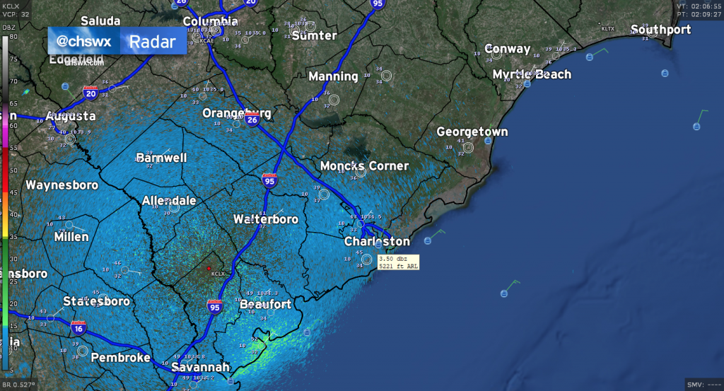
Previously, the radar’s lowest tilt was at 0.5° above ground. This gives pretty decent radar coverage across a good bit of the metro area, but it starts to get a little more murky as you get into Berkeley County and up toward Awendaw and McClellanville (where the beam hits around 10,000 feet at its lowest). Even still, the lowest vantage point radar operators tended to get around Charleston proper was between 5,000 and 6,000 feet. This is pretty decent, but a lot can still happen lower in the atmosphere.
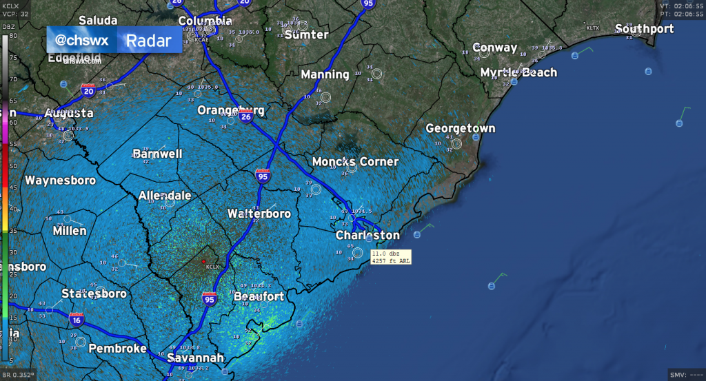
With today’s upgrade, the new low tilt is 0.3°. This will give radar meteorologists a better look at what’s going on closer to the ground over much of the area. This is going to be especially helpful for tracking thunderstorms into the relative radar no-man’s land of upper Charleston and Berkeley counties. Where the lowest tilt over McClellanville previously bottomed out around 10,000 feet, meteorologists will now be able to see as low as ~7,800 feet there (based on calculations in GR2Analyst; actual beam height may vary due to effects of ducting and other phenomena).
Not only should this lower tilt help better track low-level features such as the seabreeze and rotation in thunderstorms, but it could give us better precipitation estimates, particularly at the edges of the Tri-County, thanks to the lower beam being more likely to sample more of the atmosphere underneath the freezing level in a typical Lowcountry weather setup.
High-end radar software such as GR2Analyst and the Unidata AWIPS package is showing this new tilt already. If you use radar software like RadarScope, you’ll need an app upgrade before you can see the new lower elevation. Once it becomes available, you’ll see it as Tilt 1.
(I like geeking out on radar, can you tell?)
Follow my Charleston Weather updates on Mastodon, Bluesky, Instagram, Facebook, or directly in a feed reader. Do you like what you see here? Please consider supporting my independent, hype-averse weather journalism and become a supporter on Patreon for a broader look at all things #chswx!