Storm system arrives Sunday afternoon with rain and maybe a few thunderstorms
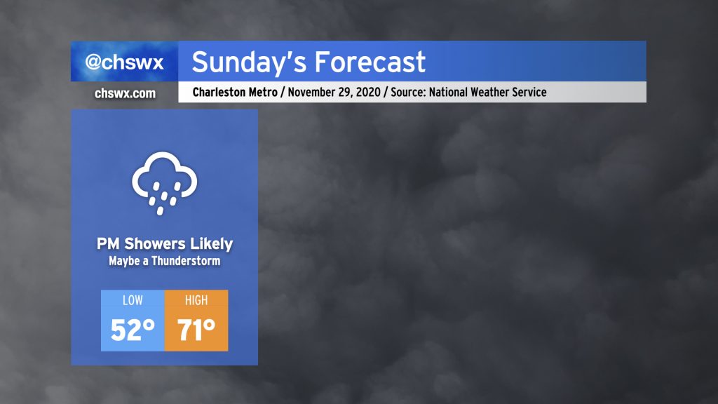
Sunday will start out dry and mostly cloudy, but will turn more rainy as a warm front lifts north across the area during the afternoon and evening. This rainfall is associated with a storm system that will move across the Gulf Coast states tomorrow and then more northeastward into the Mid-Atlantic Sunday night into Monday, ushering in a legit winter chill behind it — just in time to start meteorological winter on Tuesday.
How it looks like it’ll play out
It looks like we’ll see two main rounds of rain: one starting possibly as early as mid-morning Sunday into Sunday evening, and then along and ahead of the cold front on Monday morning.
Sunday mid-morning through evening
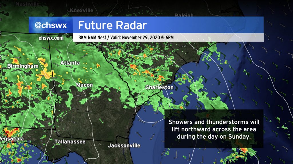
The first round of rain arrives Sunday, perhaps as early as mid-morning, through the late evening as a coastal trough transitions to a warm front and lifts north across the area. Showers and perhaps a few thunderstorms will stream into the area from the Atlantic along with this warm front, with periods of heavy downpours and gusty winds possible.
It’s interesting to note the closed isobar south of Charleston on the NAM 3km image above, suggestive of possibly a meso-low of some type that may develop along the warm front. If this is not a spurious feature — which is supported by a couple of the other convection-allowing models — it could enhance convergence along and ahead of the low, squeezing out more rainfall in spots across the Tri-County area.
We’ll also want to watch later Sunday afternoon into the evening for the potential for a few strong to severe thunderstorms, as it appears the best overlap of wind shear and limited instability will be found then. I wouldn’t be shocked to find rotating storms over the Atlantic waters, and so waterspouts or even a brief tornado cannot be totally ruled out. Stronger storms will also be capable of strong and possibly damaging straight-line wind as well. The Storm Prediction Center has the Charleston area in a marginal risk of severe thunderstorms for Sunday to account for this small — but non-zero — chance for damaging wind gusts and possibly a tornado.
Guidance generally has this first round of rain lifting northward and out of the area by midnight as the low begins to track more northeastward across Georgia, leaving a risk of scattered showers within the warm sector for the overnight hours. And it will be warm — temperatures don’t look to fall too much below 65° by Monday morning.
Monday morning
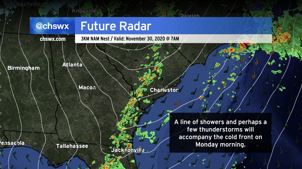
The cold front will move through the area Monday morning. Expect showers and perhaps a few thunderstorms — one or two of which could be strong with damaging wind gusts — to accompany the front as it passes through the area. Rain should exit the area by roughly midday, with clearing and a temperature drop to follow. As high pressure builds in, winds should turn gusty, particularly over marine areas where a Gale Watch is in effect through 7PM Monday. Highs on Monday will peak in the low 70s early in the day before falling back into the 60s in the afternoon.
Rainfall forecast
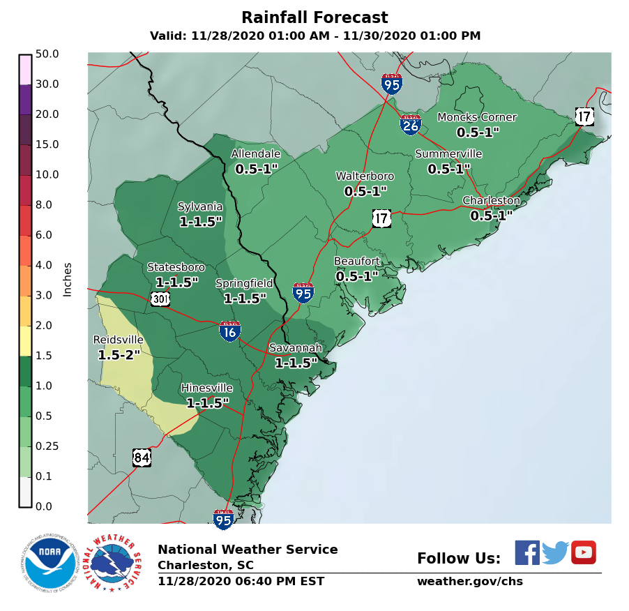
The National Weather Service forecast generally shows a half-inch to an inch of rain in most spots in the Lowcountry, with locally higher amounts possible in stronger thunderstorms. This should add to our rainfall surplus; with 51.79″ of rain as of the 5PM Saturday climate report, we’re running just a hair over four inches above normal for the year.
Flooding should not be a major concern, but we’ll want to see where the heaviest rain is around the 7:20 PM high tide on Sunday just in case.
Big chill to come
Tuesday, December 1 begins meteorological winter, and it sure will feel like it. The NWS forecast for Tuesday shows highs struggling into the low 50s at best, well below normal for the beginning of December, despite mostly sunny skies. The first freeze for many locations along and inland of 17-A could arrive on Wednesday morning, followed by a little warming trend as we get into the end of the week. Overall, though, temperatures will remain below normal into next weekend.
Follow my Charleston Weather updates on Mastodon, Bluesky, Instagram, Facebook, or directly in a feed reader. Do you like what you see here? Please consider supporting my independent, hype-averse weather journalism and become a supporter on Patreon for a broader look at all things #chswx!