The week ahead: Cooling back off with a couple shots of rain
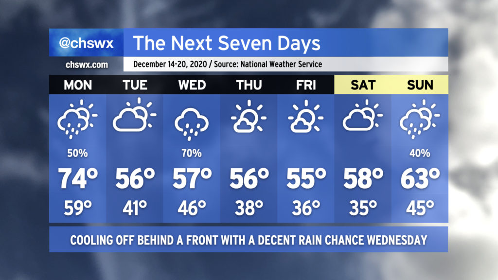
After what ended up being a fairly nice weekend, we have one more day in the 70s before we’re back to more seasonable — if not a bit below-normal — temperatures across the Lowcountry for the last full week before Christmas. (Yes, it’s almost Christmas. It’s shocking to me, too.)
A cold front will swing through Monday, bringing a chance of showers to the area generally from mid-morning to early afternoon. High pressure will wedge in behind it, cooling us off but also keeping some cloud cover around for Tuesday. Another storm system will ride up the coast Wednesday, potentially turning into a decent nor’easter for the Mid-Atlantic states and New England. We’ll see mostly sunny skies with continued chilly temperatures to close out the work week. Clouds increase for the weekend, with perhaps some showers on Sunday.
Coastal flooding a concern this week
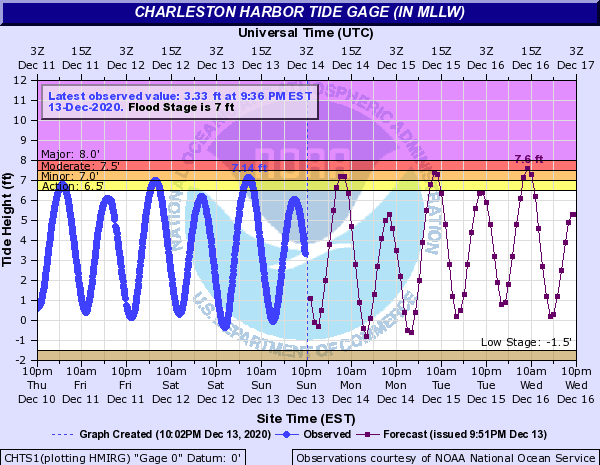
Northeast winds and the new moon will contribute to minor to moderate coastal flooding during morning high tides this week. Looks like Wednesday morning’s tide will be the highest tide of the set, with water level guidance solidly supporting moderate coastal flooding. Guidance suggests that coastal flooding could remain an issue through Friday, though northwest to northerly winds should help to keep the higher water levels at bay. Watch for this issue throughout the week, and be ready to find alternate routes during your morning commute if it involves downtown Charleston.
Follow my Charleston Weather updates on Mastodon, Bluesky, Instagram, Facebook, or directly in a feed reader. Do you like what you see here? Please consider supporting my independent, hype-averse weather journalism and become a supporter on Patreon for a broader look at all things #chswx!