Cooler for Tuesday, with showers returning to the picture in the afternoon
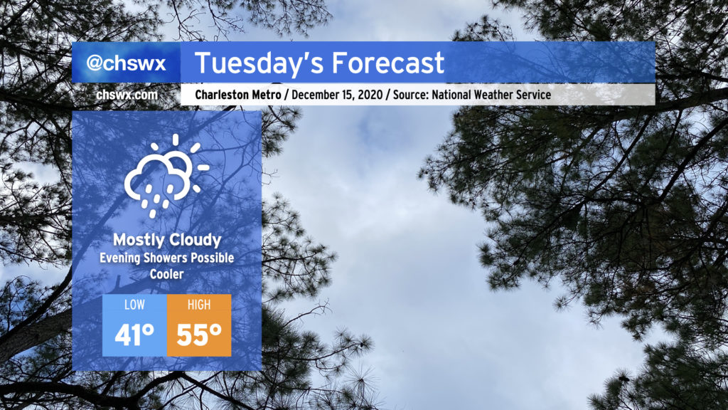
Clouds will increase overnight into Tuesday morning, giving the day a mostly cloudy look with just a few peeks of sun possible in the morning and early afternoon hours. It’ll feel noticeably colder in the wake of today’s cold front — highs should only top out in the mid-50s.
As low pressure organizes off the coast and begins to move northward, some overrunning should take place, generating scattered light showers across the area by mid-afternoon. Showers will continue into the evening, with the best rain chances arriving with the cold front Wednesday.
Minor to moderate coastal flooding possible with the morning high tide
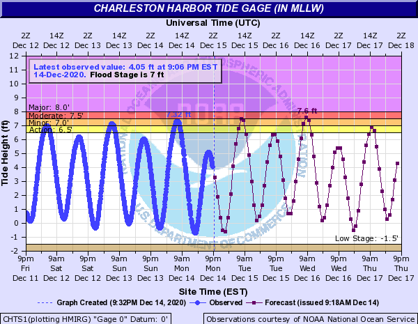
Northeasterly winds and astronomical effects will combine for minor to moderate coastal flooding around the 8:13am high tide. Watch for flooded and possibly closed roads in parts of downtown Charleston, including near the Citadel, MUSC, and the City Market.
Follow my Charleston Weather updates on Mastodon, Bluesky, Instagram, Facebook, or directly in a feed reader. Do you like what you see here? Please consider supporting my independent, hype-averse weather journalism and become a supporter on Patreon for a broader look at all things #chswx!