Rain exits, but clouds linger for Thursday

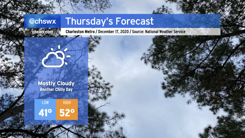
A cold front is clearing the area this evening, sweeping away the last remaining showers over the next couple hours. Clouds will persist into Thursday, though, with some patchy fog possible in the morning. Highs will only top out in the low 50s despite peeks of sun at times. (Expect more sun on Friday!)
Record seventh major coastal flooding event of the year occurred earlier today
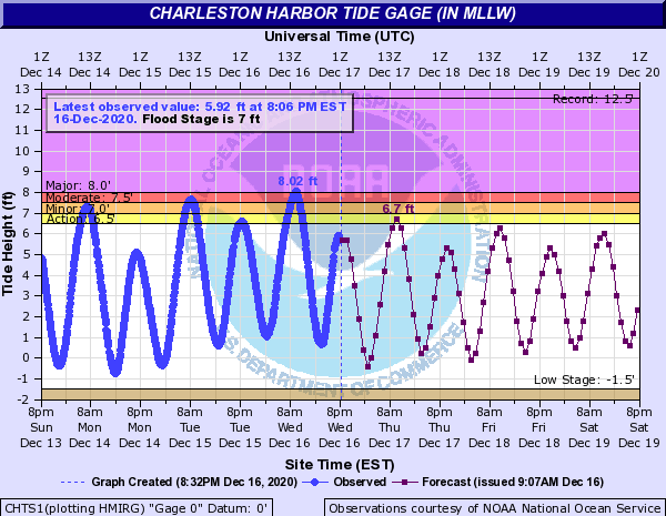
For the first time since record keeping started in 1953, a seventh major coastal flooding event was recorded in Charleston Harbor. Water levels reached 8.02′ MLLW in the harbor at 9:48am, causing major coastal flooding that caused roads throughout downtown Charleston as well as parts of Long Point Road to close in Mt. Pleasant. The previous record of six major coastal flooding events was set back in 2015. (Overall, 2020 has seen 68 coastal flooding events, the second most on record behind last year’s 89.
It is interesting to note that of the seven major coastal flooding events this year, not one was the result of a tropical cyclone. Isaias, which was our closest brush with a storm that had the potential of generating this kind of surge, reached the area closer to low tide keeping water levels in minor coastal flooding territory.

Winds going around to the northwest and west in the wake of the front should keep water levels below flood stage starting Thursday, though the morning high tide could get high enough to put some salt water on Hagood Avenue for a brief period. From there, though, coastal flooding is not expected into the weekend.
Follow my Charleston Weather updates on Mastodon, Bluesky, Instagram, Facebook, or directly in a feed reader. Do you like what you see here? Please consider supporting my independent, hype-averse weather journalism and become a supporter on Patreon for a broader look at all things #chswx!