Stormy evening ahead
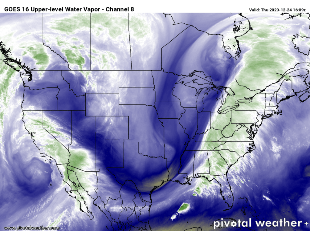
We in #chswx continue to monitor the risk for strong to severe thunderstorms this afternoon and evening as a strong cold front driven by a highly amplified upper-air pattern makes its way to the coast.
Where we’re at
As of noon, temperatures across the area have risen into the upper 60s with dewpoints rising well into the 60s, indicating a juicy airmass capable of sustaining thunderstorms. Winds are turning progressively more breezy; a 28 MPH gust was recorded earlier this morning at Mt. Pleasant, and gusts to 35 MPH will become common as the front and associated low-level jet draw closer this afternoon and evening. We have had bouts of downpours at times, but it appears that for the moment we are going to catch a few hours in a dry slot.
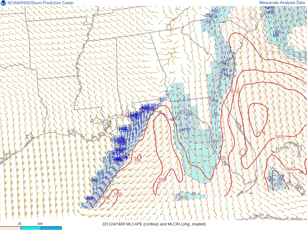
Instability has continued to trend up this morning, and should continue to do so with the warm, moist pipeline of air continuing to pump into the area. The Storm Prediction Center analysis shown above does show weak to modest areas of convective inhibition (in blue) that will work against stronger storms, but it appears this will continue to erode as the storm system progresses eastward.
Remember, even outside of storms, gusts will peak 35-40 MPH, with higher values possible on bridges and overpasses. This could be enough to cause some isolated power outages well ahead of any storms.
Severe weather outlook
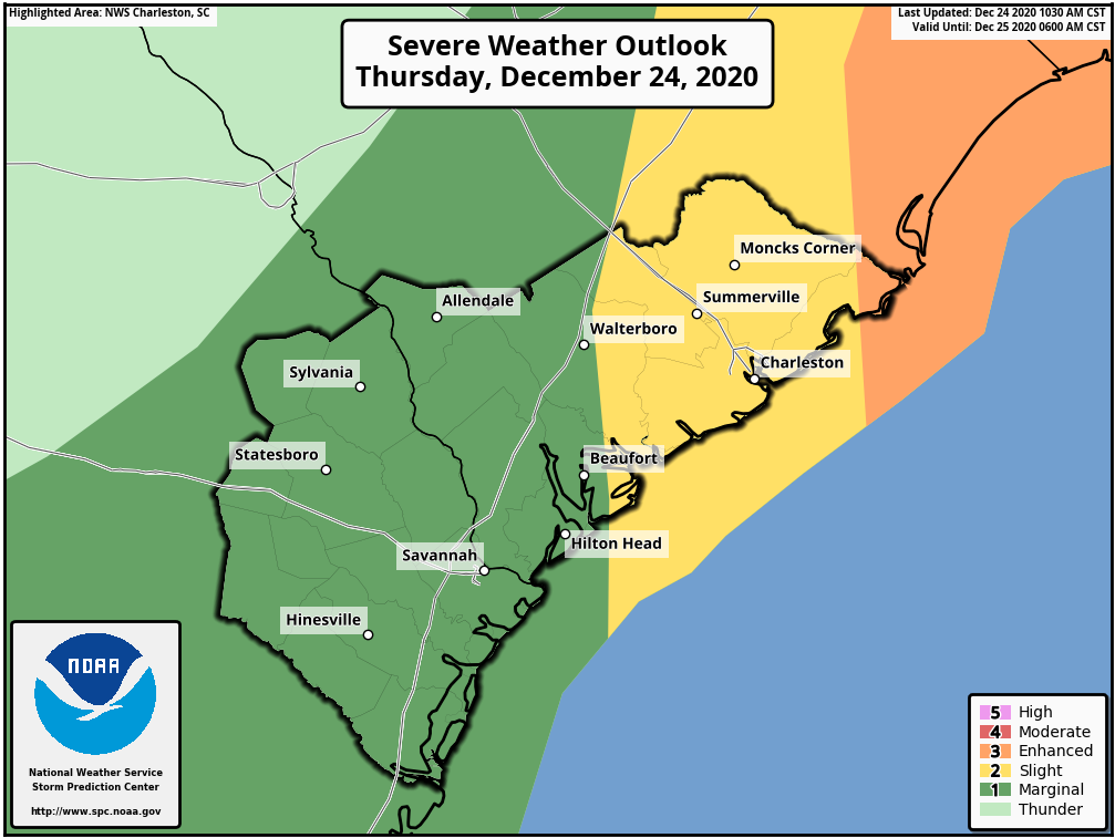
The Storm Prediction Center highlights much of the area in a slight risk of severe weather today, with damaging winds the primary concern associated with a squall line. Given strong low-level wind shear, a tornado or two cannot be ruled out along the squall line as well; these tornadoes are generally brief but can be tough to warn for. The greatest tornado risk remains to our northeast, stretching from the Grand Strand to the North Carolina Sandhills.
Timing for the line appears to be on track for later this evening. The last few High-Resolution Rapid Refresh model runs have been slowing the line down a bit, bringing it into the Tri-County area a little later in the evening (7-8 PM). I am always a little weary of model timing on these, though — squall lines often outpace the arrival times of modeled solutions. A lot will depend on where the line ultimately organizes, so this trend will be watched closely.
Bottom line: The National Weather Service continues to advertise the 5-9 PM timeframe for possible severe weather, and that’s the timeframe I would use to make your decisions around.
Of course, given that it is December and shelf waters are in the mid-50s, I would expect some weakening of the line as it moves into the area, especially if it arrives as instability wanes with the loss of daytime heating. Still, it won’t take much for storms to pull down a few strong wind gusts capable of producing tree damage and downing power lines. Be ready for power outages this evening.
The line should clear the area by 10-11 PM with the front to follow. You will know when the front comes through as the bottom will fall out of the mercury. Tomorrow’s forecast high of 42° is 31 degrees cooler than today’s expected high of 73° — big chill for Christmas is looking locked in as discussed over the past few days.
Will have updates here and on Twitter as needed throughout the day.
Follow my Charleston Weather updates on Mastodon, Bluesky, Instagram, Facebook, or directly in a feed reader. Do you like what you see here? Please consider supporting my independent, hype-averse weather journalism and become a supporter on Patreon for a broader look at all things #chswx!