The week ahead: Showers to start, then a few days of 60s
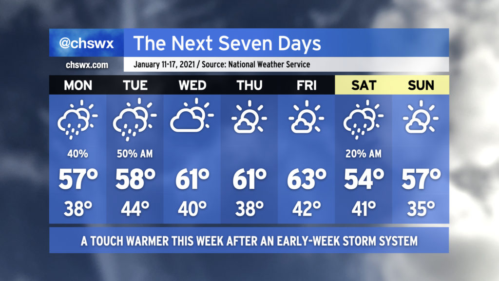
The week ahead will be characterized with a few showers to start before warming up and clearing out in the second half. Clouds will increase overnight into Monday, with showers potentially developing over the ocean and moving inland starting in the afternoon. Shower chances will continue into Tuesday as a wave of low pressure affects the area. Once the disturbance clears the area, we’ve got a few nice days to close out the work week, with temperatures topping out in the low 60s each afternoon. A cold front will swing through early Saturday that may bring a shower or two, but other than that, we’ll cool back to around or a little below normal for the weekend.
Coastal flooding possible each morning through Wednesday
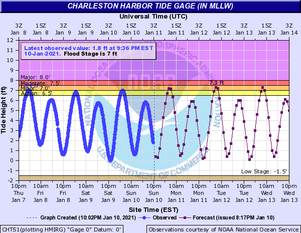
The approaching new moon and an onshore wind will contribute to minor coastal flooding each morning through Wednesday around high tide. These shouldn’t be terribly widespread events, but there will be the potential for a couple road closures in the most vulnerable locations around Lockwood, Hagood, and Fishburne.
Follow my Charleston Weather updates on Mastodon, Bluesky, Instagram, Facebook, or directly in a feed reader. Do you like what you see here? Please consider supporting my independent, hype-averse weather journalism and become a supporter on Patreon for a broader look at all things #chswx!