The week ahead: Mild and rainy
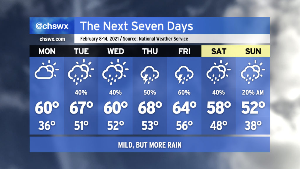
Enjoy the rain-free conditions on Monday, because we’re back to wet weather at times through perhaps Sunday morning. Temperatures will at least run at or a little above normal for much of the week with zonal flow and perhaps even a little ridging aloft, keeping a well-advertised intrusion of Arctic air for much of the northern continental United States at bay for at least the next several days.
The current forecast shows rain chances diminishing Saturday and Sunday in the wake of a cold front, with below-normal temperatures for Valentine’s Day. It’s worth noting that there is a fair bit of model spread as we get into the weekend, so be keeping an eye on forecast updates as some details will need to be fine-tuned.
Despite some of the apps’ best attempts this past Friday, winter weather is not indicated in the forecast, and there is decreasing support for this scenario unfolding from the ensemble of global model runs as the southern extent of a potent Arctic air intrusion into the continental United States appears to be retreating significantly. There has been a noted bias in the models when they get out to the longer range to try to bring Arctic air much further south than it ultimately ends up, and so far, this appears to be one of those times. If things change and it looks legit, I and the rest of the #chswx enterprise will be sure to let you know! 🙂