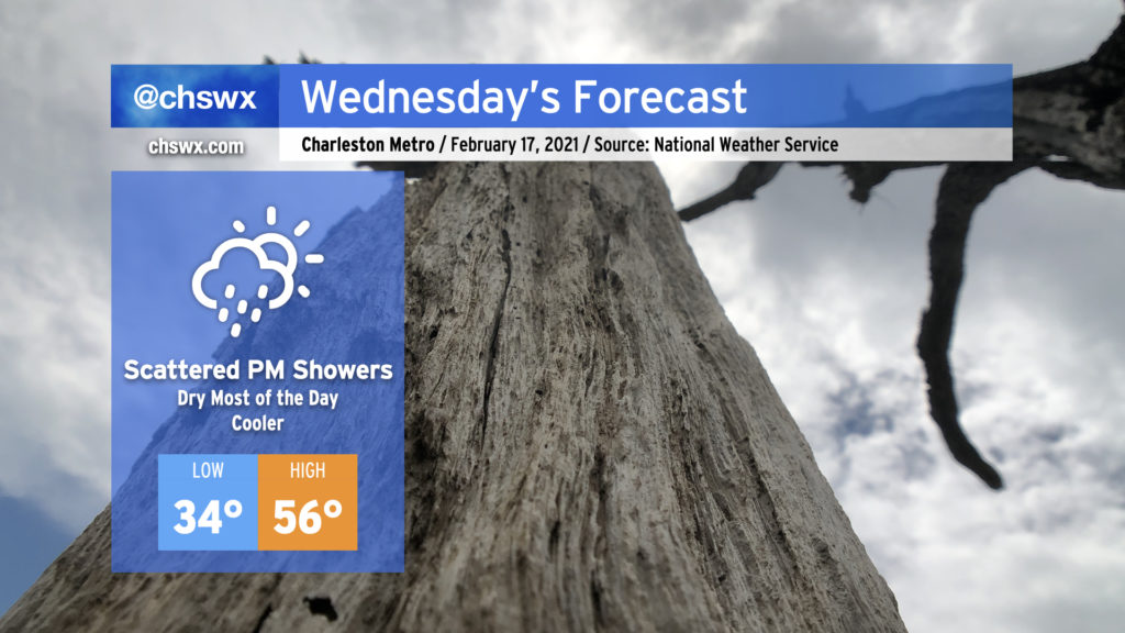
Clouds build back in for Wednesday with showers developing late
I hope everyone enjoyed the outbreak of sunshine today! It was nice to see temperatures rebound into the mid-60s across the area with nearly cloudless skies for much of the day.
Unfortunately, our unsettled weather pattern remains in place, and today’s respite will be short-lived as clouds build back into the area during the day Wednesday, with shower chances increasing after sunset.
Another wedge, but a little weaker this time
We’ll start the day with scattered clouds and chilly temperatures. A few spots inland could hit freezing overnight while the rest of us will get fairly close. Wind chills in the morning will make the mid-30s feel like freezing. Temperatures will warm into the mid 50s before high pressure moving across the Ohio Valley into New England induces the development of another cold air damming wedge inland. Closer to our neck of the woods, a trough of low pressure will develop near the coast. With more moisture entering the picture, clouds will build back in during the afternoon, with scattered showers and perhaps a few thunderstorms after dark. The coastal trough will transition to a warm front, and this could lead to some fairly warm overnight temperatures depending on how far inland the front can get.
Marginal severe weather risk Thursday
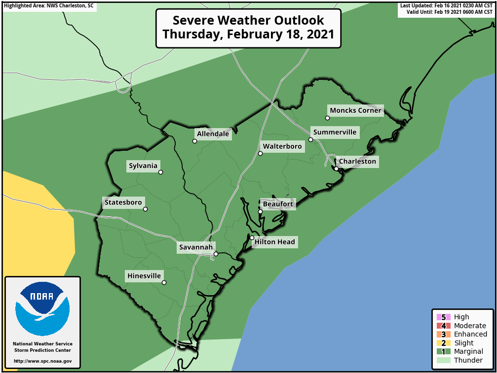
As low pressure develops in the Gulf of Mexico and heads northeast, we’ll be watching the position of the low and the aforementioned warm front carefully for a potential severe weather risk during Thursday afternoon and evening. Uncertainty is high here as the southern and eastern extent of the cold air damming wedge will, much like Monday, largely modulate the severe weather threat. Guidance is generally on board with the warm front at least clearing the coast and getting a little inland across the Tri-County area. This would allow for some destabilization to develop, but like Monday, there is some question of whether a near-surface stable layer could largely put the kibosh on a more substantial severe weather threat.
The Storm Prediction Center outlined the area in a marginal risk of severe weather for Thursday, which seems prudent given the uncertainty. Storm threats would primarily include damaging wind gusts and perhaps some hail. Given the available wind shear, one cannot totally rule out a tornado, but it appears the better risk for this will stay west of us in Southeast Georgia.
We should hopefully get some more clarity on how things evolve once we see how the wedge begins to fill in on Wednesday evening. Stay tuned!
Follow my Charleston Weather updates on Mastodon, Bluesky, Instagram, Facebook, or directly in a feed reader. Do you like what you see here? Please consider supporting my independent, hype-averse weather journalism and become a supporter on Patreon for a broader look at all things #chswx!