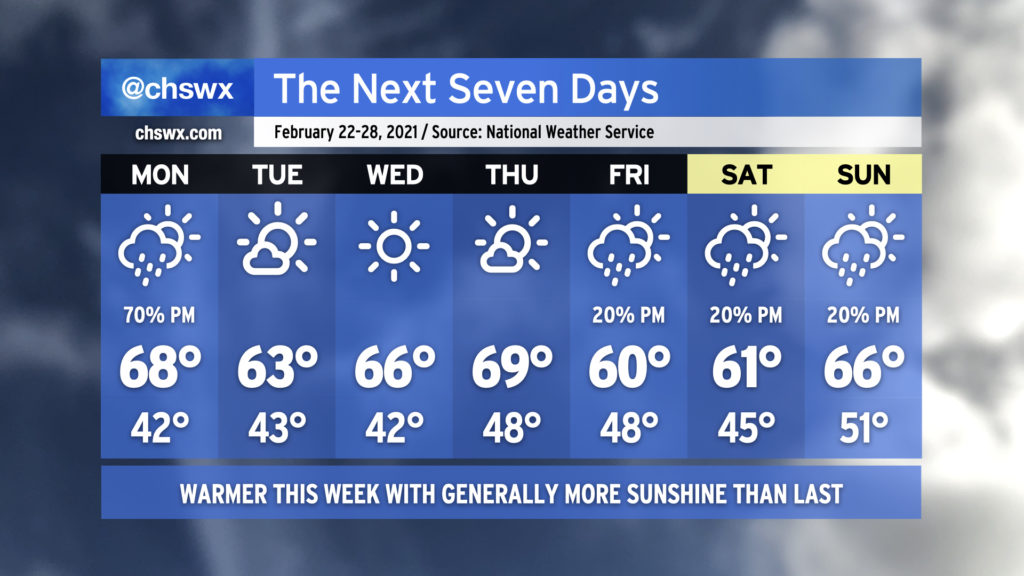
The week ahead: Showers return Monday, but a pleasant mid-week follows

Rain chances will make a brief return to start the week, but without the ridiculous tap of moisture that characterized the last few rainstorms. The recent deluge has led to river flooding in spots on the Edisto as well as on the Santee at Jamestown, with homes being threatened in Ridgeville. Overall, though, expect a quieter week of weather with warmer temperatures than we’ve been used to.
As mentioned before, Monday starts ahead of a cold front with scattered showers coming onshore for a fair bit of the day. However, the best chance of showers will be in the afternoon and evening hours as the front passes. Temperatures will rise into the upper 60s and could even crack 70° in a few spots.
Tuesday through Thursday look really nice, with ample sunshine and progressively warmer temperatures, again potentially touching 70° on Thursday.
Our next rain chance arrives Friday afternoon in the wake of another front. Isolated showers will be possible each afternoon through the weekend, but right now we should not see any washouts. Temperatures will remain near or slightly above normal.
This is the last week of meteorological winter; meteorological spring begins on March 1st. (Meteorologists and climatologists use March 1 to mark the start of spring as it is a consistent point for record-keeping. The vernal equinox, which ushers in the more traditionally accepted definition of spring, is on March 20.)