The week ahead: Unsettled start with a noticeable cooldown
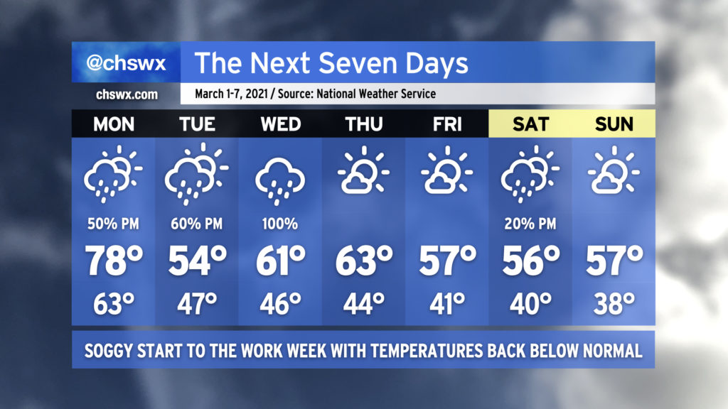
We begin meteorological spring with one more day in the 70s and increasing rain chances ahead of a cold front. The front will push southward across the area late Monday, leaving us significantly cooler for Tuesday and beyond. (I hope you’ve not put your sweaters away yet!)
The cold front will stall somewhere near the Gulf Coast, and low pressure will spin up and traverse it. Rain chances will come up ahead of this low pressure system later Tuesday, with widespread showers expected on Wednesday. Once low pressure departs, we should get a couple dry days in before a coastal trough possibly generates a few showers in the area on Saturday afternoon. High pressure is projected to usher this trough away from the area for Sunday.
I suspect the temperature shift back to below normal is going to be a bit of a jolt, especially after closing February with a weekend featuring highs in the 80s each day. Normal highs for the first week of March are around 66-67°, and it just doesn’t look like we’re going to get there this week.
Start of meteorological spring on March 1
As mentioned earlier, meteorological (or climatological, depending on who you’re talking to!) spring begins on March 1. Meteorologists and climatologists prefer to demarcate seasons by dates for more consistency when comparing historical records. Meteorological spring will run until May 31.
For the vast majority of us who look to the tilt of Earth’s axis in relation to the sun as the benchmark for the current season, the vernal equinox on the morning of March 20 will begin spring in the Northern Hemisphere.
Frost and freeze alerts to return as the growing season resumes
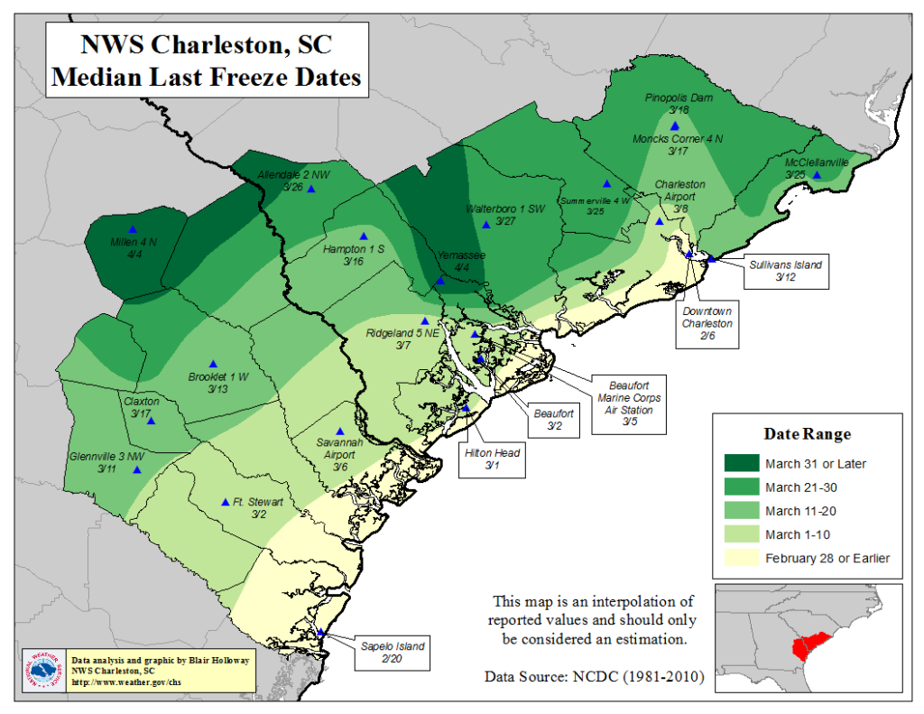
The National Weather Service will also be resuming its frost and freeze program on March 1, which means that frost and freeze watch, warning, and advisory products will once again be issued when temperatures dip low enough. Generally speaking, areas in the immediate Charleston metro tend to see its last freeze within the first week of March. Head further north or inland and you’ll find the median last freeze date in the second half of the month.
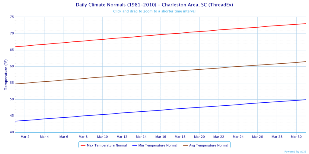
Despite the dip in temperatures this week, the overall trend is warmer. By mid-March, normal highs head back over 70°. This isn’t to say it can’t get cold, though: We’ve had plenty of March cold snaps. It’s also not impossible — but is fairly rare — to even get some winter weather especially early on in March, with a trace of snow or more being recorded 16 times since 1938 at the North Charleston climate site. The most recent recorded trace of snow at the airport occurred on March 12, 1998.
Daylight Saving Time returns on March 14
Finally, get ready for Daylight Saving Time to resume on March 14. We’ll be “springing forward” early that Sunday morning — yes, unfortunately, we’re putting an hour of sleep in escrow until fall. On the plus side, I suspect many of you will be happy to see a sunset closer to 7:30 PM. After March 13, the next pre-7PM sunset will occur around October 4.
Tomorrow, I’ll round up stats for this past meteorological winter, which looks to end up the coolest since winter 2014-2015 (but yet was not as wet as last winter!)
Follow my Charleston Weather updates on Mastodon, Bluesky, Instagram, Facebook, or directly in a feed reader. Do you like what you see here? Please consider supporting my independent, hype-averse weather journalism and become a supporter on Patreon for a broader look at all things #chswx!