The week ahead: Warmer and starting dry, but storm chances return late week
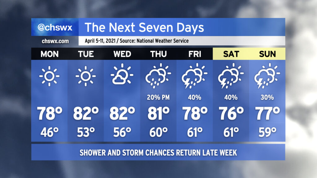
After quite a cold snap closed out last week, temperatures will be back at or a little above normal as we get into the first full week of April. There will be plenty of sunshine in the offing particularly Monday through Wednesday as high pressure maintains firm control over our weather. Lows will start out in the upper 40s on Monday but will warm into the mid-50s by Wednesday morning. Highs will generally run in the upper 70s to low 80s.
Changes begin to show up in the form of at least a few more clouds for Thursday as a storm system starts shoving the surface high offshore, allowing for some more moisture return. There’s an outside shot at a few showers Thursday evening, but the better rain chances will be ahead of the storm system’s cold front on Friday. We could see a few thunderstorms in the mix as well. The front will get through Saturday, but lingering moisture keeps rain chances in the forecast for most of the weekend. It doesn’t look like a washout, though, and as always, we’ll have time to fine-tune the details throughout the week. For now, enjoy the warm sun!