The week ahead: Getting off to a warm start, but a little cooldown might be in the cards
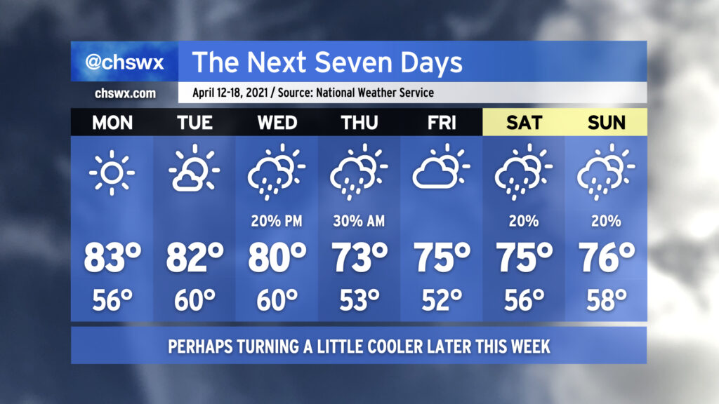
We’ll start out another work week with pretty nice weather in the wake of a cool front (can’t really call it cold with temperatures rebounding into the 80s, but the airmass will at least be drier!) before seeing another front by mid-week potentially bringing some unsettled weather.
Temperatures will start out this week in the 80s on the afternoons and mid-50s to around 60° in the mornings as high pressure moves through the area both at the surface and aloft. After a couple days of tranquil weather, cloud cover will thicken up on Wednesday as a cold front gets closer to the area. A few showers aren’t totally out of the question in the afternoon.
Forecast confidence gets a little iffy as we get into Thursday, with some timing differences in the models — the ECMWF is faster in getting the cold front through, while the GFS is about 12-18 hours slower — and thus invites some questions in when rain will move through the area. Indeed, NWS notes that forecast confidence is pretty low headed into the weekend as model differences persist. So, stay tuned as the details get sorted out, and don’t cancel any plans just yet.