Turning cooler as we close out the work week
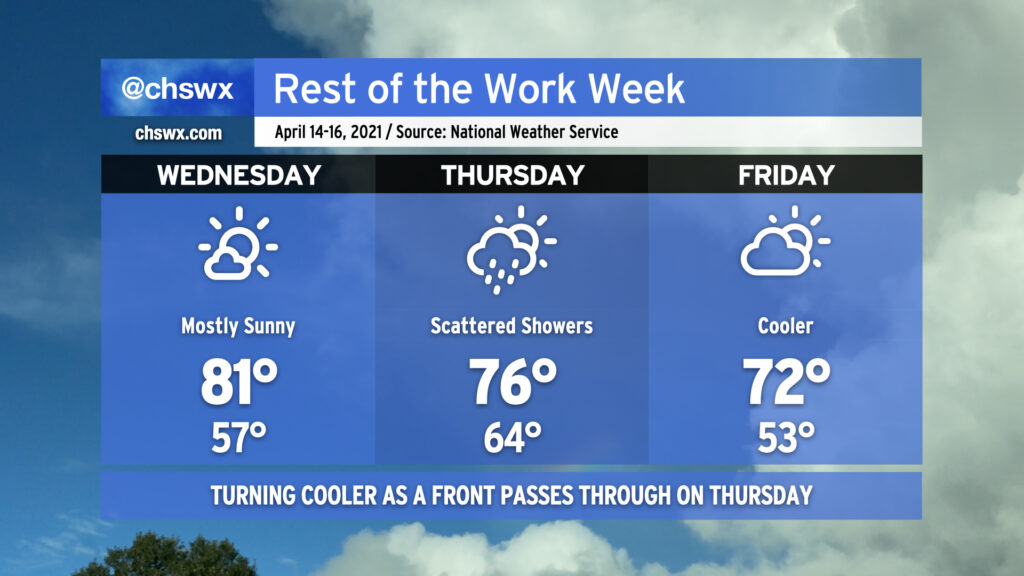
Wednesday promises one more day of above-normal temperatures before a cold front adjusts temperatures downward for the remainder of the week. We should see plenty of sunshine during the day, though clouds will be on the increase in the afternoon with even a stray shower possible in the evening. WIth gusty winds and low humidity, fire danger could be elevated tomorrow, so please don’t burn if you can help it.
Better rain chances arrive overnight into Thursday as the aforementioned cold front moves through the area. The most striking change will be to high temperatures; after several days in the 80s, we’ll top out in the mid-70s on Thursday and will run even a tad cooler on Friday under mostly cloudy skies.
Clouds will hang around on Friday into the weekend as the front stalls out to the south, with some differing solutions on whether and how much rain could re-enter the picture over the weekend as that front hangs out. Stay tuned to forecast updates as far as how the weekend ultimately plays out.