The week ahead: Dry spell largely continues
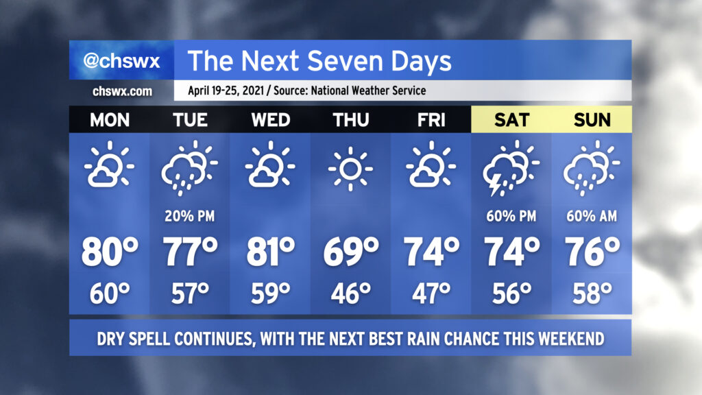
Our long-standing dry spell will continue for much of this week, save for a small chance of showers on Tuesday as a little upper-level energy ripples through.
Mostly sunny skies will prevail on Monday as temperatures reach right around 80° — still a few degrees above normal at this point in the year. We’ll run a touch cooler on Tuesday with a few more clouds in place and perhaps even a shower or two, but those won’t be enough to break us from our abnormally dry April. Mostly sunny skies return on Wednesday ahead of a dry cold front which will swing through overnight. By Thursday, cool high pressure will build in with temperatures near 8-10° below normal across the area under clear skies. High pressure gets off the coast on Friday and temperatures recover to the mid-70s with gradually increasing cloud cover in the evening ahead of a storm system.
If we are going to thwart the driest start to April since 1976, it’s likely going to happen Saturday afternoon into Sunday morning as low pressure moves through the area. At this range, of course, there are certainly model differences, and we will need to see how the details ultimately unfold, but this is the best shot at rain we’ve had probably all month! We’ll watch it closely. For now, though, keep watering your plants and washing your cars as we get through another dry work week.