Friday and the weekend: Stormy Saturday in store, bookended by quiet weather
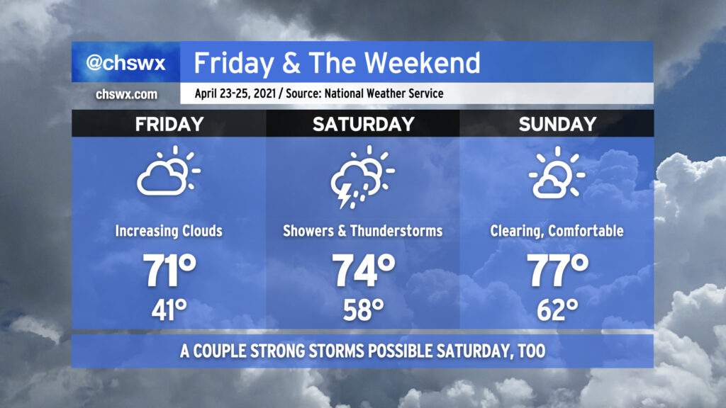
Friday will start out as another chilly morning as temperatures will dip into the low 40s. Frost should not be a concern in our neck of the woods, though, so no worries for your gardens. Temperatures will top out around 70-71° with cloud cover on the increase ahead of our next storm system. Note that fire danger remains high on Friday given continued dry conditions and low humidity.
Saturday will bring beneficial rain to the area, but it may bring some stronger thunderstorms as well. Showers will be possible on Saturday morning, but the best chance for heavier rain and thunderstorms arrives in the afternoon into the evening hours. NWS estimates rainfall amounts around 1-2″, which would be hugely helpful as long as we don’t get it all at one time. Temperatures look to top out in the mid-70s barring more rainfall earlier in the day. Regardless of thunderstorms, winds should be fairly breezy with gusts perhaps near 35-40 MPH at times.
The severe weather threat for Saturday will largely be modulated by how unstable the atmosphere can get. Wind shear will be plentiful thanks to a strengthening low-level jet and favorable upper-level winds, so that ingredient will certainly be there, and there is general model agreement that moisture will surge into the area later Saturday, which may contribute to further destabilization. A lot will depend on how warm we can get during the day — if rain fires up and sticks around, which is certainly possible, then that takes the severe threat down a peg or two (but doesn’t completely eliminate it given the aforementioned favorable wind shear). If it doesn’t, though, there will be fuel available for the storms by the time they get here, and with the expected shear in place, a few severe storms will be expected. Damaging winds and hail will be the primary concerns, but given the favorable vertical wind profiles, a tornado cannot be ruled out.
All this nastiness clears the area overnight Saturday as a front sweeps through, and by Sunday, we will have a much nicer day with clouds gradually breaking down and temperatures rising into the mid-to-upper 70s. It’ll remain windy throughout the day in the wake of the front as high pressure builds in behind it, but otherwise, there are no weather concerns for Sunday into much of next week as our fairly arid April rolls on.