Unseasonably cool despite abundant sunshine on Thursday
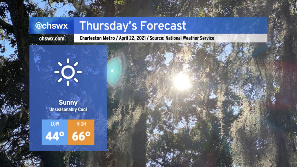
A cold front has gotten through the area this evening, and temperatures are on their way down in its wake. By morning, we’ll be bottoming out in the mid-40s, and you’ll be excused if you’re not quite sure whether it’s late April or not. Despite unencumbered sunshine, temperatures will only reach the mid-60s as chilly high pressure builds in overhead. The April sun angle should still make short sleeves reasonably comfortable, though.
First substantial rainfall of April likely on Saturday
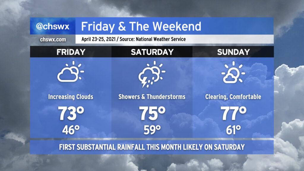
On Friday, high pressure will be slipping away from the area, and clouds will be on the increase ahead of a storm system that will bring us the first notable rainfall of April on Saturday. Low pressure will traverse the Southeast during the day on Saturday, and showers and thunderstorms will fire off ahead of it. We could see showers in the area as early as Saturday morning, with thunderstorms looking more likely as the day goes on. By evening, we could be contending not only with periods of heavy rain, but maybe even a strong or severe thunderstorm or two as low pressure moves to our northwest. There are still details to fine-tune here, but I would still be looking at indoor alternatives to Saturday outdoor plans. By Sunday morning, we’ll be seeing cloud cover clear out as high pressure builds in from the north, yielding a fairly nice day with highs topping out in the mid-to-upper 70s.
Follow my Charleston Weather updates on Mastodon, Bluesky, Instagram, Facebook, or directly in a feed reader. Do you like what you see here? Please consider supporting my independent, hype-averse weather journalism and become a supporter on Patreon for a broader look at all things #chswx!