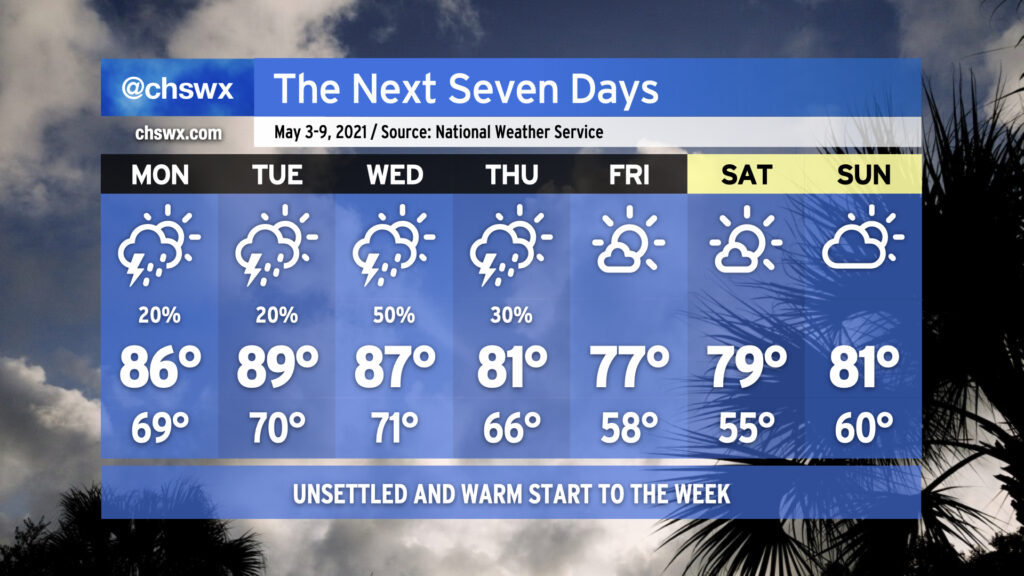
The week ahead: Warmest weather so far this year to start the week

Get ready for a very summer-like start to your week. High pressure slipping into the Atlantic with a little ridging aloft will keep us warm — dare I say it, hot — and humid for the first part of the week. Showers and thunderstorms will be possible each day through Thursday before a cold front swings through with drier air and more pleasant temperatures for the weekend.
Warm, unsettled stretch coming up
We’re likely going to see the warmest stretch of weather since late March (and perhaps the warmest of 2021) to start the week. Temperatures could approach 90° on Tuesday for the first time this year; with a low around 70°, it’s going to feel quite a bit more like early June than early May.
Thunderstorm chances will also be summer-like, as well. Thunderstorms may greet us Monday morning as a surge of unstable air associated with a warm front moves northward across the area. A stronger storm or two can’t be ruled out, either. Isolated storms will ultimately be possible for the balance of Monday, but not everyone will see a storm.
An isolated shower or storm will be possible Tuesday afternoon, but the better rain chances arrive with upper-level energy and an approaching cold front on Wednesday into early Thursday. Severe weather is not anticipated, but beneficial rain looks probable — a win-win scenario for parched lawns and gardens.
Cooling off and clearing out for the weekend
Once the cold front gets through sometime Thursday, high pressure will build back in from the northwest, ushering in cooler and drier air for the weekend. It looks pretty great, with highs in the 70s on Friday and Saturday under mostly sunny skies.
Follow my Charleston Weather updates on Mastodon, Bluesky, Instagram, Facebook, or directly in a feed reader. Do you like what you see here? Please consider supporting my independent, hype-averse weather journalism and become a supporter on Patreon for a broader look at all things #chswx!