One more day of mugginess before weather improves markedly to close the work week
We’ve got one more day of thunderstorm chances this week before a cold front sweeps them out of here by Thursday, setting us up for a fine end to the work week and a nice weekend.
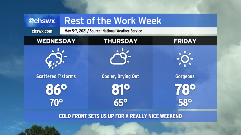
First, though, we need to handle Wednesday. Wednesday is going to be a tricky day in the forecast; scattered showers and thunderstorms certainly seem possible, but the overall coverage of storms is less certain. It appears that thunderstorm activity along the Gulf Coast will rob our area of moisture, which should keep coverage and intensity a tick lower than we’ve seen over the past couple days. Still, a strong to severe storm or two cannot be totally ruled out, either.
What is certain about Wednesday is that it’ll be another warm and muggy day. Temperatures will head into the mid-80s once again, with heat indices running around 90°.
The cold front swings through overnight Wednesday/early Thursday morning, and the airmass begins to change in response. We’ll see partly cloudy skies on Thursday with highs topping out in the low 80s with a little lower humidity. This airmass really begins to take hold later Thursday into Friday, when temperatures will start in the upper 50s and warm to comfortable temperatures in the upper 70s with lower humidity. This nice weather hangs around into the weekend, particularly on Saturday. Enjoy it — we don’t have too many more of these “cool” snaps left until later this year!