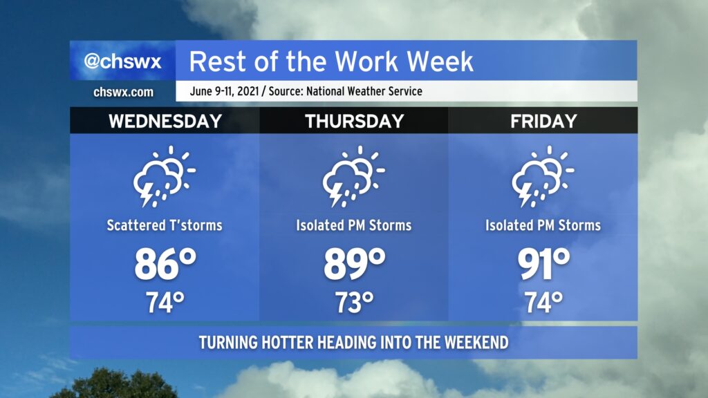
Turning warmer and a little less unsettled to close the work week

We’ve got one more day of scattered to numerous storms inland (we can’t seem to catch a raindrop here toward the coast) before ridging and drier air begins to put a bit of a lid on more widespread thunderstorm activity heading into Thursday and Friday. As storm coverage decreases, temperatures will increase, and we look in line for our first 100° heat indices of the year come Friday. A storm or two will still be possible, which may bring some brief relief, but be ready to pay a little more attention to hydration and time outside later this week.