Soggy Saturday to start the weekend as a frontal boundary sags into the area
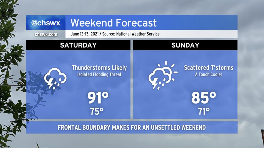
We will get off to an unsettled start to the weekend as a frontal boundary sags south into the area during the day on Saturday. Ahead of the front, expect highs to top out in the low 90s before numerous showers and thunderstorms develop across the area. Chances are pretty good that you’ll see at least a little rain at some point tomorrow. With plenty of available moisture to wring out, though, it is conceivable that flooding may be a concern tomorrow within the strongest storms. While severe weather looks unlikely, all storms are dangerous due to the lightning they produce. When thunder roars, go indoors!
It’s expected that the front will pass through and stall out to our south by Sunday. Temperatures will run a little “cooler” with highs topping out in the mid-80s, but scattered showers and thunderstorms should still develop in the afternoon. How Sunday ultimately evolves will depend on what goes on during the day Saturday, so keep an eye out for forecast adjustments.